Antokonala
| Antokonala | |
|---|---|
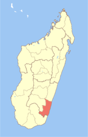
 Antokonala Location in Madagascar | |
| Coordinates: 23°0′S 47°22′E / 23.000°S 47.367°E | |
| Country |
|
| Region | Atsimo-Atsinanana |
| District | Vondrozo |
| Elevation[1] | 150 m (490 ft) |
| Population (2001)[2] | |
| • Total | 4,000 |
| Time zone | EAT (UTC3) |
Antokonala is a town and commune in Madagascar. It belongs to the district of Vondrozo, which is a part of Atsimo-Atsinanana Region. The population of the commune was estimated to be approximately 4,000 in 2001 commune census.[2]
Only primary schooling is available. The majority 99% of the population of the commune are farmers. The most important crop is rice, while other important products are bananas, coffee and cassava. Services provide employment for 1% of the population.[2]
References and notes
- ↑ Estimated based on DEM data from Shuttle Radar Topography Mission
- 1 2 3 "ILO census data". Cornell University. 2002. Retrieved 2008-05-10.
Coordinates: 23°0′S 47°22′E / 23.000°S 47.367°E
This article is issued from Wikipedia - version of the 12/30/2013. The text is available under the Creative Commons Attribution/Share Alike but additional terms may apply for the media files.