Antalaha
| Antalaha | |
|---|---|
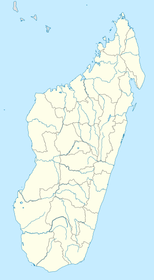
 Antalaha Location in Madagascar | |
| Coordinates: 14°53′S 50°17′E / 14.883°S 50.283°E | |
| Country |
|
| Region | Sava |
| District | Antalaha |
| Population (2004) | |
| • Total | 34,112[1] |
| Time zone | EAT (UTC3) |
Antalaha is a commune (Malagasy: kaominina) in northern Madagascar. It belongs to the district of Antalaha, which is a part of Sava Region. According to 2004 census the population of Antalaha was 34112.[1]
Antalaha has a maritime harbour. In addition to primary schooling the town offers secondary education at both junior and senior levels. The town has a permanent court and hospital.[2]
Farming provides employment for 40% of the working population. The most important crop is vanilla, while other important products are cloves and rice. Industry and services provide employment for 30.00% and 29.98% of the population, respectively. Additionally fishing employs 0.02% of the population.[2]
Climate
Antalaha experiences a humid equatorial climate (Koppen Af) with prodigious rainfall all year-round. The heaviest rainfall, highest humidity, and hottest temperatures are typically observed from December to April, the wettest month being January, receiving a copious average of 358.1 mm (14.10 in) of total precipitation. The driest month is September, receiving an average of 90.9 mm (3.58 in) of precipitation. The months from May to November are slightly drier, cooler, and less humid. Despite this, hot temperatures, high humidity, and high rainfall dominate year-round in Antalaha.
| Climate data for Antalaha, Madagascar | |||||||||||||
|---|---|---|---|---|---|---|---|---|---|---|---|---|---|
| Month | Jan | Feb | Mar | Apr | May | Jun | Jul | Aug | Sep | Oct | Nov | Dec | Year |
| Average high °C (°F) | 30.3 (86.5) |
30.7 (87.3) |
30.2 (86.4) |
29.6 (85.3) |
28.2 (82.8) |
26.7 (80.1) |
25.9 (78.6) |
25.7 (78.3) |
26.4 (79.5) |
27.5 (81.5) |
28.8 (83.8) |
30.0 (86) |
28.3 (82.9) |
| Daily mean °C (°F) | 25.9 (78.6) |
26.1 (79) |
25.8 (78.4) |
25.1 (77.2) |
23.7 (74.7) |
22.1 (71.8) |
21.4 (70.5) |
21.2 (70.2) |
21.9 (71.4) |
23.0 (73.4) |
24.4 (75.9) |
25.5 (77.9) |
23.8 (74.8) |
| Average low °C (°F) | 22.4 (72.3) |
22.5 (72.5) |
22.4 (72.3) |
21.9 (71.4) |
20.4 (68.7) |
19.0 (66.2) |
18.4 (65.1) |
18.1 (64.6) |
18.4 (65.1) |
19.3 (66.7) |
20.7 (69.3) |
21.9 (71.4) |
20.4 (68.7) |
| Average precipitation mm (inches) | 358.1 (14.098) |
245.8 (9.677) |
306.3 (12.059) |
225.8 (8.89) |
165.1 (6.5) |
176.9 (6.965) |
170.1 (6.697) |
188.6 (7.425) |
90.9 (3.579) |
92.0 (3.622) |
143.8 (5.661) |
212.6 (8.37) |
2,376 (93.543) |
| Average precipitation days (≥ 1.0 mm) | 16 | 14 | 17 | 15 | 15 | 17 | 19 | 19 | 13 | 12 | 13 | 14 | 184 |
| Mean monthly sunshine hours | 210.1 | 199.7 | 203.6 | 205.1 | 211.1 | 178.6 | 180.9 | 197.2 | 208.9 | 238.5 | 226.3 | 225.1 | 2,485.1 |
| Source: NOAA[3] | |||||||||||||
Education
In Antalaha, the Centre Universitaire Régional de la SAVA (CURSA) was recently opened. It offers basic academic training in French, English, and Natural Sciences/Natural Resources. CURSA is a regional unit of the University in Antsiranana (UNA) located farther north.
The local French international school in Antalaha is the Ecole Primaire Française Antalaha.[4][5]
International Projects
Projet d'Analalava - Long Forest (Ala = Forest; lava = long) This Project was initiated by a Swiss called Erich Steiner. Because Madagascar separated early from Africa, it has a unique nature. The tropical rain forest gets more and more cut down, the problem there is the thin layer of humus, so the earth dries out and no more plants can grow. Plus there are worldwide 10 coast rain forests left and one of them is in Madagascar.
The Project not only works the forest but also with the inhabitants, taking care of schools and grow economic plants. Of course all employers are natives. The project is financed by free donations and a greenhouse about Madagascar in Zurich (Swiss).
Since 2008 Projet d'Analalava is an official social service-spot of the Austrian service abroad.
External links
References and notes
- 1 2 wolframalpha.com- antalaha
- 1 2 "ILO census data". Cornell University. 2002. Retrieved 2008-02-15.
- ↑ "Antalaha/Antsirabat Climate Normals 1961–1990". National Oceanic and Atmospheric Administration. Retrieved March 8, 2015.
- ↑ Home page (Archive). Ecole Primaire Française Antalaha. Retrieved on May 4, 2015.
- ↑ "École primaire française d'Antalaha." AEFE. Retrieved on May 4, 2015.
Coordinates: 14°53′S 50°17′E / 14.883°S 50.283°E
