Andapa District
Not to be confused with Andapa, the Malagasy commune with same name.
| Andapa District | |
|---|---|
| District | |
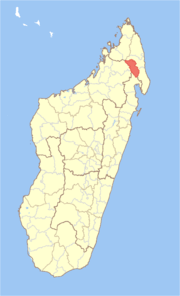 Location in Madagascar | |
| Coordinates: 14°39′S 49°39′E / 14.650°S 49.650°E | |
| Country |
|
| Region | Sava |
| Area | |
| • Total | 4,051.48 km2 (1,564.29 sq mi) |
| Population (2013) | |
| • Total | 189,882 |
| • Density | 47/km2 (120/sq mi) |
| Time zone | EAT (UTC3) |
Andapa District is a district in northern Madagascar. It is a part of Sava Region and borders the districts of Ambilobe and Sambava to the north, Antalaha to the east, Maroantsetra to the south, and Befandriana Nord and Bealanana to the west. The area is 4,051.48 km2 (1,564 sq mi) and the population was estimated to be 189,8822 in 2013.[1] The district is further divided into 17 communes:
- Ambalamanasy II
- Ambodiangezoka
- Ambodimanga, Andapa
- Andapa
- Andrakata
- Andranomena
- Anjialava Be
- Ankiaka Be Nord
- Anoviara
- Antsahamena
- Bealampona
- Belaoka Marovato
- Betsakotsako Andranotsara
- Doany
- Marovato, Andapa
- Matsohely
- Tanandava, Andapa
References and notes
- ↑ Institut National de la Statistique, Antananarivo.
Coordinates: 14°39′S 49°39′E / 14.650°S 49.650°E

This article is issued from Wikipedia - version of the 8/30/2015. The text is available under the Creative Commons Attribution/Share Alike but additional terms may apply for the media files.