Andrejová
| Andrejová | ||
| Village | ||
 Adnrejova Valley at Winter | ||
|
||
| Country | Slovakia | |
|---|---|---|
| Region | Prešov | |
| District | Bardejov | |
| Municipality | Andrejova | |
| Tourism region | Šariš | |
| River | Andrejovka | |
| Elevation | 325 m (1,066 ft) | |
| Coordinates | 49°17′00″N 21°16′00″E / 49.28333°N 21.26667°ECoordinates: 49°17′00″N 21°16′00″E / 49.28333°N 21.26667°E | |
| Area | 11.60 km2 (4.5 sq mi) | |
| Population | 362 (2011) | |
| Density | 31/km2 (80/sq mi) | |
| Founded | 1355 | |
| Mayor | Vladimir Fricky | |
| Timezone | CET (UTC+1) | |
| - summer (DST) | CEST (UTC+2) | |
| Postal code | 086 37 | |
| Area code | +421-54 | |
| Car plate | BJ | |
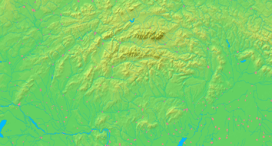  Location in Slovakia
| ||
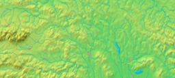  Location in the Prešov Region
| ||
| Statistics: txtUroven=440707&lstObec=524140&Okruh=zaklad MOŠ/MIS] | ||
| Website: | ||
Andrejová (Rusyn: Андріёва, Ukrainian: Андрійова, Hungarian: Endrevágása) is a village and municipality in Bardejov District in the Prešov Region of Slovakia.[1] In historical records the village was first mentioned in 1355. The predominant religion is the Greek Catholic Church with 4.9% Eastern Orthodox. The Catholic Church of Virgin Mary the Protectrice of 1893 can be found in the village. The village lies at an altitude of 325 metres and covers an area of 11.679 km². It has a population of about 362 inhabitants.[2] The village is about 51% Slovak, 20% Rusyn, 16% Romany and 11% Ukrainian with minorities. The village used to have public library. There is a football pitch and volleyball playground.
Genealogical resources
The records for genealogical research are available at the state archive "Statny Archiv in Presov, Slovakia"
- Roman Catholic church records (births/marriages/deaths): 1695-1895
- Greek Catholic church records (births/marriages/deaths): 1831-1900 (parish A)
- Census records 1869 of Andrejova are not available at the state archive.
- Census records 1857 of Andrejova are available at the state archive.
See also
References
External links
- http://en.e-obce.sk/obec/andrejova/andrejova.html
- Official homepage
- Surnames of living people in Andrejova