Mueang Mae Hong Son District
| Mueang Mae Hong Son เมืองแม่ฮ่องสอน | |
|---|---|
| Amphoe | |
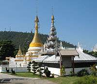
 Amphoe location in Mae Hong Son Province | |
| Coordinates: 19°18′14″N 97°58′38″E / 19.30389°N 97.97722°ECoordinates: 19°18′14″N 97°58′38″E / 19.30389°N 97.97722°E | |
| Country | Thailand |
| Province | Mae Hong Son |
| Seat | Chong Kham |
| Area | |
| • Total | 2,483.115 km2 (958.736 sq mi) |
| Population (2010) | |
| • Total | 53,333 |
| • Density | 22.2/km2 (57/sq mi) |
| Time zone | ICT (UTC+7) |
| Postal code | 58000 |
| Geocode | 5801 |
Mueang Mae Hong Son (Thai: เมืองแม่ฮ่องสอน, pronounced [mɯ̄a̯ŋ mɛ̂ː hɔ̂ŋ sɔ̌ːn]) is the capital district (amphoe mueang) of Mae Hong Son Province, northern Thailand.
History
The Interior Ministry upgraded Mueang Mae Hong Son to a fourth-class city under Monthon Phayap on 10 May 1910.[1] It then consisted of the four districts: Mueang Mae Hong Son, Mueang Yuam (now Mae Sariang District), Pai, and Khun Yuam.
In 1917, the district was renamed from Mueang to Muai To (ม่อยต่อ).[2] In 1938 it was renamed Mueang Mae Hong Son.[3] The northeastern part of the district was split off in 1987 and formed the new district Pang Mapha.[4]
Geography
The Daen Lao Range dominates the landscape of this district. Neighboring districts are (from south clockwise) Khun Yuam of Mae Hong Son Province, Kayah State of Myanmar, Pang Mapha, Pai of Mae Hong Son Province and Galyani Vadhana and Mae Chaem of Chiang Mai Province.
The Namtok Mae Surin National Park office is in the district.
Administration
The district is divided into seven sub-districts (tambon), which are further subdivided into 70 villages (muban). Mae Hong Son itself is a town (thesaban mueang) which covers the complete tambon Chong Kham. Each of the other six tambon is administrated by a tambon administrative organization (TAO).
| No. | Name | Thai | Villages | Pop.[5] |
|---|---|---|---|---|
| 1. | Chong Kham | จองคำ | - | 6,534 |
| 2. | Huai Pong | ห้วยโป่ง | 15 | 6,948 |
| 3. | Pha Bong | ผาบ่อง | 12 | 9,519 |
| 4. | Pang Mu | ปางหมู | 13 | 14,725 |
| 5. | Mok Champae | หมอกจำแป่ | 9 | 6,936 |
| 6. | Huai Pha | ห้วยผา | 8 | 5,431 |
| 9. | Huai Pu Ling | ห้วยปูลิง | 11 | 3,240 |
Missing numbers are tambon which now form Pang Mapha District.
References
- ↑ ประกาศกระทรวงมหาดไทย ประกาศยกเมืองแม่ฮ่องสอนเป็นเมืองจัตวารวมอยู่ในมณฑลพายัพ (PDF). Royal Gazette (in Thai). 27 (0 ง): 198–199. 1910-07-15.
- ↑ ประกาศกระทรวงมหาดไทย เรื่อง เปลี่ยนชื่ออำเภอ (PDF). Royal Gazette (in Thai). 34 (0 ก): 40–68. 1917-04-29.
- ↑ พระราชกฤษฎีกาเปลี่ยนนามจังหวัด และอำเภอบางแห่ง พุทธศักราช ๒๔๘๑ (PDF). Royal Gazette (in Thai). 55 (0 ก): 658–666. 1938-11-14.
- ↑ ประกาศกระทรวงมหาดไทย เรื่อง แบ่งเขตท้องที่อำเภอเมืองแม่ฮ่องสอน จังหวัดแม่ฮ่องสอน ตั้งเป็นกิ่งอำเภอปางมะผ้า (PDF). Royal Gazette (in Thai). 104 (67 ง): 2485. April 9, 1987.
- ↑ "Population statistics 2010". Department of Provincial Administration.
External links
 Mae Hong Son travel guide from Wikivoyage
- amphoe.com (Thai)
- Namtok Mae Surin National Park