Bang Rachan District
| Bang Rachan บางระจัน | |
|---|---|
| Amphoe | |
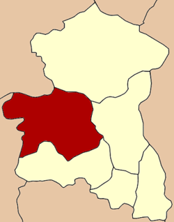 Amphoe location in Singburi Province | |
| Coordinates: 14°53′32″N 100°19′2″E / 14.89222°N 100.31722°ECoordinates: 14°53′32″N 100°19′2″E / 14.89222°N 100.31722°E | |
| Country |
|
| Province | Singburi |
| Seat | Sing |
| Area | |
| • Total | 190.5 km2 (73.6 sq mi) |
| Population (2000) | |
| • Total | 37,936 |
| • Density | 199.1/km2 (516/sq mi) |
| Time zone | THA (UTC+7) |
| Postal code | 16130 |
| Geocode | 1702 |
Bang Rachan (Thai: บางระจัน; IPA: [bāːŋ rā.tɕān]) is a district (Amphoe) of Singburi Province, central Thailand.
History
The area of Amphoe Bang Rachan was mostly part of the historical Mueang Sing. When the government re-established Mueang Sing, the area was divided within two districts - Bang Phutsa (now Mueang Sing Buri) and Sing. The district was renamed to Bang Rachan in 1939.[1]
The first district office was located on the right bank of the Noi river in Tambon Choeng Klat. In 1898 was moved to the left bank of the river in Tambon Sing area.
Despite its name, the historic battle of Bang Rachan between the Burmese army and Thai villagers took place in the area of neighboring Khai Bang Rachan district, which was split off from Bang Rachan district in 1972.
Geography
Neighboring districts are (from the north clockwise) Sankhaburi of Chainat Province, In Buri, Mueang Sing Buri and Khai Bang Rachan of Singburi Province, and Doem Bang Nang Buat of Suphanburi Province.
Administration
The district is subdivided into 8 subdistricts (tambon).
| 1. | Sing | สิงห์ | |
| 2. | Mai Dat | ไม้ดัด | |
| 3. | Choeng Klat | เชิงกลัด | |
| 4. | Pho Chon Kai | โพชนไก่ | |
| 5. | Mae La | แม่ลา | |
| 6. | Ban Cha | บ้านจ่า | |
| 7. | Phak Than | พักทัน | |
| 8. | Sa Chaeng | สระแจง |
References
- ↑ พระราชกฤษฎีกาเปลี่ยนนามอำเภอ กิ่งอำเภอ และตำบลบางแห่ง พุทธศักราช ๒๔๘๒ (PDF). Royal Gazette (in Thai). 56 (0 ก): 354–364. April 17, 1939.