Amado, Arizona
| Amado, Arizona | |
|---|---|
| Census-designated place | |
 Location in Santa Cruz County and the state of Arizona | |
 Amado, Arizona Location in the United States | |
| Coordinates: 31°42′18″N 111°3′56″W / 31.70500°N 111.06556°WCoordinates: 31°42′18″N 111°3′56″W / 31.70500°N 111.06556°W | |
| Country | United States |
| State | Arizona |
| County | Santa Cruz |
| Area | |
| • Total | 5.27 sq mi (13.66 km2) |
| • Land | 5.26 sq mi (13.62 km2) |
| • Water | 0.02 sq mi (0.04 km2) |
| Elevation | 3,097 ft (944 m) |
| Population (2010) | |
| • Total | 295 |
| • Density | 56/sq mi (22/km2) |
| Time zone | MST (no daylight saving time) (UTC-7) |
| ZIP codes | 85645, 85646 |
| Area code(s) | 520 |
| FIPS code | 04-01990 |
| GNIS feature ID | 0025614 |
Amado is a census-designated place (CDP) in Santa Cruz County, Arizona, United States. The population was 295 at the 2010 census.[1]
Geography
Amado is located at 31°42′18″N 111°3′56″W / 31.70500°N 111.06556°W (31.704900, -111.065492).[2]
According to the United States Census Bureau, the CDP has a total area of 5.3 square miles (13.7 km2), of which 5.3 square miles (13.6 km2) is land and 0.015 square miles (0.04 km2), or 0.33%, is water.[1]
Demographics
As of the census[3] of 2000, there were 275 people, 104 households, and 66 families residing in the CDP. The population density was 24.5 people per square mile (9.5/km²). There were 107 housing units at an average density of 9.5/sq mi (3.7/km²). The racial makeup of the CDP was 70.91% White or European American, 0.36% Black or African American, 1.09% Native American, 0.73% Asian, 26.18% from other races, and 0.73% from two or more races. 43.27% of the population were Hispanic or Latino of any race.
There were 104 households out of which 29.8% had children under the age of 18 living with them, 53.8% were married couples living together, 8.7% had a female householder with no husband present, and 35.6% were non-families. 27.9% of all households were made up of individuals and 11.5% had someone living alone who was 65 years of age or older. The average household size was 2.64 and the average family size was 3.39.
In the CDP the population was spread out with 29.1% under the age of 18, 5.8% from 18 to 24, 24.7% from 25 to 44, 25.8% from 45 to 64, and 14.5% who were 65 years of age or older. The median age was 37 years. For every 100 females there were 93.7 males. For every 100 females age 18 and over, there were 93.1 males.
The median income for a household in the CDP was $20,417, and the median income for a family was $82,922. Males had a median income of $22,946 versus $26,563 for females. The per capita income for the CDP was $21,452. About 7.1% of families and 8.8% of the population were below the poverty line, including 27.3% of those under the age of eighteen and none of those sixty five or over.
Amado in film
The opening "Oh, What a Beautiful Mornin'" sequence in the 1955 film Oklahoma!, with Gordon MacRae singing the famous song while riding a horse past the stalks of corn "as high as a elephant's eye", was filmed in Amado. One scene in Alice Doesn't Live Here Anymore was filmed in Amado at the Long Horn Grill, an iconic restaurant with an entrance in the shape of a large cow skull.[4]
See also
- MMT Observatory - visitor center for observatory is in Amado
- 2015 Amado checkpoint protest
References
- 1 2 "Geographic Identifiers: 2010 Demographic Profile Data (G001): Amado CDP, Arizona". U.S. Census Bureau, American Factfinder. Retrieved November 30, 2012.
- ↑ "US Gazetteer files: 2010, 2000, and 1990". United States Census Bureau. 2011-02-12. Retrieved 2011-04-23.
- ↑ "American FactFinder". United States Census Bureau. Archived from the original on 2013-09-11. Retrieved 2008-01-31.
- ↑ http://www.atlasobscura.com/places/abandoned-longhorn-grill
Municipalities and communities of Santa Cruz County, Arizona, United States | ||
|---|---|---|
| City | 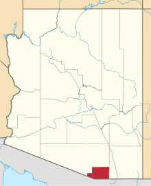 | |
| Town | ||
| CDPs | ||
| Unincorporated communities | ||
| Ghost towns | ||