Alum Bridge, West Virginia
| Alum Bridge, West Virginia | |
|---|---|
| Unincorporated community | |
 Alum Bridge  Alum Bridge | |
| Coordinates: 39°02′21″N 80°39′18″W / 39.03917°N 80.65500°WCoordinates: 39°02′21″N 80°39′18″W / 39.03917°N 80.65500°W | |
| Country | United States |
| State | West Virginia |
| County | Lewis |
| Elevation | 820 ft (250 m) |
| Time zone | Eastern (EST) (UTC-5) |
| • Summer (DST) | EDT (UTC-4) |
| ZIP code | 26321 |
| Area code(s) | 304 & 681 |
| GNIS feature ID | 1553722[1] |
Alum Bridge is an unincorporated community in Lewis County, West Virginia, United States. Alum Bridge is located on U.S. Route 33 and U.S. Route 119 along Leading Creek,[2] 10 miles (16 km) west of Weston. Alum Bridge has a post office with ZIP code 26321.[3]
Alum Bridge was named for the local bridge over Alum Fork.[4]
References
- ↑ "US Board on Geographic Names". United States Geological Survey. 2007-10-25. Retrieved 2008-01-31.
- ↑ West Virginia Atlas & Gazetteer. Yarmouth, Me.: DeLorme. 1997. p. 35. ISBN 0-89933-246-3.
- ↑ ZIP Code Lookup
- ↑ Kenny, Hamill (1945). West Virginia Place Names: Their Origin and Meaning, Including the Nomenclature of the Streams and Mountains. Piedmont, WV: The Place Name Press. p. 78.
Municipalities and communities of Lewis County, West Virginia, United States | ||
|---|---|---|
| City | 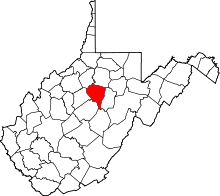 | |
| Town | ||
| Unincorporated communities |
| |
| Footnotes | ‡This populated place also has portions in an adjacent county or counties | |
This article is issued from Wikipedia - version of the 7/28/2016. The text is available under the Creative Commons Attribution/Share Alike but additional terms may apply for the media files.