Altoona, Florida
| Altoona, Florida | |
|---|---|
| Census-designated place | |
|
SR 19, looking north towards the CR 42 intersection in April 2009. | |
 Location in Lake County and the state of Florida | |
| Coordinates: 28°57′57″N 81°38′54″W / 28.96583°N 81.64833°WCoordinates: 28°57′57″N 81°38′54″W / 28.96583°N 81.64833°W | |
| Country |
|
| State |
|
| County |
|
| Area | |
| • Total | 0.5 sq mi (1.3 km2) |
| • Land | 0.4 sq mi (1.2 km2) |
| • Water | 0.1 sq mi (0.1 km2) |
| Elevation | 98 ft (30 m) |
| Population (2000) | |
| • Total | 88 |
| • Density | 176/sq mi (67.7/km2) |
| Time zone | Eastern (EST) (UTC-5) |
| • Summer (DST) | EDT (UTC-4) |
| ZIP code | 32702 |
| Area code(s) | 352 |
| FIPS code | 12-01050[1] |
| GNIS feature ID | 0305212[2] |

Altoona is an unincorporated census-designated place in Lake County, Florida. The population was 88 at the 2000 United States Census. It is part of the Orlando–Kissimmee–Sanford Metropolitan Statistical Area.
Geography
Altoona is located at 28°57′57″N 81°38′54″W / 28.96583°N 81.64833°W (28.965742, -81.648453).[3]
According to the United States Census Bureau, the CDP has a total area of 0.5 square miles (1.3 km2), of which, 0.4 square miles (1.0 km2) of it is land and 0.1 square miles (0.26 km2) of it (12.00%) is water.
History
Altoona was either named after Thomas Jefferson Hinson's hometown of Allatoona, Georgia, or after Altoona, Pennsylvania, which was the hometown of Augustus Gottschee, the first merchant in this settlement. Altoona became an incorporated municipality on February 12, 1887. The town was abolished on May 27, 1899, following a fire that wiped out most of its buildings and reduced its tax base to near zero.
Demographics
As of the census[1] of 2000, there were 88 people, 39 households, and 26 families residing in the CDP. The population density was 196.5 people per square mile (75.5/km²). There were 49 housing units at an average density of 109.4/sq mi (42.0/km²). The racial makeup of the CDP was 98.86% White, 1.14% from other races. Hispanic or Latino of any race were 1.14% of the population.
There were 39 households out of which 20.5% had children under the age of 18 living with them, 61.5% were married couples living together, 5.1% had a female householder with no husband present, and 30.8% were non-families. 28.2% of all households were made up of individuals and 2.6% had someone living alone who was 65 years of age or older. The average household size was 2.26 and the average family size was 2.78.
In the CDP the population was spread out with 19.3% under the age of 18, 8.0% from 18 to 24, 33.0% from 25 to 44, 26.1% from 45 to 64, and 13.6% who were 65 years of age or older. The median age was 40 years. For every 100 females there were 91.3 males. For every 100 females age 18 and over, there were 102.9 males.
The median income for a household in the CDP was $27,143, and the median income for a family was $58,750. Males had a median income of $22,000 versus $40,417 for females. The per capita income for the CDP was $16,939. None of the population and none of the families were below the poverty line.
References
- 1 2 "American FactFinder". United States Census Bureau. Archived from the original on 2013-09-11. Retrieved 2008-01-31.
- ↑ "US Board on Geographic Names". United States Geological Survey. 2007-10-25. Retrieved 2008-01-31.
- ↑ "US Gazetteer files: 2010, 2000, and 1990". United States Census Bureau. 2011-02-12. Retrieved 2011-04-23.
Municipalities and communities of Lake County, Florida, United States | ||
|---|---|---|
| Cities | 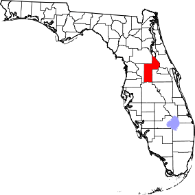 | |
| Towns | ||
| CDPs | ||
| Unincorporated communities |
| |
| Footnotes | ‡This populated place also has portions in an adjacent county or counties | |