Almegíjar
| Almegíjar | ||
|---|---|---|
|
| ||
| ||
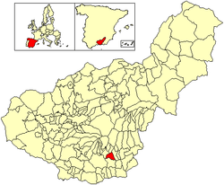 Location of Almegíjar | ||
| Country |
| |
| Aut. community |
| |
| Province | Granada | |
| Comarca | Alpujarra Granadina | |
| Judicial district | Órgiva | |
| Area | ||
| • Total | 30 km2 (10 sq mi) | |
| Elevation | 812 m (2,664 ft) | |
| Population (2005) | ||
| • Total | 435 | |
| • Density | 14.5/km2 (38/sq mi) | |
| Time zone | CET (UTC+1) | |
| • Summer (DST) | CEST (UTC+2) | |
| Website | Official website | |

.svg.png)
Almegíjar is a Spanish village and municipality located in the province of Granada, Andalusia. According to the 2005 census (INE), it has a population of 435 inhabitants.
Overview
It is situated at over 800 metres above sea level, on the southern slopes of the Sierra Morena, a spur of Mulhacen, the highest mountain in Spain. Before the Spanish Civil War in 1935, the church was burned by anarchists and during the war it was just behind the republican front lines; the remains of trenches can still be seen up the mountain. These trenches represents the furthest advance of the Fascists into Las Alpujarras after they took Granada.
The people of the village still largely work on the land, often using mules. There are many olive groves (and an olive oil processing factory), almonds, oranges and lemons, along with vegetable gardens.[3]
See also
References
- ↑ Cortijadas are little rural settlements of Spain
- ↑ Cortijadas are little rural settlements of Spain
- ↑ (Spanish) Some general infos about Almegíjar
External links
![]() Media related to Almegíjar at Wikimedia Commons
Media related to Almegíjar at Wikimedia Commons
- (Spanish) Almegíjar official website
Coordinates: 36°54′N 3°18′W / 36.900°N 3.300°W