Aldreth
| Aldreth | |
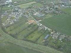 Aerial view of Aldreth |
|
 Aldreth |
|
| OS grid reference | TL446735 |
|---|---|
| – London | 62 mi (100 km) S |
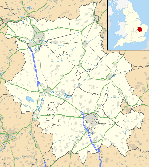
| Civil parish | Haddenham |
| District | East Cambridgeshire |
| Shire county | Cambridgeshire |
| Region | East |
| Country | England |
| Sovereign state | United Kingdom |
| Post town | ELY |
| Postcode district | CB6 |
| Dialling code | 01353 |
| Police | Cambridgeshire |
| Fire | Cambridgeshire |
| Ambulance | East of England |
| EU Parliament | East of England |
| UK Parliament | South East Cambridgeshire |
| Website | ECDC |
|
|
Coordinates: 52°20′N 0°07′E / 52.34°N 00.12°E
Aldreth is a hamlet in Cambridgeshire with about 260 residents (2001 census). It is located near the larger village of Haddenham (where the population is listed) and falls under the same Parish council. Aldreth is surrounded by fenland on all sides and the River Great Ouse, or the Old West as the locals call it, runs close by. Aldreth has no church.
Blossoms and Bygones
Aldreth shares an annual village open day, Blossoms & Bygones, with neighbouring village Haddenham. Features of the day include tractor rides and vintage car and tractor displays, while many residents throw open their gardens to visitors. Blossoms & Bygones celebrated its 40th Anniversary in 2011 with a VE Day theme, that saw the villagers of Aldreth dress up as if it was 1940.[1] They also have geocaching by the river which is good for dog walkers and explorers.
History
The origin of the name
According to one place-name authority, the name "Aldreth" occurs as "Alreheða" in the Pipe rolls, under the year 1170, and means "Landing-place by the alders", from a combination of the Old English words for "alder" and "hythe".[2] The name also occurs a number of times in the text of the 12th century Liber Eliensis, as "Alreheðe", with one variant as "Alhereðe".[3] The origin of the name There are other theories about how Aldreth got its name. Here are the most popular ones: It may be a derivation of the words Alder Hithe (the old shore), which relates to the Old West river flowing near Aldreth. It could also come from the words Alder Reche (the old reach), which also relates to the Old West river.
Two battles
Aldreth may have been the site of two battles[4][5] in history between Hereward the Wake (Saxons) and William the Conqueror (Normans). Aldreth was one of three routes, or causeways, into the Isle of Ely at that time; Stuntney Causeway 2.25 miles (3.62 km) to the south-east, the Earith Causeway 10 miles (16 km) to the west-south-west and the Aldreth Causeway 7 miles (11 km) south-west of the Isle of Ely.[6][7] For comparison of such causeways, consider the Bronze-Age causeway discovered in 1934 between Little Thetford and Fordey Farm, Barway.[8]
Geography
Geology
The village is on an east-west running boulder clay (middle-Pleistocene till) ridge sitting on a belt of mainly Jurassic Kimmerigian clays running south-west from The Wash. To the east is a north-south running belt of geologically more recent Upper-Cretaceous Lower Greensand capped by Lower-Cretaceous Gault Clay; the whole area is surrounded by even more recent fen deposits. To the west, again running north-east—south-west, is a scarp belt of middle-Jurassic sedimentary rocks including limestone and sandstone.[9][10]
The flat fenland countryside around the village, typical for this part of the region, lies about 16 feet (5 m) above sea-level. The highest point in the village is 23 feet (7 m) above sea-level and the highest point in the area is 85 feet (26 m) at Ely, seven-mile (11 km) north-east.[11] In contrast, the highest point in Cambridgeshire, 479 feet (146 m) above sea-level, is at Great Chishill, 21 miles (34 km) almost due south. Holme at nine feet (2.75 m) below sea-level is East Cambridgeshire's (and the United Kingdom's) lowest point, and is 18 miles (29 km) north-west.[12]
 |
New Bedford River | Sutton | Haddenham | |
| Earith | |
Wilburton | ||
| ||||
| | ||||
| Willingham | River Great Ouse Cottenham |
Chittering |
References
- ↑ "Ely People – Blossoms & Bygones story".
- ↑ Ekwall, E., The Concise Oxford Dictionary of English Place-Names (4th ed.), OUP, 1960, p. 5 (Aldreth). Cf. Mills, A.D., A dictionary of British place-names, OUP, 1991–2003, p. 5 (Aldreth). Note that Head (1995), p. 86, quotes "Freeman" as follows: "…Aldreth, a corruption of the name of the patron saint Æthelthryth". Head does not give a reference for, or expand on, the statement from "Freeman", but see Head (1995), pp. 7–8, and cf. Freeman, E.A., The History of the Norman Conquest of England (5 vols. & Index), OUP, 1867-9.
- ↑ Blake, E.O. (ed.), Liber Eliensis, Camden 3rd Series XCII, Royal Historical Society, 1962, pp. 178, 185, 194, 314(x2), 315, 322, 328; the variant "Alhereðe" is at p. 314.
- ↑ Miller (1895) chap. XXI
- ↑ Miller (1895) chap. XXV
- ↑ Head (1995) p. 149 plus google earth for distances
- ↑ Darby (1970) p. 106–118 and fig. 16 on p. 107
- ↑ Lethbridge (1934) | pp. 86–89
- ↑ Darby (1970) p. 3 fig. 1
- ↑ Geological Survey of Great Britain (Map) (Based on 1st series 1:50000 map part of sheet 143 – 1974 ed.). Ordnance Survey. 1981. § Cambridge, Sheet 188.
- ↑ Get-A-Map (Map) (2010 1:25,000 Scale ed.). Ordnance Survey. § TL446735GB. Retrieved 11 August 2010.
- ↑ "UK's lowest spot is getting lower". England: BBC. 29 November 2002. p. 1. Retrieved 11 August 2010.
Bibliography
- Darby, H C (1974). The Medieval Fenland. Cambridge University Press. ISBN 0-7153-5919-3.
- Fairweather, Janet (2005). Liber Eliensis: a history of the Isle of Ely from the seventh century to the twelfth. The Boydell Press. p. 502. ISBN 1-84383-015-9. Retrieved 3 August 2010.*
- Head, Vincent (1995). Hereward. Alan Sutton Publishing Inc. p. 86. ISBN 0-7509-0807-6.
- Lethbridge, T.C. (1934). "Investigations of the Ancient Causeway in the Fen between Fordy and Little Thetford". Proceedings of the Cambridge Antiquarian Society. XXXV.
- Miller, S H; Rev. W D Sweeting (1895). De Gestis herwardi Saxonis. Geo. C. Caster, Market Place, Peterborough. Retrieved 16 August 2010.
External links
| Wikimedia Commons has media related to Aldreth. |
- Haddenham & Aldreth Blossoms & Bygones Pictures 2011
- Aldreth in Vision of Britain
- A castle at Alrehede/Aldreth was constructed in 1071
- CHER record for Aldreth causeway (archaeology)
- The search for Hereward the Wake
