Albers, Illinois
| Albers, Illinois | |
| Village | |
| Country | United States |
|---|---|
| State | Illinois |
| County | Clinton |
| Coordinates | 38°32′41″N 89°36′59″W / 38.54472°N 89.61639°WCoordinates: 38°32′41″N 89°36′59″W / 38.54472°N 89.61639°W |
| Area | 0.85 sq mi (2 km2) |
| - land | 0.85 sq mi (2 km2) |
| - water | 0.00 sq mi (0 km2) |
| Population | 1,190 (2010) |
| Density | 1,400.0/sq mi (541/km2) |
| Timezone | CST (UTC-6) |
| - summer (DST) | CDT (UTC-5) |
| Postal code | 62215 |
| Area code | 618 |
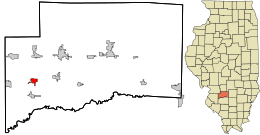 Location in Clinton County and the state of Illinois.
| |
.svg.png) Location of Illinois in the United States
| |
| Website: www | |
Albers is a village in Clinton County, Illinois, United States. The population was 1,190 at the 2010 census.[1]
Geography
Albers is located in western Clinton County at 38°32′41″N 89°36′59″W / 38.54472°N 89.61639°W (38.544833, -89.616300).[2] Illinois Route 161 runs through the village, leading east 27 miles (43 km) to Centralia and west 6 miles (10 km) to Interstate 64, which leads 28 miles (45 km) farther west to St. Louis. I-64 eastbound can be reached 3 miles (5 km) south of Albers in the village of Damiansville.
According to the 2010 census, the village has a total area of 0.85 square miles (2.2 km2), all land.[3]
Demographics
| Historical population | |||
|---|---|---|---|
| Census | Pop. | %± | |
| 1960 | 566 | — | |
| 1970 | 656 | 15.9% | |
| 1980 | 663 | 1.1% | |
| 1990 | 700 | 5.6% | |
| 2000 | 878 | 25.4% | |
| 2010 | 1,190 | 35.5% | |
| Est. 2015 | 1,174 | [4] | −1.3% |
As of the census[6] of 2000, there were 878 people, 315 households, and 225 families residing in the village. The population density was 1,211.1 people per square mile (470.8/km²). There were 322 housing units at an average density of 444.1 per square mile (172.7/km²). The racial makeup of the village was 98.86% White, 0.11% African American, 0.23% Native American, 0.34% from other races, and 0.46% from two or more races. Hispanic or Latino of any race were 0.80% of the population.
There were 315 households out of which 43.2% had children under the age of 18 living with them, 62.2% were married couples living together, 7.9% had a female householder with no husband present, and 28.3% were non-families. 24.8% of all households were made up of individuals and 12.4% had someone living alone who was 65 years of age or older. The average household size was 2.79 and the average family size was 3.40.
In the village the population was spread out with 30.4% under the age of 18, 9.5% from 18 to 24, 33.8% from 25 to 44, 14.7% from 45 to 64, and 11.6% who were 65 years of age or older. The median age was 33 years. For every 100 females there were 97.3 males. For every 100 females age 18 and over, there were 92.7 males.
The median income for a household in the village was $46,964, and the median income for a family was $57,625. Males had a median income of $36,316 versus $26,250 for females. The per capita income for the village was $19,017. About 2.7% of families and 4.0% of the population were below the poverty line, including 5.9% of those under age 18 and 5.9% of those age 65 or over.
History
Albers had its start in the 1860s when the railroad was extended to that point.[7]
References
- ↑ "Geographic Identifiers: 2010 Demographic Profile Data (G001): Albers village, Illinois". U.S. Census Bureau, American Factfinder. Retrieved August 1, 2014.
- ↑ "US Gazetteer files: 2010, 2000, and 1990". United States Census Bureau. 2011-02-12. Retrieved 2011-04-23.
- ↑ "Places: Illinois". 2010 Census Gazetteer Files. United States Census Bureau. Retrieved October 13, 2012. External link in
|work=(help) - ↑ "Annual Estimates of the Resident Population for Incorporated Places: April 1, 2010 to July 1, 2015". Retrieved July 2, 2016.
- ↑ "Census of Population and Housing". Census.gov. Archived from the original on May 11, 2015. Retrieved June 4, 2015.
- ↑ "American FactFinder". United States Census Bureau. Archived from the original on 2013-09-11. Retrieved 2008-01-31.
- ↑ Callary, Edward (29 September 2008). Place Names of Illinois. University of Illinois Press. p. 3. ISBN 978-0-252-09070-7.
External links
Municipalities and communities of Clinton County, Illinois, United States | ||
|---|---|---|
| Cities | ||
| Villages | ||
| Townships | ||
| Unincorporated communities | ||
| Ghost town | ||
| Footnotes | ‡This populated place also has portions in an adjacent county or counties | |