Akron, Alabama
| Akron, Alabama | |
|---|---|
| Town | |
|
Tanglewood in Akron | |
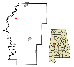 Location in Hale County and the state of Alabama | |
| Coordinates: 32°52′35″N 87°44′27″W / 32.87639°N 87.74083°W | |
| Country | United States |
| State | Alabama |
| County | Hale |
| Area | |
| • Total | 0.6 sq mi (1.4 km2) |
| • Land | 0.6 sq mi (1.4 km2) |
| • Water | 0 sq mi (0 km2) |
| Elevation | 131 ft (40 m) |
| Population (2007)[1] | |
| • Total | 436 |
| • Density | 868.3/sq mi (372.1/km2) |
| Time zone | Central (CST) (UTC-6) |
| • Summer (DST) | CDT (UTC-5) |
| ZIP code | 35441 |
| Area code(s) | 205 |
| FIPS code | 01-00676 |

Akron (/ˈækrɒn/) is a town in Hale County, Alabama, United States. In 1906, the owner of a large plantation, Waller Evan Wedgworth, sold part of his land to developers, and a construction boom followed. The town was incorporated in March 1918.[2] At the 2010 census the population was 356. Akron has one site on the National Register of Historic Places, the Greek Revival cottage known as Tanglewood.
Geography
Akron is located at 32°52′35″N 87°44′28″W / 32.87639°N 87.74111°W (32.876425, -87.740978).[3]
According to the United States Census Bureau, the town has a total area of 0.6 square miles (1.6 km2), all land.
Nearby cities and communities
Akron lies about halfway between Mounille (≈ 10 miles) and Eutaw (≈ 8 miles). Interstate 59/20 provides rapid access to Meridian, Mississippi (≈ 70 miles) and Tuscaloosa (≈ 30 miles). Other nearby communities include:Greensboro, Demopolis and Aliceville.
Demographics
| Historical population | |||
|---|---|---|---|
| Census | Pop. | %± | |
| 1920 | 675 | — | |
| 1930 | 793 | 17.5% | |
| 1940 | 504 | −36.4% | |
| 1950 | 684 | 35.7% | |
| 1960 | 604 | −11.7% | |
| 1970 | 535 | −11.4% | |
| 1980 | 604 | 12.9% | |
| 1990 | 468 | −22.5% | |
| 2000 | 521 | 11.3% | |
| 2010 | 356 | −31.7% | |
| Est. 2015 | 337 | [4] | −5.3% |
| U.S. Decennial Census[5] 2013 Estimate[6] | |||
As of the 2010 Census Akron had a population of 356. The racial and ethnic composition of the population was 86.5% black or African American, 13.2% white, 0.3% reporting two or more races and 0.3% Hispanic or Latino of any race.[7]
As of the census[8] of 2000, there were 521 people, 207 households, and 142 families residing in the town. The population density was 939.2 people per square mile (365.7/km²). There were 239 housing units at an average density of 430.8 per square mile (167.8/km²). The racial makeup of the town was 17.85% White, 81.00% Black or African American, and 1.15% from two or more races. 1.54% of the population were Hispanic or Latino of any race.
There were 207 households out of which 36.7% had children under the age of 18 living with them, 34.8% were married couples living together, 30.9% had a female householder with no husband present, and 31.4% were non-families. 28.5% of all households were made up of individuals and 14.5% had someone living alone who was 65 years of age or older. The average household size was 2.52 and the average family size was 3.15.
In the town the population was spread out with 29.4% under the age of 18, 9.8% from 18 to 24, 25.3% from 25 to 44, 20.9% from 45 to 64, and 14.6% who were 65 years of age or older. The median age was 32 years. For every 100 females there were 81.5 males. For every 100 females age 18 and over, there were 68.8 males.
The median income for a household in the town was $19,875, and the median income for a family was $21,250. Males had a median income of $22,396 versus $18,500 for females. The per capita income for the town was $10,929. About 37.1% of families and 40.7% of the population were below the poverty line, including 60.2% of those under age 18 and 32.7% of those age 65 or over.
Notable person
- Riggs Stephenson, Major League Baseball player for the Cleveland Indians and Chicago Cubs
References
- ↑ "Annual Estimates of the Population for Incorporated Places in Alabama". United States Census Bureau. 2008-07-10. Retrieved 2008-07-14.
- ↑ http://www.encyclopediaofalabama.org/article/h-3558
- ↑ "US Gazetteer files: 2010, 2000, and 1990". United States Census Bureau. 2011-02-12. Retrieved 2011-04-23.
- ↑ "Annual Estimates of the Resident Population for Incorporated Places: April 1, 2010 to July 1, 2015". Retrieved July 2, 2016.
- ↑ "U.S. Decennial Census". Census.gov. Archived from the original on May 11, 2015. Retrieved June 6, 2013.
- ↑ "Annual Estimates of the Resident Population: April 1, 2010 to July 1, 2013". Retrieved June 3, 2014.
- ↑ 2010 census report on race and Hispanic or Latino by place]
- ↑ "American FactFinder". United States Census Bureau. Archived from the original on 2013-09-11. Retrieved 2008-01-31.
Coordinates: 32°52′35″N 87°44′28″W / 32.876425°N 87.740978°W
Municipalities and communities of Hale County, Alabama, United States | ||
|---|---|---|
| City | 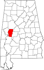 | |
| Towns | ||
| Unincorporated communities | ||
| Ghost towns | ||
| Footnotes | ‡This populated place also has portions in an adjacent county or counties | |