Adams, Minnesota
| Adams, Minnesota | |
|---|---|
| City | |
 Location of Adams, Minnesota | |
| Coordinates: 43°34′1″N 92°43′7″W / 43.56694°N 92.71861°W | |
| Country | United States |
| State | Minnesota |
| County | Mower |
| Area[1] | |
| • Total | 1.01 sq mi (2.62 km2) |
| • Land | 1.01 sq mi (2.62 km2) |
| • Water | 0 sq mi (0 km2) |
| Elevation | 1,286 ft (392 m) |
| Population (2010)[2] | |
| • Total | 787 |
| • Estimate (2012[3]) | 791 |
| • Density | 779.2/sq mi (300.9/km2) |
| Time zone | Central (CST) (UTC-6) |
| • Summer (DST) | CDT (UTC-5) |
| ZIP code | 55909 |
| Area code(s) | 507 |
| FIPS code | 27-00190[4] |
| GNIS feature ID | 0639202[5] |
Adams is a city in Adams Township, Mower County, Minnesota, United States. The population was 787 at the 2010 census.[6]
Geography
According to the United States Census Bureau, the city has a total area of 1.01 square miles (2.62 km2), all of it land.[1]
Demographics
| Historical population | |||
|---|---|---|---|
| Census | Pop. | %± | |
| 1880 | 96 | — | |
| 1890 | 216 | 125.0% | |
| 1900 | 573 | 165.3% | |
| 1910 | 576 | 0.5% | |
| 1920 | 609 | 5.7% | |
| 1930 | 574 | −5.7% | |
| 1940 | 674 | 17.4% | |
| 1950 | 663 | −1.6% | |
| 1960 | 806 | 21.6% | |
| 1970 | 771 | −4.3% | |
| 1980 | 797 | 3.4% | |
| 1990 | 756 | −5.1% | |
| 2000 | 800 | 5.8% | |
| 2010 | 787 | −1.6% | |
| Est. 2015 | 779 | [7] | −1.0% |
2010 census
As of the census[2] of 2010, there were 787 people, 304 households, and 188 families residing in the city. The population density was 779.2 inhabitants per square mile (300.9/km2). There were 330 housing units at an average density of 326.7 per square mile (126.1/km2). The racial makeup of the city was 98.3% White, 0.5% from other races, and 1.1% from two or more races. Hispanic or Latino of any race were 1.7% of the population.
There were 304 households of which 28.3% had children under the age of 18 living with them, 50.7% were married couples living together, 7.6% had a female householder with no husband present, 3.6% had a male householder with no wife present, and 38.2% were non-families. 34.5% of all households were made up of individuals and 20.4% had someone living alone who was 65 years of age or older. The average household size was 2.30 and the average family size was 2.95.
The median age in the city was 46.6 years. 21.3% of residents were under the age of 18; 7.3% were between the ages of 18 and 24; 19.1% were from 25 to 44; 20.8% were from 45 to 64; and 31.4% were 65 years of age or older. The gender makeup of the city was 46.4% male and 53.6% female.
2000 census
As of the census[4] of 2000, there were 800 people, 329 households, and 208 families residing in the city. The population density was 791.6 people per square mile (305.8/km²). There were 351 housing units at an average density of 347.3 per square mile (134.2/km²). The racial makeup of the city was 99.25% White, 0.12% Native American, 0.38% Asian, 0.25% from other races. Hispanic or Latino of any race were 0.62% of the population.
There were 329 households out of which 24.3% had children under the age of 18 living with them, 55.6% were married couples living together, 5.8% had a female householder with no husband present, and 36.5% were non-families. 35.0% of all households were made up of individuals and 24.9% had someone living alone who was 65 years of age or older. The average household size was 2.21 and the average family size was 2.85.
In the city the population was spread out with 20.9% under the age of 18, 6.5% from 18 to 24, 19.3% from 25 to 44, 17.0% from 45 to 64, and 36.4% who were 65 years of age or older. The median age was 49 years. For every 100 females there were 87.8 males. For every 100 females age 18 and over, there were 80.9 males.
The median income for a household in the city was $31,289, and the median income for a family was $38,125. Males had a median income of $31,083 versus $22,639 for females. The per capita income for the city was $16,550. About 4.4% of families and 6.3% of the population were below the poverty line, including 5.8% of those under age 18 and 8.2% of those age 65 or over.
History
The village of Adams was platted on January 30, 1868[9] by Selah Chamberlain. A two-room public school was built in 1869 and was later expanded to four rooms. The village was officially incorporated on March 2, 1887. A water works system was installed in the summer of 1897. A volunteer fire department was established as Adams Hose Co. No. 1 in 1898. A sewage system was installed in 1902. A Catholic school was built in 1903 and roughly half of the public school students started attending there, greatly relieving overcrowding. The sewage system was updated in 1958. The town is in the Southland school district (which includes Southland High School), and is home to the varsity fields for the teams.
Notable people
- Hubert H. Peavey, Wisconsin politician
- Harvey B. Sathre, Minnesota politician
References
- 1 2 "US Gazetteer files 2010". United States Census Bureau. Archived from the original on 2012-07-14. Retrieved 2012-11-13.
- 1 2 "American FactFinder". United States Census Bureau. Retrieved 2012-11-13.
- ↑ "Population Estimates". United States Census Bureau. Archived from the original on 2013-06-17. Retrieved 2013-05-28.
- 1 2 "American FactFinder". United States Census Bureau. Archived from the original on 2013-09-11. Retrieved 2008-01-31.
- ↑ "US Board on Geographic Names". United States Geological Survey. 2007-10-25. Retrieved 2008-01-31.
- ↑ "2010 Census Redistricting Data (Public Law 94-171) Summary File". American FactFinder. United States Census Bureau. Archived from the original on 21 July 2011. Retrieved 27 April 2011.
- ↑ "Annual Estimates of the Resident Population for Incorporated Places: April 1, 2010 to July 1, 2015". Retrieved July 2, 2016.
- ↑ "Census of Population and Housing". Census.gov. Archived from the original on May 11, 2015. Retrieved June 4, 2015.
- ↑ Upham, Warren (1920). Minnesota Geographic Names: Their Origin and Historic Significance. Minnesota Historical Society. p. 359.
Further reading
- Mill on the Willow: A History of Mower County, Minnesota by various authors. Library of Congress No. 84-062356
External links
Municipalities and communities of Mower County, Minnesota, United States | ||
|---|---|---|
| Cities | 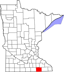 | |
| Townships | ||
| CDP | ||
| Unincorporated communities | ||
| Footnotes | ‡This populated place also has portions in adjacent county or counties | |
Coordinates: 43°33′55″N 92°43′10″W / 43.56528°N 92.71944°W