Acıpayam
| Acıpayam | |
|---|---|
 Acıpayam | |
| Coordinates: 37°25′30″N 29°21′14″E / 37.42500°N 29.35389°ECoordinates: 37°25′30″N 29°21′14″E / 37.42500°N 29.35389°E | |
| Country |
|
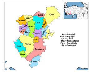
| Province | Denizli |
| Government | |
| • Mayor | Hulusi Şevkan (Republican People's Party) |
| • Kaymakam | Uğur Kalkar |
| Area[1] | |
| • District | 1,627.87 km2 (628.52 sq mi) |
| Elevation | 895 m (2,936 ft) |
| Population (2012)[2] | |
| • Urban | 13,746 |
| • District | 56,330 |
| • District density | 35/km2 (90/sq mi) |
| Website |
www |
Acıpayam is a town and a rural district of Denizli Province in high country between the Aegean and Mediterranean regions of Turkey. A plain, watered by two reservoirs, known for growing melons and watermelons, on the road between the city of Denizli and Antalya. It covers an area of 1700 km², and the altitude is 895 m. The district has a population of 57,533 of which 13,700 live in the city of Acipayam.
Etymology
The name Acıpayam means bitter almond (payam being a loanword from Persian) in the local dialect, the town was formerly named Garbipayam and Garbikaraağaç.
History
The plain has been settled since 2000 BC, and Hittites were here in 1500 BC, followed by the Ancient Greeks and more civilizations up to the Byzantines and then the arrival of the Turkish peoples. From 1097 the area was in the hands of the Seljuk Turks. Turkish rule was interrupted by the Crusades but afterwards was settled by the Oghuz Turks and eventually was absorbed into the Ottoman Empire.
Climate
| Climate data for Acipayam | |||||||||||||
|---|---|---|---|---|---|---|---|---|---|---|---|---|---|
| Month | Jan | Feb | Mar | Apr | May | Jun | Jul | Aug | Sep | Oct | Nov | Dec | Year |
| Average high °C (°F) | 7 (44) |
9 (48) |
13 (55) |
18 (64) |
23 (73) |
27 (80) |
31 (87) |
31 (87) |
28 (82) |
21 (69) |
14 (57) |
8 (46) |
19 (66) |
| Average low °C (°F) | −2 (28) |
−1 (30) |
0 (32) |
3 (37) |
7 (44) |
10 (50) |
14 (57) |
13 (55) |
9 (48) |
5 (41) |
1 (33) |
0 (32) |
4 (39) |
| Average precipitation mm (inches) | 91 (3.6) |
69 (2.7) |
53 (2.1) |
33 (1.3) |
36 (1.4) |
20 (0.8) |
10 (0.4) |
13 (0.5) |
13 (0.5) |
33 (1.3) |
56 (2.2) |
91 (3.6) |
516 (20.3) |
| Source: Weatherbase [3] | |||||||||||||
Acıpayam today
As well as agriculture some of Denizli's textile industry has spread to Acıpayam too, where there is a cellulose factory. In the past the people would migrate seasonally to pick tobacco or cotton in other parts of Turkey, today this is not necessary.
Places of interest
- Keloğlan Cave - a 145m long cave, open to visitors.
See also
References
- ↑ "Area of regions (including lakes), km²". Regional Statistics Database. Turkish Statistical Institute. 2002. Retrieved 2013-03-05.
- ↑ "Population of province/district centers and towns/villages by districts - 2012". Address Based Population Registration System (ABPRS) Database. Turkish Statistical Institute. Retrieved 2013-02-27.
- ↑ "Weatherbase: Historical Weather for Acipayam, Turkey". Weatherbase. 2011. Retrieved on November 24, 2011.
External links
| Wikimedia Commons has media related to Acıpayam. |
- A local news web site (Turkish)