1810 Crete earthquake
 | |
| Date | 16 February 1810 |
|---|---|
| Magnitude | 7.5 Mw |
| Depth | 90 km[1] |
| Epicenter | 35°30′N 25°36′E / 35.5°N 25.6°ECoordinates: 35°30′N 25°36′E / 35.5°N 25.6°E |
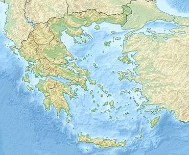
| Areas affected | Greece, Crete, Heraklion |
| Tsunami | minor |
| Casualties | 2,000 fatalities |
The 1810 Crete earthquake occurred at 22:15 on 16 February. It caused great destruction in Heraklion, some damage from Malta to northern Egypt and was felt from central Italy to Syria. 2,000 fatalities were reported from Candia (Heraklion).[2]
Tectonic setting
The Hellenic arc is an arcuate tectonic feature related to the subduction of the African Plate beneath the Aegean Sea Plate. It is one of the most active seismic zones in western Eurasia and has a history of large earthquakes that also affect Egypt.[3] Large earthquakes with epicenters near Crete and to the north of the island are typically intermediate depth events located at the subducting plate interface. Such events are often M>7, but due to their depths cause relatively little damage for their size, while being very widely felt.[4]
Damage
The earthquake caused severe damage in Heraklion and northeastern Crete. Damage was also reported from islands in the south Aegean, Cairo, Rosetta, Alexandria in northern Egypt and on Malta. Reports of the collapse of part of the Temple of Amon at Siwa Oasis in 1811 have been also been attributed to the 1810 event, rather than a separate earthquake, which is now regarded as a 'spurious event'.[5]
Characteristics
The earthquake was widely felt, and recorded from as far away as Cyprus, Turkey, Syria, central Italy and various parts of North Africa.[5][6] The main shock is reported to have lasted for two minutes in Malta.[2]
There are reports of a tsunami, with waves being recorded in the harbours of Malta and Alexandria and nearby canals, although these have more the character of seiches.[5][6]
See also
References
- ↑ Papazachos, B.C.; Comninakis, P.E.; Karakaisis, G.F.; Karakostas B.G.; Papaioanno Ch.A.; Papazachos C.B. & Scordilis E.M. (2000). "A catalogue of earthquakes in Greece and surrounding area for the period 550BC-1999". Retrieved 1 August 2010.
- 1 2 Mallet, R. (1855). "On the facts of earthquake phænomena". Report of the annual meeting, Volume 1854. Office of the British Association. p. 87. Retrieved 1 August 2010.
- ↑ Hamouda, A.Z. (2006). "Numerical computations of 1303 tsunamigenic propagation towards Alexandria, Egyptian Coast". Journal of African Earth Sciences. 44 (1): 37–44. Bibcode:2006JAfES..44...37H. doi:10.1016/j.jafrearsci.2005.11.005. Retrieved 26 July 2010.
- ↑ USGS (29 March 2010). "Tectonic Summary of Greece". Retrieved 1 August 2010.
- 1 2 3 Ambraseys, N.N.; Melville, C.P.; Adams, R.D (1994). The seismicity of Egypt, Arabia, and the Red Sea: a historical review. Cambridge University Press. p. 63. ISBN 978-0-521-39120-7. Retrieved 1 August 2010.
- 1 2 Papadopoulos, G.A.; Daskalaki E.; Fokaefs A. & Giraleas N. (2010). "Tsunami hazards in the eastern Mediterranean Sea: strong earthquakes and tsunamis in the west Hellenic arc and trench system" (PDF). Journal of Earthquakes and Tsunamis.