1481 Rhodes earthquake
 | |
| Date | 3 May 1481 |
|---|---|
| Magnitude | 7.1 |
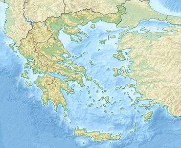
| Epicenter | 36°00′N 28°00′E / 36.0°N 28.0°ECoordinates: 36°00′N 28°00′E / 36.0°N 28.0°E |
| Areas affected | Greece, Rhodes |
| Casualties | 30,000 |
The 1481 Rhodes earthquake occurred at 3:00 in the morning on 3 May. It triggered a small tsunami, which caused local flooding. There were an estimated 30,000 casualties. It was the largest of a series of earthquakes that affected Rhodes, starting on 15 March 1481, continuing until January 1482.
Tectonic setting
The island of Rhodes lies on part of the boundary between the Aegean Sea and African plates. The tectonic setting is complex, with a Neogene history that includes periods of thrusting, extension and strike slip. It sits in what is known as the Hellenic arc and is a modern-day Grecian city.[1]Greece and specifically the Hellenic arc is in an area that is highly vulnerable to seismic activity, and historically always has been, dating back to the 226 BC Rhodes Earthquake.[2] This is because the region sits on many fault lines, including the Turkish-Greek plate boundary. Currently the island of Rhodes is undergoing a counter-clockwise rotation (17° ±5° in the last 800,000 years) associated with the south Aegean sinistral strike-slip fault system.[3] The island had also been tilted to the northwest during the Pleistocene, an uplift attributed to a reverse fault lying just to the east of Rhodes.
Damage
Sources refer to destruction in Rhodes Town; the Palace of the Grand Master of the Knights of Rhodes was sufficiently damaged to require immediate rebuilding (Rhodes was at the time under siege by the Turks).[4] The damage caused by the earthquakes led to a wave of rebuilding after 1481.[5] Damage from the tsunami was said to be greater than from the earthquake. The tsunami caused a large ship to break free from its moorings. It (or another ship) later sank with loss of all its crew after running onto a reef.[6]
Characteristics
Tsunami
The tsunami appears to have been relatively minor, estimated at a maximum 1.8 m. However, it was observed on the Levantine coasts and a tsunami sediment layer found at Dalaman, on the southwest coast of Turkey. Although the studies on sediment transport from tsunamis are limited, it is probable that the tsunami can be dated 1473 ±46. The sediment found and studied appears to be consistent with the aforementioned tsunami.[7][8]
Earthquake
There was a major foreshock on 15 March of that year. Following the mainshock on 3 May, earthquakes (presumably aftershocks) continued until January 1482, with large aftershocks on 5 May, 12 May, 3 October and 18 December. The estimated magnitude for the mainshock is 7.1 on the surface wave magnitude scale.[6]
References
- ↑ Yolsal-Çevikbilen, Seda; Taymaz, Tuncay (16 April 2012). "Earthquake source parameters along the Hellenic subduction zone and numerical simulations of historical tsunamis in the Eastern Mediterranean". Tectonophysics. 536–537: 61–100. doi:10.1016/j.tecto.2012.02.019.
- ↑ Papadopoulos, Gerassimos A.; Gràcia, Eulàlia; Urgeles, Roger; Sallares, Valenti; De Martini, Paolo Marco; Pantosti, Daniela; González, Mauricio; Yalciner, Ahmet C.; Mascle, Jean; Sakellariou, Dimitris; Salamon, Amos; Tinti, Stefano; Karastathis, Vassilis; Fokaefs, Anna; Camerlenghi, Angelo; Novikova, Tatyana; Papageorgiou, Antonia (1 August 2014). "Historical and pre-historical tsunamis in the Mediterranean and its connected seas: Geological signatures, generation mechanisms and coastal impacts". Marine Geology. 354: 81–109. doi:10.1016/j.margeo.2014.04.014.
- ↑ van Hinsbergen, D.J.J.; Krijgsman W.; Langeris C.G.; Cornée J-J.; Duermeijer C.E.; van Vugt N. (2007). "Discrete Plio-Pleistocene phases of tilting and counterclockwise rotation in the southeastern Aegean arc (Rhodos, Greece): early Pliocene formation of the south Aegean left-lateral strike-slip system". Journal of the Geological Society. 164 (6): 1133–1144. doi:10.1144/0016-76492006-061. Retrieved 6 December 2013.
- ↑ Bradbury, J. (2004-02-20). The Routledge companion to medieval warfare. Routledge Companions to History Series. Routledge. p. 295. ISBN 978-0-415-22126-9.
- ↑ Luttrell, A.; Borchardt, K.; Jaspert, N.; Nicholson, H.J. (2007). The Hospitallers, the Mediterranean and Europe: festschrift for Anthony Luttrell. Ashgate Publishing, Ltd. p. 113. ISBN 978-0-7546-6275-4. Retrieved 6 December 2013.
- 1 2 NGDC. "Comments for the Significant Earthquake". Retrieved 24 July 2010.
- ↑ Alpar, Bedri; Ünlü, Selma; Altınok, Yıldız; Özer, Naşide; Aksu, Abdullah (28 December 2010). "New approaches in assessment of tsunami deposits in Dalaman (SW Turkey)". Nat Hazards. 63 (1): 181–195. doi:10.1007/s11069-010-9692-5.
- ↑ Papadopoulos, G.A.; Daskalaki E.; Fokaefs A. & Giraleas N. (2007). "Tsunami hazards in the Eastern Mediterranean: strong earthquakes and tsunamis in the East Hellenic Arc and Trench system" (PDF). Natural Hazards and Earth System Sciences. 7: 57–64. doi:10.5194/nhess-7-57-2007. Retrieved 24 July 2010.