Ömnögovi, Uvs
| Ömnögovi District Өмнөговь сум ᠡᠮᠦᠨᠡᠭᠣᠪᠢᠰᠤᠮᠤ | |
|---|---|
| District | |
 Ömnögovi District | |
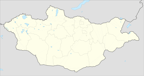
| Coordinates: MN 49°6′23″N 91°43′7″E / 49.10639°N 91.71861°ECoordinates: MN 49°6′23″N 91°43′7″E / 49.10639°N 91.71861°E | |
| Country | Mongolia |
| Province | Uvs Province |
| Time zone | UTC + 7 (UTC+7) |
Ömnögovi (Mongolian: Өмнөговь, Ömnögowĭ) is a sum (district) of Uvs Province in western Mongolia.
Part of the sum is desert, that has sand dunes.
Climate
Ömnögovi has a semi-arid climate (Köppen climate classification BSk) with warm summers and severely cold winters. The average minimum temperature in January is −28.3 °C (−18.9 °F), and temperatures as low as −45.5 °C (−49.9 °F) have been recorded. Most precipitation falls in the summer as rain, with some snow in the adjacent months of May and September. Winters are very dry.
| Climate data for Ömnögovi | |||||||||||||
|---|---|---|---|---|---|---|---|---|---|---|---|---|---|
| Month | Jan | Feb | Mar | Apr | May | Jun | Jul | Aug | Sep | Oct | Nov | Dec | Year |
| Record high °C (°F) | 3.2 (37.8) |
8.2 (46.8) |
17.5 (63.5) |
24.3 (75.7) |
28.3 (82.9) |
31.3 (88.3) |
33.6 (92.5) |
38.9 (102) |
29.7 (85.5) |
24.4 (75.9) |
11.9 (53.4) |
9.2 (48.6) |
38.9 (102) |
| Average high °C (°F) | −15.2 (4.6) |
−11.1 (12) |
−0.4 (31.3) |
8.6 (47.5) |
16.7 (62.1) |
21.6 (70.9) |
22.5 (72.5) |
21.0 (69.8) |
15.3 (59.5) |
6.9 (44.4) |
−3.8 (25.2) |
−13.1 (8.4) |
5.75 (42.35) |
| Daily mean °C (°F) | −22.6 (−8.7) |
−19.5 (−3.1) |
−8.6 (16.5) |
1.0 (33.8) |
9.5 (49.1) |
15.0 (59) |
16.2 (61.2) |
14.2 (57.6) |
7.9 (46.2) |
−0.6 (30.9) |
−10.9 (12.4) |
−20.3 (−4.5) |
−1.56 (29.2) |
| Average low °C (°F) | −28.4 (−19.1) |
−26.0 (−14.8) |
−16.0 (3.2) |
−6.1 (21) |
2.2 (36) |
8.2 (46.8) |
10.5 (50.9) |
8.2 (46.8) |
1.2 (34.2) |
−6.3 (20.7) |
−16.4 (2.5) |
−25.1 (−13.2) |
−7.83 (17.92) |
| Record low °C (°F) | −45.5 (−49.9) |
−42.3 (−44.1) |
−35.6 (−32.1) |
−23.1 (−9.6) |
−16.9 (1.6) |
−3.0 (26.6) |
1.5 (34.7) |
−1.8 (28.8) |
−18.5 (−1.3) |
−22.0 (−7.6) |
−31.8 (−25.2) |
−42.8 (−45) |
−45.5 (−49.9) |
| Average precipitation mm (inches) | 0.7 (0.028) |
0.5 (0.02) |
1.9 (0.075) |
4.3 (0.169) |
6.8 (0.268) |
24.9 (0.98) |
44.6 (1.756) |
27.0 (1.063) |
12.2 (0.48) |
3.0 (0.118) |
1.3 (0.051) |
1.4 (0.055) |
128.6 (5.063) |
| Average precipitation days (≥ 1.0 mm) | 0.1 | 0.3 | 0.6 | 1.0 | 1.6 | 4.3 | 4.2 | 4.5 | 2.1 | 0.5 | 0.3 | 0.5 | 20 |
| Source: NOAA (1963-1990) [1] | |||||||||||||
References
- ↑ "Umnugovi Climate Normals 1963-1990". National Oceanic and Atmospheric Administration. Retrieved January 13, 2013.
 | ||
This article is issued from Wikipedia - version of the 6/22/2016. The text is available under the Creative Commons Attribution/Share Alike but additional terms may apply for the media files.