Deadwood River (Idaho)
The Deadwood River is a 43.5-mile (70.0 km) tributary of the South Fork Payette River, flowing through Boise National Forest in Valley and Boise counties, Idaho in the United States. It joins the South Fork Payette River about 3 miles (4.8 km) west of Lowman. The source of the Deadwood River is below Deadwood summit on forest road 579 in the Salmon River Mountains. The Deadwood Dam was completed in 1931 and impounded the river to form Deadwood Reservoir.[3][4][5]
| Deadwood River | |
|---|---|
 Construction of the Deadwood Dam in 1930 | |
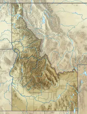 Location of the mouth of Deadwood River in Idaho  Deadwood River (Idaho) (the United States) | |
| Location | |
| Country | United States |
| State | Idaho |
| Region | Valley and Boise counties |
| Physical characteristics | |
| Source | |
| • location | Deadwood Summit |
| • coordinates | 44°32′39″N 115°33′48″W[1] |
| • elevation | 6,965 ft (2,123 m) |
| Mouth | South Fork Payette River |
• coordinates | 44°04′45″N 115°39′30″W[1] |
• elevation | 3,700 ft (1,100 m) |
| Length | 43.5 mi (70.0 km) |
| Basin size | 109 sq mi (280 km2)[2] |
| Discharge | |
| • maximum | 2,580 cu ft/s (73 m3/s) |
References
- "Deadwood River". Geographic Names Information System. United States Geological Survey. 1979-06-21. Retrieved December 27, 2014.
- "USGS National Map Streamer". United States Geological Survey. Archived from the original on September 7, 2014. Retrieved November 17, 2014.
- Boise National Forest (Map). 1:126720. U.S. Forest Service. 2012.
- "USGS 13236500 Deadwood River Bl Deadwood Res Nr Lowman ID". USGS. Retrieved December 27, 2014.
- "Boise and Deadwood River Bull Trout (Salvelinus confluentus monitoring activities". Bureau of Reclamation. 2009. Archived from the original (PDF) on December 27, 2014. Retrieved December 27, 2014. Cite journal requires
|journal=(help)
This article is issued from Wikipedia. The text is licensed under Creative Commons - Attribution - Sharealike. Additional terms may apply for the media files.