Rock Creek (Montana)
For other uses, see Rock Creek.
| Rock Creek | |
|---|---|
| Basin | |
| Main source | 46°13′26″N 113°31′21″W / 46.22389°N 113.52250°W |
| River mouth |
3,520 feet (1,070 m) 46°43′31″N 113°41′02″W / 46.72528°N 113.68389°WCoordinates: 46°43′31″N 113°41′02″W / 46.72528°N 113.68389°W[1] |
| River system | Columbia River |
| Physical characteristics | |
| Length | 52 miles (84 km)[2] |
Rock Creek is a 52-mile (84 km) river in Missoula and Granite County, Montana. Rock Creek is a tributary of the Clark Fork river. The river's headwaters are in Lolo National Forest near Phillipsburg, Montana. The river roughly parallels the Sapphire Mountains and enters the Clark Fork near Clinton, Montana. Sapphires are found along the river.[3][4]
Angling
Rock Creek is a popular fly fishing river for locals and destination anglers. It contains rainbow, brown, westslope cutthroat and the threatened bull trout.[5]
Notes
- ↑ "Rock Creek". Geographic Names Information System. United States Geological Survey.
- ↑ "Detailed Water Body Report-Rock Creek". Montana Fish, Wildlife and Parks Department. Retrieved 2011-11-06.
- ↑ "Montana Sapphires - Gemology". Gem Gallery. Retrieved October 29, 2011. Note: Includes map of major Montana sapphire mines
- ↑ Voynick, Stephen M. (1985). Yogo The Great American Sapphire (March 1995 printing, 1987 ed.). Missoula, MT: Mountain Press Publishing. p. 193. ISBN 0-87842-217-X.
- ↑ "Montana's Rock Creek". AnglerGuide.com. Retrieved 2011-11-07.
Municipalities and communities of Missoula County, Montana, United States | ||
|---|---|---|
| City | 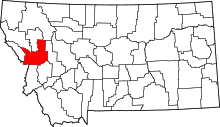 | |
| CDPs | ||
| Unincorporated communities | ||
| Ghost towns | ||
| Indian reservation | ||
| Footnotes | ‡This populated place also has portions in an adjacent county or counties | |
This article is issued from Wikipedia - version of the 9/11/2016. The text is available under the Creative Commons Attribution/Share Alike but additional terms may apply for the media files.