Kilbourn Bridge
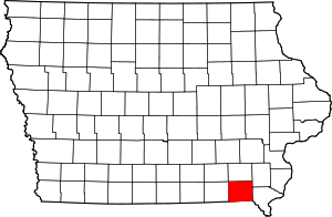
The Kilbourn Bridge is located just south of Kilbourn, Iowa, United States. It carried traffic on Lark Avenue over the Des Moines River for 855 feet (261 m).[2] In 1890 the Van Buren County Board of Supervisors contracted with the Western Bridge Company of Chicago to build a bridge at the Kilbourn ferry crossing. It was destroyed in a flood in 1903. The Board of Supervisors put off replacing the bridge until 1907, and then all the proposals came over the $20,000 limit. The following the year they removed the limit. The six-span bridge was designed by the Iowa State Highway Commission (ISHC), and built by the Ottumwa Supply and Construction Company of Ottumwa, Iowa. It was the first large-scale engineering project undertaken by the newly formed ISHC.[2] The bridge was listed on the National Register of Historic Places in 1998.[1]
References
|
|---|
|
| Topics | |
|---|
|
| Lists by states | |
|---|
|
| Lists by insular areas | |
|---|
|
| Lists by associated states | |
|---|
|
| Other areas | |
|---|
|
-
 Portal Portal
-
 WikiProject WikiProject
|
|
|---|
|
| Bonaparte | | |
|---|
|
| Cantril | |
|---|
|
| Farmington | |
|---|
|
| Keosauqua | |
|---|
|
| Kilbourn | |
|---|
|
| Milton | |
|---|
|
| Mount Zion | |
|---|
|
| Vernon | |
|---|
|
|