Finch Hatton, Queensland
| Finch Hatton Queensland | |||||||||||||
|---|---|---|---|---|---|---|---|---|---|---|---|---|---|
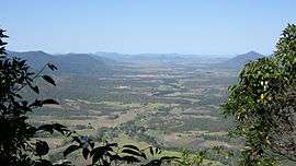 The locality occupies part of the Cattle Creek valley (background) | |||||||||||||
 Finch Hatton | |||||||||||||
| Coordinates | 21°08′02″S 148°38′20″E / 21.13389°S 148.63889°ECoordinates: 21°08′02″S 148°38′20″E / 21.13389°S 148.63889°E | ||||||||||||
| Postcode(s) | 4756 | ||||||||||||
| Location | |||||||||||||
| LGA(s) | Mackay Region | ||||||||||||
| State electorate(s) | Mirani | ||||||||||||
| Federal Division(s) | Capricornia | ||||||||||||
| |||||||||||||
Finch Hatton is a town and locality in the Mackay Region, Queensland, Australia.[1][2] At the 2011 census, Finch Hatton had a population of 260.[3]
History
The town is believed to be named after Harold Heneage Finch-Hatton (1856-1904), a grazier of Mount Spencer run (1881–83), and imperial federationist in United Kingdom (1884-1904).[1][2]
Finch Hatton Post Office opened by December 1906 (replacing a receiving office named Pelion open from December 1895).[4]
Finch Hatton State School opened on 5 July 1909.[5][6]
The Finch Hatton War Memorial was erected in 1921. It commemorated those servicemen from Finch Hatton and Netherdale who died in World War I. Later an additional plaque was added with the details of those who died in World War II. The memorial is located in Anzac Parade (21°08′26″S 148°37′55″E / 21.140431°S 148.632073°E).[7]
On 18 February 1958, Mackay was hit with massive flooding caused by heavy rainfall upstream with 878 mm of rain falling at Finch Hatton in 24 hours. The flood peaked at 9.14 metres (29.99 ft).[8] The water flowed down the valley and flooded Mackay within hours. Residents were rescued off rooftops by boats and taken to emergency accommodation. The flood broke Australian records.[9]
Heritage listings
Finch Hatton has a number of heritage-listed sites, including:
- Anzac Parade: Finch Hatton War Memorial[10]
- Mackay-Eungella Road: Finch Hatton railway station[11]
Education
Finch Hatton State School is a government primary (P-7) school located on Eungella Road (21°08′23″S 148°38′22″E / 21.139643°S 148.639357°E).[12] In 2012, it had an enrolment of 50 students.[13]
References
- 1 2 "Hatton Finch (town) (entry 12437)". Queensland Place Names. Queensland Government. Retrieved 25 May 2014.
- 1 2 "Hatton Finch (locality) (entry 46785)". Queensland Place Names. Queensland Government. Retrieved 25 May 2014.
- ↑ Australian Bureau of Statistics (31 October 2012). "Finch Hatton (L)". 2011 Census QuickStats. Retrieved 11 July 2013.
- ↑ Premier Postal History. "Post Office List". Premier Postal Auctions. Retrieved 10 May 2014.
- ↑ "Opening and closing dates of Queensland Schools". Queensland Government. Retrieved 25 May 2014.
- ↑ "Agency ID5218, Finch Hatton State School". Queensland State Archives. Retrieved 26 May 2014.
- ↑ "Finch Hatton War Memorial". Monument Australia. Retrieved 26 May 2014.
- ↑ Flood Warning System for the Pioneer River. Bom.gov.au. Retrieved on 18 August 2011.
- ↑ http://www.bom.gov.au/qld/flood/fld_reports/mackay_feb1958.pdf
- ↑ "Finch Hatton War Memorial (entry 600723)". Queensland Heritage Register. Queensland Heritage Council. Retrieved 10 July 2013.
- ↑ "Finch Hatton Railway Station (entry 600985)". Queensland Heritage Register. Queensland Heritage Council. Retrieved 10 July 2013.
- ↑ "Queensland State and Non-State Schools". Queensland Government. Retrieved 25 May 2014.
- ↑ "2012 School Annual Report" (PDF). Finch Hatton State School. Archived (PDF) from the original on 26 May 2014. Retrieved 26 May 2014.
Further reading
- Finch Hatton State School (2009), 100 years of memories : the school on the hill, Finch Hatton School, retrieved 28 October 2016