Evans Creek (Rogue River)
| Evans Creek | |
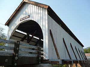 Wimer Bridge crosses the creek in Wimer | |
| Country | United States |
|---|---|
| State | Oregon |
| County | Jackson |
| Source | |
| - coordinates | 42°45′04″N 122°56′27″W / 42.75111°N 122.94083°W [1] |
| Mouth | Rogue River |
| - location | Rogue River |
| - elevation | 991 ft (302 m) [1] |
| - coordinates | 42°25′57″N 123°10′36″W / 42.43250°N 123.17667°WCoordinates: 42°25′57″N 123°10′36″W / 42.43250°N 123.17667°W [1] |
| Length | 36 mi (58 km) [2] |
| Basin | 224 sq mi (580 km2) [3] |
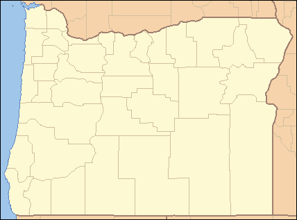 Location of the mouth of Evans Creek in Oregon | |
Evans Creek is a tributary, about 35 miles (56 km) long, of the Rogue River in the U.S. state of Oregon. It begins near Richter Mountain in the Cascade Range and flows generally south to The Meadows then southwest to Wimer then south to the city of Rogue River, all in Jackson County. The creek enters the river about 111 miles (179 km) from the Rogue's mouth on the Pacific Ocean.[2] Wimer Bridge, a one-lane covered bridge crosses the creek at Wimer.[4]
Named tributaries from source to mouth are Railroad Gap, Wolf, Coal, Chapman, Canon, and Morrison creeks. Further downstream come Spignet, West Fork Evans, May, Sykes, and Pleasant creeks. Last are Bear Branch and Fielder Creek.[2]
Formerly listed among the 10 worst dams in the state for migratory fish passage, two abandoned dams on Evans Creek were demolished in 2015. The removal of the Wimer and Fielder dams opened about 70 miles (110 km) of stream channels in the watershed to salmon and steelhead. Wimer Dam was about 9 miles (14 km) from the mouth of Evans Creek, and Fielder Dam was further downstream.[5]
See also
References
- 1 2 3 "Evans Creek". Geographic Names Information System (GNIS). United States Geological Survey. November 28, 1980. Retrieved February 18, 2016.
- 1 2 3 "United States Topographic Map". United States Geological Survey. Retrieved February 18, 2016 – via Acme Mapper. The map includes mile markers along the Rogue River and mile markers along Evans Creek for the lower 26 miles (42 km). The additional 10 miles (16 km) for the creek is an estimate based on map scale and ruler.
- ↑ "Water Quality Restoration Plan, Southern Oregon Coastal Basin, Evans Creek Watershed" (PDF). Bureau of Land Management. 2009. p. 9. Retrieved February 18, 2016.
- ↑ Mann, Damien (January 3, 2008). "Wimer Bridge Lives!". Medford Mail-Tribune. Local Media Group. Retrieved February 18, 2016.
- ↑ Burns, Jes (August 5, 2015). "Two of Oregon's Worst Dams for Fish are Coming Down". Oregon Public Broadcasting. Retrieved February 18, 2016.