Coyote Creek (Long Tom River)
| Coyote Creek | |
.jpg) Coyote Creek Bridge carries Battle Creek Road over the stream near Crow. | |
| Country | United States |
|---|---|
| State | Oregon |
| County | Lane |
| Source | Hills south of Eugene |
| - location | near Gillespie Corners |
| - elevation | 980 ft (299 m) [1] |
| - coordinates | 43°54′41″N 123°10′37″W / 43.91139°N 123.17694°W [2] |
| Mouth | Long Tom River |
| - location | Fern Ridge Reservoir |
| - elevation | 377 ft (115 m) [2] |
| - coordinates | 44°03′26″N 123°16′28″W / 44.05722°N 123.27444°WCoordinates: 44°03′26″N 123°16′28″W / 44.05722°N 123.27444°W [2] |
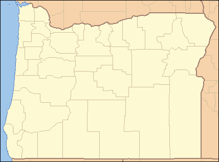 Location of the mouth of Coyote Creek in Oregon
| |
Coyote Creek is a tributary of the Long Tom River via Fern Ridge Reservoir in Lane County in the U.S. state of Oregon. Beginning in hills south of Eugene, it meanders generally north through Gillespie Corners and Crow before entering the reservoir east of Veneta.[3]
Slightly upstream of Crow, the creek flows under Coyote Creek Bridge. The covered bridge, on the National Register of Historic Places since 1979,[4] carries Battle Creek Road over the water.[5]
The creek's named tributaries from source to mouth are Rebel, Jackson, and Doak creeks followed by Fox Hollow. Then come Bear, Beaver, and Powell creeks followed by Hayes Branch. Further downstream are Jordan, Nighswander, Battle, Sturtevant, and Spencer creeks.[3]
See also
References
- ↑ Source elevation derived from Google Earth search using GNIS source coordinates.
- 1 2 3 "Coyote Creek". Geographic Names Information System (GNIS). United States Geological Survey. November 28, 1980. Retrieved February 6, 2016.
- 1 2 "United States Topographic Map". United States Geological Survey. Retrieved February 6, 2016 – via Acme Mapper.
- ↑ "Oregon National Register List" (PDF). Oregon Parks and Recreation Department. June 6, 2011. p. 20. Retrieved February 6, 2016.
- ↑ "Coyote Creek (Battle Creek) Covered Bridge" (PDF). Oregon Department of Transportation. Retrieved February 6, 2016.
External links
This article is issued from Wikipedia - version of the 9/11/2016. The text is available under the Creative Commons Attribution/Share Alike but additional terms may apply for the media files.