Zuffenhausen
| Stuttgart-Zuffenhausen | ||
|---|---|---|
| Stadtbezirk of Stuttgart | ||
|
Church of Saint Paul | ||
| ||
 Stuttgart-Zuffenhausen | ||
Location within Stuttgart 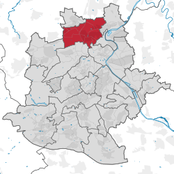 | ||
| Coordinates: 48°49′N 9°10′E / 48.817°N 9.167°ECoordinates: 48°49′N 9°10′E / 48.817°N 9.167°E | ||
| Country | Germany | |
| State | Baden-Württemberg | |
| Admin. region | Stuttgart | |
| District | Urban district | |
| City | Stuttgart | |
| Borough | Stadtbezirk | |
| Government | ||
| • District Director | Gerhard Hanus[1] | |
| Area | ||
| • Total | 11.96 km2 (4.62 sq mi) | |
| Population (2009/12/31) | ||
| • Total | 35,568 | |
| • Density | 3,000/km2 (7,700/sq mi) | |
| Time zone | CET/CEST (UTC+1/+2) | |
| Postal codes | 70435, 70437, 70439 | |
| Dialling codes | 0711 | |
| Vehicle registration | S | |
| Website |
www | |


Zuffenhausen is one of three northernmost urban district of the city of Stuttgart, the capital of the German state of Baden-Württemberg. The district is primarily formed by the formerly independent towns of Zuffenhausen, Zazenhausen, and Neuwirtshaus, and Rot, a historic town that gained importance as a refugee camp for German refugees. 35,000 people (as of 2009) live in Zuffenhausen's 1,200 hectares (12 km2), making it the third largest of Stuttgart's urban districts. Zuffenhausen is also one of the oldest, continuously inhabited places in Stuttgart, with evidence of permanent settlements taking back 7,500 years.
The etymological roots of "Zuffenhausen" likely comes from the Alemanni words "Uffo" or "Offo," and the oldest official mentioning of the town was by Pope Innocent III on May 18, 1204. Zuffenhausen was proclaimed a city in 1907, but its income was badly affected by the Great Depression and so Zuffenhausen (and later Zazenhausen) agreed to incorporation into Stuttgart on 1 April 1931.
Stuttgart-Zuffenhausen station is on the Franconia Railway and is served by lines S4, S5, S6 and S60 of the Stuttgart S-Bahn. The headquarters of Porsche and the Porsche Museum are located in Zuffenhausen. Stuttgart Neuwirtshaus (Porscheplatz) station is nearby and is served by lines S6 and S60.
Geography

Geography, Topography and Geology
Geography and topography
Zuffenhausen's terrain, a river valley carved into existence by the Feuerbach river, has two distinct elevations: Zuffenhausen with an average of 255 metres (837 ft) and Zazenhausen at 252 metres (827 ft). To the north and northwest, the vast stretches of the Gäuplatte and it is the "Long field" with their flat waves average at an elevation of about 300 metres (980 ft) (327 metres (1,073 ft) at Neuwirtshaus) that makes up the eastern part of the Strohgäu, a rich farmland largely free of trees. To the south lies the Swabian Alps and the Schurwald behind them, and to the east is the Neckar and its fertile valley. In the area of Zuffenhausen itself there are irregular increases in elevation, of which Burgholzhof is the highest with 359 metres (1,178 ft) above sea level.
Zuffenhausen's topography, crucial to the area's transport and settlement geography, has made Zuffenhausen a high traffic area for much of its history. The north-south road and trade artery running through the Pragsattel and Stuttgart Bay would repeatedly place Zuffenhausen at the center of local history. For example, on August 29, 1797 Johann Wolfgang von Goethe drove through Zuffenhausen on this road while on his third trip to Switzerland from Ludwigsburg.[2]
The location of settlements in the municipal area was determined both by the quality of the soil, proximity to the river such that the river would not flood but still be close enough to cultivate, and being on or very near the local trade routes.[3]
Geology
The geology of Zuffenhause is, by the nature of cuesta landscape, determined by a topographically varied picture of the different layers of rock and sediment as they were deposited in the 240-145 million year span of time that Zuffenhausen was part of the bottom of a primordial ocean. This is evidenced, thanks to paleontological fossil digs, by a layer of Muschelkalk at the bottom of this formation. Nearby quarries would also occasionally dig up Gipskeuper, gravel, and Stubensandstein at about the same level as far west as Neuwirtshaus.[4] The next two layers are Lettenkeuper and the Gipskeuper Formations, which show that the area was coastal at the time of the Triassic period. Following that is the Schilfsandstein; sediment deposited here, once a river delta for an ancient river system, that originated from areas with higher elevations such as the region from Burgholzhof to the Lemberg. Following layers, such as Löwenstein and Keuper formations, were again not expected to be found in Zuffenhausen due to the relatively low elevation, and thus likely occurred (in very limited quantity) as a result of a large local faultline. This fault, called the "Schwieberdinger-Zuffenhäuser-Cannstatter rejection," was created 65 million years ago by the plate tectonics that created the nearby Alps. It has a steep height of about 110 metres (360 ft), and mineral water rises from it in nearby Cannstatt.
Landscape, Flora, and Fauna
Landscape Development:[5] The diverse landscape present in Zuffenhausen is due to a troubled geological history involving very different stabilities and solubilities in the different soils and stones in the municipal area. The mostly flat area composed largely of Loess, Brown and Black soils, thanks to a Pleistocene era ice age, made for very optimal prerequisites for later use beginning at around the time of the Neolithic Revolution. Though these fertile soils were spread generously across the river valley, some areas were less fertile than others and were thus better suited for pastures than agricultural adaptation. In the succeeding Holocene epoch, the landscape changed from Tundra into Deciduous forest. The Linear Pottery culture began the decades-long process of deforestation that would forever change the climate of Europe in the mid 6th Millennium BC. They were the first to repurpose the soil those forests once stood on and it made for such prosperous agriculture that hunting began to account for only 10% of all consumed food.[5] However, pieces of that primordial forest still exist as the "Hofkammerwald" (named after the man who once owned the land), an area of over 58 hectares (0.58 km2) that has been operated by the City of Stuttgart as a community forest since 1968. The eastern part of the forest is the present city park, the northern section near Neuwirtshaus is now Schützenwies Forest, the westernmost part in Weilimdorf is now called the Maierwald.[6]
Also occurring during the Holocene period was the buildup of a floodplain thanks to the Feuerbach river at high tide, which created a deposit of fine material 8 metres (26 ft), nicknamed the "Alte Flecken" (German: Old Stain). In modern times, the entire water network is oriented on the Neckar, but the Feuerbach is still an important part of it featuring several tributaries of its own coming mostly from the west. The old town center, hardly affected by floods because of its location on the elevated west bank, lies between the Schmerbach which once flowed between Böhringer and Colmar. A few old creeks and streams would later become city streets, such as the Hördtstraße / Bönnigheimer road and Beilsteiner street. The density of water network's bedrock depended on the presence of limestone because it caused numerous seepages resulting in the superficial outflow of columns of marl.
Since the 19th century, Man has also considerably changed the geographical features of Zuffenhausen via the development of railway lines and roads, excavation of material to fill sinks, and the draining of local ponds. Until very recently, the settlement of Zuffenhausen itself was confined to the valley created by the Feuerbach eons ago. The landscape changed during the massive expansion of settlements beyond the Feuerbach valley, especially during the second half of the 19th century to the west and to the east after 1945, thanks to the creation of Impervious surfaces and the rerouting of streams in unprecedented scale. The Second World War also had profound changes on the landscape thanks to the veritable mountain of garbage and debris that had to be disposed of. Miscellaneous changes to the landscape includes the filling in of a few old quarries and clay pits in the Feuerbach river valley, and the flattening of an old stream and ditch that came down from Stammheim for an expansion to Zuffenhausen's cemetery.
The flora and fauna is quite diverse, even though the fauna has declined in number sharply thanks to impervious surfaces.[7] Birds, however, are less affected by the loss of habitat thanks to generously sized home gardens and the Hofkammerwald. Located west of Zuffenhausen are larger forests and different types of semi-arid grassland between the marginal fields and meadows used for farmland and the orchards, still visible on the Coat of Arms of Zazenhausen, were the most important boon of Zuffenhausen's economy until 1907. Since the emergence of a concern for the conservation of natural habitats in 2003, nature reserves have been declared by local government as conservation areas. Since 1976-1979, most of the vineyards on the western slope of Feuerbach river in the region are fully operational.
Environmental Protection:[8] As a response to pollution from the heavy traffic relatively nearby (Nitrogen oxide and Particulates) and Forest damage, has been established.[9] Noise pollution in the area can be attributed mostly to Bundesautobahn 81, Bundesstraße 10, 27, and 27a, and the Stuttgart S-Bahn and Stuttgarter Straßenbahnen. Measures have been made to improve the fell situation faced by the landscape of Zuffenhausen, such as Land restoration, the creation of Wildlife corridors, and the establishment of Green development plans.
History
- See Also: Zazenhausen, Neuwirtshaus, Rot

Overview
Stuttgart-Zuffenhausen has been inhabited consistently for about 7500 years, and hunter gatherers (evidenced by the discovery of early tools typically made of mammoth bones at Travertine nearby Cannstatt and Ludwigsburg) such as Neanderthals and Homo Erectus, have stalked the rich and abundant wildlife present for roughly 300,000 years.
During the Middle Ages, Zuffenhausen was often mistakenly documented as "Offenhausen" and "Ottohausen" due to differences in Alemannic German and later German tongues. For most of its history, Zuffenhausen has served as valuable farmland for its occupiers. On April 23, 1907, during the reign of King William II of Württemberg, Zuffenhausen became a city and would later be incorporated into Stuttgart on March 31, 1931, following financial difficulties symptomatic of the Great Depression.[10] The convenient location of Zuffenhausen on the bank of the Neckar river led to a sharp incline in population in the Industrial Revolution, when the purely rural character of Zuffenhausen was phased out by Industralization.[10]
May 1, 1933 saw the final union of Zazenhausen, Neuwirtshaus, and Zuffenhausen in one district. Starting in 1949, Zuffenhausen became increasing important to Stuttgart as an industrial district, and the "Rotwegsiedlung" municipality was founded in the northern part of the district for use by the SS in 1938. In the redivision of Stuttgart into the current municipalities in 1956, all administration in Stuttgart was once again completely restructured.
Since January 1, 2001, during yet another administrative reorganization of the municipalities of Stuttgart, Zuffenhausen is endowed with 11 municipalities. Today, Zuffenhausen is still an important location for industry, both local and international, as Porsche is headquartered here.[10]
Prehistory and Early History

The prehistoric finds made in Zuffenhausen district and surrounding areas (Lemburg, Burgholzhof, Stammheim, and Viesenhäuser Hof) date back to the Neolithic period and are among some of the oldest and most diverse of the Urban districts of Stuttgart. Though many settlements from the Neolithic period to the Iron Age exist, Zuffenhausen proper truly began during the Alemanni period.
Paleolithic and Mesolithic Zuffenhausen
Paleolithic:[11] Numerous findings and excavations in the area suggest the usage of hills in the region as paleolithic rest stops as far back as the Middle Paleolithic (300,000 years ago), suggesting that early peoples came through the region frequently. Further substantiation is offered by tools and processed bones discovered at Travertinbrüchen in nearby Bad Cannstatt.[12][13]
The first finds made in Zuffenhausen itself are only from the Upper Paleolithic time. In 1879, four Hand scrapers and pieces of Flint and Mammoth bone pieces were discovered at Hofäcker brickyard. Whether they have a connection to the extinct Neanderthal peoples or other once present early humans of Cro-Magnon origin is unknown, as scrapers tend not to differ from culture group to culture group because of their simple nature. At this time, Europe's landscape was glacial tundra, where ancient hunter gatherer societies followed and hunted the large herds of Mammoths, Reindeer, and Wild horses that migrated around ancient Stuttgart.
Mesolithic:[14] Initially, the people living here during the Mesolithic era were nomadic. Several tool storage bins dating back to the Mesolithic period have been discovered in the Stuttgart area, primarily in Bad Cannstatt and Burgholzhof in the Zuffenhausen district, that contained microliths that are characteristic to the Mesolithic era.
Neolithic Zuffenhausen
Early Neolithic (Linear Pottery):[15] The primary discoveries dating back to this period include the remains of a settlement with its usual banded ceramics in the northern and eastern areas of the district. Such settlements developed there at the southern edge of the Long Field, where good amounts of loess were available. Since crop rotation was a yet unknown practice, early settlements and their residents had to practice Shifting cultivation (as evidenced by the aforementioned ceramic bands) as the nutrients in the soil became depleted. Even with the practice of shifting cultivation, archeological evidence shows that dimensions of the fields and the settlements were too large. After about three years of use, the field would deplete and require decades to regain the lost fertility (longhouses typically would stand for about 30–50 years).[16][17] Due to the existence of such types of soils it is implied that there used to be a warmer climate and open wooded steppes during the Holocene period that were suitable for clearing and could be found in valleys. A few "Stool tombs" from this period have been discovered in hollow ditches, complete with grave goods. One of these graves contained one of the oldest examples of prepared food (legumes, toasted bread, hazelnuts and flaxseed), which was intended likely for provision in the afterlife journey and allow conclusions regarding their religious ideas which probably included ancestor worship. They cultivated einkorn, emmer and wheat, but only after the cutting down and incineration of nearby mixed oak forests by early settlements in need of new lands for crops.
As is common knowledge, the Neolithic Revolution saw the birth of civilization and true human settlement and Zuffenhausen was no different. As the longhouses on the various farmsteads that would soon become small farming villages began to stand at a length of about 40 feet (12 m), man began to keeping domesticated Sheep, Pigs, and Goats. The remains of several of these early sites have been discovered in the Zuffenhausen area from many different phases of the Early Neolithic period. The largest of these sites, located in Rot, yielded many individual finds of flint tools (blades, scrapers, axes, Quern-stones) and even inkstones and ceramics. The large amount of flint tools, blades in particular, suggests that the production of the tools using techniques such as stone grinding had become traditional. Such findings are spread across the region between Neuwirtshaus, Friedrichswahl, Zazenhausen and Rot and even beyond the Feuerbach river valley. The site of the old town center was an unsuitable location for the longhouses of the Linear Pottery culture (usually about 20 metres (66 ft)-40 metres (130 ft) long, typically held up to 60 persons and their cattle) as it was a swampy floodplain (the average temperatures of the then climate were about 2-3 degrees higher than they are now), so they built their villages (typically a cluster of 10 or so buildings) at more elevated locations that still had a decent amount of loess.[18][19] Another notable series of local discoveries are the about 200 tombs belonging to the Bandkeramik peoples in the 6th millennium BC have been unearthed. These findings, when combined with the roughly 4000 traces of prehistoric settlement like Hallstatt houses would indicate that this area was a favorite haunt of early civilization.[20]
Middle Neolithic:[21] Starting at the end of the 6th Millennium BC, the decoration on the pottery changed, stone axes began to actually pierce the handle or were hammered on instead of the usage of a splice. The dead were no longer buried in fetal position but instead lying on their backs as is the modern custom. In Southern Germany, the Mesolithic cultures at that point present were replaced by the Hinkelstein culture, the Großgartacher culture, the Planig-Friedberg culture, and the Rössen culture. These groups made little to no record of their existence in Zuffenhausen; the site of a village belonging to the Großgartach culture was discovered in the district.[22]
As the Neolithic Age began in earnest, the Schwieberdinger culture that had developed in the 5th Millennium BC and spread over much of Western Germany died out and was replaced by the Schussenrieder culture.[21]
Late Neolithic, Chalcolithic:[23] Though it is only slightly evident in Zuffenhausen, the usage and creation of copper tools by the Goldberg III culture had become apparent by the mid-4th Millennium BC, and vice versa with the Wheel and the Horgen culture. The Beaker culture, another Mid-4th Millennium group of early Europeans, left behind multiple examples of their pottery in a region stretching from Zuffenhausen to Kornwestheim. Included in these discoveries are their flat graves and trinkets. Other notable early Bronze Age items left in the Zuffenhausen area are various potteries left behind by the Corded ware culture.
| Bronze Age |
|---|
| ↑ Chalcolithic |
|
Near East (c. 3300–1200 BC) South Asia (c. 3000– 1200 BC) Europe (c. 3200–600 BC)
China (c. 2000–700 BC) |
| ↓Iron Age |
Bronze Age Zuffenhausen
Next to no barrows from the Bronze Age can be found in the area of Zuffenhausen, even though barrows from the Hallstatt peoples and other cultures from later times are present. However, in nearby Ludwigsburg and Weilimdorf, Bronze Age barrows do exist, but they are of considerable size, due to smaller tombs usually being destroyed by hapless farmers.
Bodies belonging to the Urnfield people, found in a trench under Friedrichshaller Street in Zuffenhausen itself and Neuwirtshaus with ceramics and bronze brooches and Rainbow cups, are some of the only demonstrable pieces of evidence for the settlement of Zuffenhausen during the Bronze Age.[24] The aforementioned Hallstatt culture houses are yet another assurance that people lived in Zuffenhausen and enjoyed its fertile soils.
Pre-Roman Iron Age Zuffenhausen
Inside the city district of Zuffenhausen, six hills inside Schelmenwasen (the city park) have been identified as grave mounds. They stand at about 0.3 to 2 meters, or one to six feet above ground and have a diameter of 15 to 33 meters, or 49 to 108 feet. Unfortunately, when the mounds were opened, they only wielded bones and a few minor trinkets. Outside the city, another nine burial mounds have been identified. Waste pits and a storage cellar located in the Hallstatt settlements seem to suggest a relationship between earlier Bronze Age folk and the Iron Age ones that came after. Similarly underground, there are other such grave findings in Rot and Neuwirtshaus with a base ring made of bronze. By far the largest discovery in the area is a massive Iron Age earthwork made up of walls that contained about 6,000 square metres (65,000 sq ft) of space.
La Tène:[25] In Zuffenhausen, two Celtic coins, minted in the Roman fashion, were unearthed in and near the La Tène settlement foundations at Elbelen/Wollinstraße, Nonnenäcker, Hummelbrunnental, Rot. Earlier La Tène ceramics have also been discovered in these foundations.
Roman Zuffenhausen

The then sparsely inhabited land north of the Danube river and east of the Rhine river that Roman geographer Claudius Ptolemy called the "Helvetii Wastes" came under Roman administration in the late 1st Century AD. Gradually, border fortresses and the Rhaetian Limes as well as towns and cities for civilian inhabitance were established. As is proven by written sources, a Roman provincial culture emerged in Agri Decumates and Germania Superior with Mainz (Then known as Mogontiacum) serving as the region's capital and seat of the governor of the province. From 85 to 90 AD, one of the most important Roman forts north of the Alps was built in nearby Bad-Cannstatt and christened Altenburg (German: Old Castle). This fortress, now known as Castrum Stuttgart-Bad Cannstatt, spanned about 37,400 square metres (403,000 sq ft), held 500 horsemen, and had about 20 towers. Civilian estates (mostly Villa rustica), while being nowhere near as gigantic as the Castrum, were still numerous throughout the region and existed to supply the plebeian soldiers and patrician officers alike. In Baden-Württemberg alone, at least a thousand such estates are known to exist and the majority thereof in the fertile Neckar river valley around Zuffenhausen, Cannstatt, Ludwigsburg, and Heilbronn. With the Romans came horticulture, the vineyards that still blanket the hills around Stuttgart, the orchards, Roman roads, factory produced pottery (Terra sigillata), and culture of the Romans.[26] Overall, Roman archeological sites inside Stuttgart are extremely numerous.[20]
The area of Zuffenhausen contains numerous of these cultural testimonies, such as several estates spread across the south and southeastern parts of the river valley that made intensive use of the soil (regardless of its fertility), as the need for food was enormous and required an extensive road network. One of the main southwestern Roman roads in Germany, marked by Roman milestones, started at Mainz (Mogontiacum) and passed through Schwieberdingen, up the alps and finally to Heidenheim an der Brenz. Even 2,000 years later, this rectilinear route to Schwieberdingen is nearly identical to its modern counterpart. In Neuwirtshaus, a waystation where travelers could exchange their horses for fresh mounts existed on this highway.
By about 232/233 AD, Germanic peoples (the Alemanni especially) began to cause the destruction of the Empire from within and without. The cracks started showing in earnest when the Alemanni overran Agri Decumates in 260 and the wars of 353 to 378 AD (thus bringing Old High German into the region). Later, the Alemanni would also expand into Alsace before being conquered by Clovis and the Franks. As Roman central leadership slowly withered and died with the rest of the Empire, the Romans left the region to its own devices. When the Alemanni became the new masters of the region, they began to organize it into territories.[27]
Alemanni and Merovingian Zuffenhausen

With the Romans left writing down one's history for a time, so what is known of Zuffenhausen's history during the Migration Period is known thanks to discovery and Archaeological excavation.
This period in the Alemanni era experienced a small explosion of places using the suffixes "-hausen" and "-hofen" that developed in the region (especially in the north: Zuffenhausen, Zazenhausen, Mühlhausen, Viesenhausen, Hofen). Toponyms with the ending "-hausen" are often characterized by names of settlements, like is presumably the case in Zazenhausen und Zuffenhausen (the "Z" in Zuffenhausen probably has its roots in a datival "zu"), or a specific feature of the place (for instance in Mühlhausen). The derivative was "Offo" or "Uffo" rather than "uffe," meaning that until about the 1150s AD, Zuffenhausen was still sometimes being referred to as "Offohausen," an annoyance for later historians. Without a doubt, the Alemanni period in Zuffenhusen's history was the most influential for the layout of the town and its municipalities.
Zuffenhausen Begins:[28] The plot of land that made up Zuffenhausen at the time was about 10 km and was determined by Burgholzhof (now part of Bad Cannstatt), the Lemberg and by such landmarks as abandoned Roman forts and old burial mounds. Initially, it is to be believed, the settlement was dominated by two estates - the first on the old Roman road near a large cemetery and the other on the site of a previous Pre-Roman settlement (likely built to protect an east-west river crossing) as marked by the existence of large Alemanni burial mounds with substantial goods. By the mid-7th Century, these two settlements were joined, creating Zuffenhausen as we know it. In the so-called "Expansion Phase" of 7th Century Frankish Merovingian Christendom, the organization and influence swelled with the growing population of Catholics living inside the Merovingian Empire. This Christianization also meant the end of placing burial goods with the dead - a boon for future archaeologists.
Twin towns
 La Ferté-sous-Jouarre, France
Trivia
References
Notes
- ↑ Gerhard Hanus Bio
- ↑ "von Goethe's Journal: August, 1797". zeno.org. Zeno.org.
- ↑ Gühring/Kull, p. 19
- ↑ Gühring/Kull, pp. 19–28
- 1 2 Gühring/Kull, pp. 28–32
- ↑ Gühring/Kull, pp. 181–193
- ↑ Gühring/Kull, pp. 32–36
- ↑ Gühring/Kull p. 36
- ↑ Gühring/Kull, p. 36
- 1 2 3 Official Site
- ↑ Gühring/Kull, p. 41
- ↑ Müller-Beck, pp. 252, 257–260
- ↑ Schukraft, p. 12
- ↑ Gühring/Kull, p. 42
- ↑ Gühring, pp. 42–44
- ↑ Keefer, pp. 90–107
- ↑ Müller-Beck, p. 464
- ↑ Keefer, p. 90, 106
- ↑ Hoffmann, p. 236
- 1 2 Schukraft, p. 14
- 1 2 Gühring/Kull, p. 45
- ↑ Keefer, p. 126–139, 145
- ↑ Gühring/Kull, p. 46
- ↑ Gühring/Kull, p. 47
- ↑ Gühring/Kull, p. 48
- ↑ Waßner, p. 24
- ↑ Gühring/Kull, p. 52
- ↑ Gühring/Kull, p. 55
- ↑ Archive: Dobermann
Bibliography
- Bassler, Siegfried (1987). Mit uns für die Freiheit. 100 Jahre SPD in Stuttgart. Stuttgart: Thienemanns Verlag. ISBN 3-522-62570-6.
- Bedürftig, Freidemann (1997). Lexikon Drittes Reich. 2. Munich: Piper. ISBN 3-492-22369-9.
- Benz, Wolfgang; Graml, Hermann; Weiß, Hermann (2001). Enzyklopädie des Nationalsozialismus. Munich: dtv. ISBN 3-423-33007-4.
- Brockhaus Enzyklopädie (19 ed.). Mannheim: FA Brockhaus. 1994. ISBN 3-7653-1200-2.
- Broszat, Martin; Frei, Norbert (1996). Das Dritte Reich im Überblick. Chronik – Ereignisse – Zusammenhänge. 5. Munich: Piper. ISBN 3-492-21091-0.
- Cunliffe, Barry (1996). Illustrierte Vor- und Frühgeschichte Europas. Frankfurt am Main: Campus Verlag. ISBN 3-593-35562-0.
- Chronik der Deutschen. 4. Gütersloh: Chronik Verlag. 1995. ISBN 3-577-14341-X.
- Chronik des 20. Jahrhunderts. 14. Chronik Verlag/Weltbild Verlag. 1996. ISBN 3-86047-130-9.
- "Auszug aus der Geschichte". Der Große Ploetz. Freiburg: Verlag Ploetz. 1981. ISBN 3-87640-170-4.
- Fritz, Eberhard (1980). Arbeit gegen das Dritte Reich. Berlin: Landeszentrale für politische Bildung Berlin.
- Fiedler, Lutz; Rosendahl, Gaëlle; Rosendahl, Wilifried (2011). Altsteinzeit von A bis Z. Darmstadt: WBG. ISBN 978-3-534-23050-1.
- Gühring, Albrecht; Beer, Mathias; Binder, Petra; Ehmer, Hermann; Friederich, Susanne; Glück, Manfred; Heinz, Reinhard; Juréwitz, Peter; Kull, Ulrich; Meyle, Wolfgang; Müller, Roland; Raberg, Frank; Rees, Werner; W., Hermann (2004). Zuffenhausen. Dorf – Stadt – Stadtbezirk. Zuffenhausen: Verein zur Förderung der Heimat- und Partnerschaftspflege sowie der Jugend- und Altenhilfe. ISBN 3-00-013395-X.
- Gutman, Israel; Jäckel, Eberhard; Longerich, Peter; Schoeps, Julius (1998). Enzyklopädie des Holocaust. Die Verfolgung und Ermordung der europäischen Juden. 2. Munich: Piper. ISBN 3-492-22700-7.
- Hirsch, Rudolf; Schuder, Rosemarie (1999). Der gelbe Fleck. Wurzeln und Wirkungen des Judenhasses in der deutschen Geschichte. Wiesbaden/Cologne: Fourier/PapyRossa-Verlag. ISBN 3-932412-86-9.
- Hoffmann, Emil (1999). Lexikon der Steinzeit. Munich: Verlag C. H. Beck. ISBN 3-406-42125-3.
- Hansjörg, Kammerer (2004). Amtsenthoben. Maßnahmen gegen württembergische Pfarrer unter dem Regiment Deutscher Christen im Herbst 1934. Stuttgart: Verein für württembergische Kirchengeschichte. ISBN 3-7722-3044-X.
- Keefer, Erwin (1993). Steinzeit. 1. Stuttgart: Theiss Verlag. ISBN 3-8062-1106-X.
- Kühnl, Reinhard (2000). Der deutsche Faschismus in Quellen und Dokumenten. Wiesbaden/Munich: PapyRossa/Fourier. ISBN 3-932412-85-0.
- Lamb, Hubert (1994). Klima und Kulturgeschichte. Der Einfluss des Wetters auf den Gang der Geschichte. Reinbek: Rowohlt Taschenbuch Verlag. ISBN 3-499-55478-X.
- Landeszentrale für politische Bildung Baden-Württemberg (Hrsg.): Taschenbuch Baden-Württemberg. Gesetze – Daten – Analysen. 1984: Kohlhammer Verlag. 1984. ISBN 3-17-008226-4.
- Lüning, Jens; Stelhi, Petar (1989). Die Bandkeramik in Mitteleuropa: von der Natur- zur Kulturlandschaft. Spektrum der Wissenschaft (Hrsg.): Siedlungen der Steinzeit. Heidelberg: Die Bandkeramik in Mitteleuropa: von der Natur- zur Kulturlandschaft. pp. 110–120. ISBN 3-922508-48-0.
- Mann, Golo (1986). Propyläen Weltgeschichte. Eine Universalgeschichte. Berlin, Ullstein, Frankfurt: Propyläen Verlag. ISBN 3-549-05731-8.
- Miller, Susanne; Potthof, Heinrich (1983). Kleine Geschichte der SPD. Darstellung und Dokumentation 1848–1983. 5. Bonn: Verlag Neue Gesellschaft. ISBN 3-87831-350-0.
- Mirow, Jürgen (1996). Geschichte des deutschen Volkes. Von den Anfängen bis zur Gegenwart. 2. Gernsbach: Casimir Katz Verlag. ISBN 3-925825-64-9.
- Müller-Beck, Hansjürgen (1983). Urgeschichte in Baden-Württemberg. Stuttgart: Konrad Theiss Verlag. ISBN 3-8062-0217-6.
- Schukraft, Harald (1999). Wie Stuttgart wurde, was es ist. Ein kleiner Gang durch die Stadtgeschichte. Stuttgart: Silberburg Verlag. ISBN 3-87407-222-3.
- 111 Jahre SPD Zuffenhausen 1889–2000. Sozialdemokratische Geschichte am Beispiel eines Stuttgarter Ortsvereins. Zuffenhausen: SPD-Ortsverein. 2000.
- Licht auf dunkle Zeit. Stuttgart in der Zeit von 1933 bis 1945. Stuttgart: Stadtjugendring Stuttgart. 2000.
- "Zuffenhausen". Encyclopædia Britannica. Chicago. 1993.
External links
- Official site
- City site
- Porsche in Zuffenhausen
- "Zuffenhausen" (PDF) (in German). Statistisches Amt Stuttgart. 2009. Retrieved 2011-10-08.
| Wikimedia Commons has media related to Stuttgart-Zuffenhausen. |
Districts of Stuttgart | ||
|---|---|---|
| Inner distracts |
| |
| Outer districts |
| |