Zoigê County
| Zoigê County | |
|---|---|
| County | |
| Tibetan transcription(s) | |
| • Tibetan | མཛོད་དགེ་རྫོང༌། |
| • Wylie | mdzod dge rdzong |
| Chinese transcription(s) | |
| • Simplified | 若尔盖县 |
| • Traditional | 若爾蓋縣 |
| • Pinyin | Ruò'ěrgài Xiàn |
|
Baozuo township in Zoigê County | |
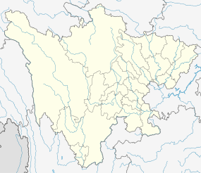
.png) Zoigê County (pink) in Ngawa Prefecture (yellow) and Sichuan | |
 Zoigê County Location of the seat in Sichuan | |
| Coordinates: 33°37′12″N 102°56′24″E / 33.62000°N 102.94000°ECoordinates: 33°37′12″N 102°56′24″E / 33.62000°N 102.94000°E | |
| Country | People's Republic of China |
| Province | Sichuan |
| Prefecture-level city | Ngawa |
| County seat | Dazhasi (达扎寺镇) |
| Area | |
| • Total | 10,620 km2 (4,100 sq mi) |
| Population | |
| • Total | 69,000 |
| • Density | 6.5/km2 (17/sq mi) |
| • Major nationalities | Tibetan - 90.4% |
| Time zone | China Standard (UTC+8) |
| Postal code | 624500 |
| Area code(s) | 0837 |

Zoigê County (Tibetan: མཛོད་དགེ་རྫོང༌།, Wylie: mdzod dge rdzong, Chinese: 若尔盖县; pinyin: Ruò'ěrgài Xiàn) is a county of Ngawa Tibetan and Qiang Autonomous Prefecture, Sichuan province, China, bordering Gansu to the north. It is the northernmost county of the province. It is part of Tibetan traditional part called Amdo.
It has an area of 10,620 km2 (4,100 sq mi) and 69,900, 90.4% of which are Tibetan people.[1]
Administrative divisions
Zoigê County has 2 town and 15 townships:[2]
- Town:
- Dazhasi (达扎寺镇)
- Tangke (唐克镇)
- Townships:
- Banyou (班佑乡)
- Axi (阿西乡)
- Xiaman (辖曼乡)
- Hongxing (红星乡)
- Maixi (麦溪乡)
- Neiwa (嫩哇乡)
- Donglie (冻列乡)
- Chong'er (崇尔乡)
- Re'er (热尔乡)
- Zhanwa (占哇乡)
- Jiangzha (降扎乡)
- Baxi (巴西乡)
- Axirong (阿西茸乡)
- Qiuji (求吉乡)
- Baozuo (包座乡)
Transport
Climate
Zoigê has an alpine subarctic climate (Köppen Dwc), featuring very cold nights even in summertime, and very cold winters with extreme diurnal temperature ranges. Snow can fall any time of the year and usually does not melt until summer due to repeated nightly freezing even when maxima are above 0 °C (32 °F). Therefore, access to Zoigê is heavily restricted during the winter months from late October to early May. Sitting at an altitude of more than 11,000 feet, high-altitude sickness is another common problem for tourists.
| Climate data for Zoige | |||||||||||||
|---|---|---|---|---|---|---|---|---|---|---|---|---|---|
| Month | Jan | Feb | Mar | Apr | May | Jun | Jul | Aug | Sep | Oct | Nov | Dec | Year |
| Record high °C (°F) | 12.4 (54.3) |
15.5 (59.9) |
18.3 (64.9) |
23.5 (74.3) |
23.3 (73.9) |
24.1 (75.4) |
25.2 (77.4) |
25.4 (77.7) |
23.8 (74.8) |
22.6 (72.7) |
16.2 (61.2) |
11.4 (52.5) |
25.4 (77.7) |
| Average high °C (°F) | 0.5 (32.9) |
2.4 (36.3) |
5.9 (42.6) |
9.3 (48.7) |
12.6 (54.7) |
15.0 (59) |
17.2 (63) |
17.2 (63) |
13.3 (55.9) |
9.2 (48.6) |
4.8 (40.6) |
1.7 (35.1) |
9.1 (48.4) |
| Daily mean °C (°F) | −10.1 (13.8) |
−7.0 (19.4) |
−2.3 (27.9) |
1.7 (35.1) |
5.5 (41.9) |
8.7 (47.7) |
10.7 (51.3) |
10.1 (50.2) |
6.5 (43.7) |
1.8 (35.2) |
−4.2 (24.4) |
−8.8 (16.2) |
1.05 (33.9) |
| Average low °C (°F) | −19.3 (−2.7) |
−15 (5) |
−8.5 (16.7) |
−4 (25) |
−0.1 (31.8) |
3.4 (38.1) |
5.3 (41.5) |
4.4 (39.9) |
1.7 (35.1) |
−3.2 (26.2) |
−10.5 (13.1) |
−17 (1) |
−5.2 (22.6) |
| Record low °C (°F) | −33.6 (−28.5) |
−31.8 (−25.2) |
−26 (−15) |
−16.6 (2.1) |
−11.5 (11.3) |
−6.6 (20.1) |
−3.7 (25.3) |
−5.6 (21.9) |
−9.6 (14.7) |
−15.5 (4.1) |
−23.4 (−10.1) |
−28 (−18) |
−33.6 (−28.5) |
| Average precipitation mm (inches) | 4.8 (0.189) |
7.9 (0.311) |
17.2 (0.677) |
36.6 (1.441) |
76.8 (3.024) |
101.6 (4) |
122.4 (4.819) |
112.6 (4.433) |
101.0 (3.976) |
57.0 (2.244) |
7.8 (0.307) |
2.8 (0.11) |
648.5 (25.531) |
| Average precipitation days (≥ 0.1 mm) | 5.4 | 7.5 | 11.8 | 14.8 | 18.5 | 19.8 | 18.6 | 16.7 | 18.7 | 15.7 | 5.8 | 3.7 | 157 |
| Source: Weather China | |||||||||||||
References
- ↑ "Profile of Zoigê County" (in Chinese). Official website of Ngawa Prefecture Government. Archived from the original on 2008-04-09. Retrieved 2008-06-08.
- ↑ "Profile of Zoigê County" (in Chinese). Archived from the original on 2008-05-17. Retrieved 2008-06-07.