Zara'a, Hama
| Zara'a الزارة | |
|---|---|
| Village | |
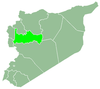
 Zara'a Location in Syria | |
| Coordinates: 34°55′12″N 36°39′34″E / 34.92000°N 36.65944°ECoordinates: 34°55′12″N 36°39′34″E / 34.92000°N 36.65944°E | |
| Country |
|
| Governorate | Hama |
| District | Hama |
| Subdistrict | Hirbnafsah |
| Population (2004) | |
| • Total | 929 |
| Time zone | EET (UTC+2) |
| • Summer (DST) | EEST (UTC+3) |
| City Qrya Pcode | C3041 |
Zara'a (Arabic: الزارة also spelled Zara or Zarah) is a Syrian village located in the Hirbnafsah Subdistrict in Hama District. It is situated along the banks of the Orontes River. According to the Syria Central Bureau of Statistics (CBS), Zara'a had a population of 929 in the 2004 census.[1] The village is mainly inhabited by Alawites.[2] Al-Nusra Front took control of the village on 12 May 2016. There were reports that Alawite families either fled or were killed.
References
- ↑ "General Census of Population 2004.". Retrieved 10 July 2014.
- ↑ "Al-Qaida, Hard-Line Rebels Seize Alawite Village in Syria". ABC News. 12 May 2016.
This article is issued from Wikipedia - version of the 6/1/2016. The text is available under the Creative Commons Attribution/Share Alike but additional terms may apply for the media files.

