Zaghdraiya
| Zaghdraiya | |
|---|---|
| Village | |
 Zaghdraiya Location in Lebanon | |
| Coordinates: 33°31′32″N 35°24′8″E / 33.52556°N 35.40222°ECoordinates: 33°31′32″N 35°24′8″E / 33.52556°N 35.40222°E | |
| Country |
|
| Governorate | South Governorate |
| District | Sidon District |
| Time zone | EET (UTC+2) |
| • Summer (DST) | EEST (UTC+3) |
| Area code(s) | 07 |
Zaghdraiya (also Zeghdrâya, Zoghedraya, Zghedraia. Arabic: زغدرايا) is a town in the South Governorate in Lebanon. It is located southeast of Sidon.[1] The village is bordered with a number of villages/towns like Darb es Sim, Maghdouche, Miye ou Miye. It has a very small population and is mainly formed of very few houses and a lot of agricultural space.
The word Zaghdraiya means "castle" or "fortress" possibly due to the fact that the village is surrounded by hill tops in almost every direction.[2]
History
In 1875, Victor Guérin found it to be a village of 150 Metualis, who planted figs and olives in the environment.[3] Many of the inhabitants of the town participated in a lot of the country's struggles with Israel.
The town saw many struggles between its political party branches of various militias and the PLO (The Palestine Liberation Organization) which later spread to surrounding villages.
Ron Arad Capture
In 1986, two Israeli pilots on a mission to attack PLO targets near Sidon had their plane bombed and so the pilots ejected and parachuted down. One of the pilots (Yishai Aviram) was able to escape after being found by another Israeli helicopter, whereas the other pilot Ron Arad fell into a valley in Zaghdraiya and was captured by Amal fighters from a different village that were patrolling the area, Arad was then taken to Beirut and has been missing ever since despite various attempts and years of searching by the Israeli government to determine his whereabouts.[4]
Demographics
The town has very little inhabitants that are of a variety of religions that include Shiites as well as Melkite Catholics and Maronite Catholics as it shares borders with villages that are of Christian and Shi'a Majority.
A good portion of the town's population hold university degrees and work as doctors, nurses, lawyers, teachers, engineers including many of which have travelled abroad and went on to become very successful at their jobs. Others work in the public and governmental sector and a vast majority take good interest in maintaining and taking care of their crops and the town's agriculture. Many of the natives that went on to live elsewhere return on holidays/weekends to take care and see their lands.
Sights
The town is mostly an agricultural landscape with a lot of olive, lemon, fig, orange, loquat (Akkidenia), and green almond trees. the town produces a lot of grapes, green beans, and jujubes. The Siniq river passes through the village and is usually the source of irrigation of these crops.
The town overlooks a vast array of the hills of southern Lebanon due to it being predominantly uninhabited landscapes and rarely any tall buildings. Inhabitants also have a view of the Our Lady of Mantara and part of Maghdouche from the village as well as a view of the Mediterranean Sea.
References
- ↑ "زغدرايا". geoview.info. Retrieved 2015-09-26.
- ↑ http://www.lwc-london.com/pages.php?id=10
- ↑ Guérin, 1880, p. 515
- ↑ "جنوبيات - لبنانيات - كيف اسقطت طائرة رون أراد في وادي طنبوريت بعد الإغارة على مواقع فلسطينية في المية ومية وجبل الحليب؟". www.janobiyat.com (in Arabic). Retrieved 2015-09-26.
Bibliography
- Guérin, Victor (1880). Description Géographique Historique et Archéologique de la Palestine (in French). 3: Galilee, pt. 2. Paris: L'Imprimerie Nationale.
| Capital | 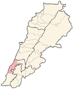 | |
|---|---|---|
| Towns and villages | ||
| Other | ||