Yuryung-Khaya
| Yuryung-Khaya (English) Юрюнг-Хая (Russian) Үрүҥ Хайа (Sakha) | |
|---|---|
|
- Rural locality[1] - Selo[1] | |
 View of Yuryung-Khaya from the Anabar River | |
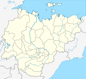
_Republic_(2008-03).svg.png) Location of the Sakha (Yakutia) Republic in Russia | |
 Yuryung-Khaya | |
|
| |
| Administrative status (as of June 2009) | |
| Country | Russia |
| Federal subject | Sakha Republic[1] |
| Administrative district | Anabarsky District[1] |
| Rural okrug | Yuryung-Khainsky National (Dolgan) Rural Okrug[1] |
| Administrative center of | Yuryung-Khainsky National (Dolgan) Rural Okrug[1] |
| Municipal status (as of April 2012) | |
| Municipal district | Anabarsky Municipal District[2] |
| Rural settlement | Yuryung-Khainsky National (Dolgan) Rural Settlement[2] |
| Administrative center of | Yuryung-Khainsky National (Dolgan) Rural Settlement[2] |
| Statistics | |
| Population (2010 Census) | 1,148 inhabitants[3] |
| Population (January 2016 est.) | 1,120 inhabitants[4][5] |
| Time zone | YAKT (UTC+09:00)[6] |
| Founded | 1930 |
| Postal code(s)[7] | 678431 |
| Yuryung-Khaya on Wikimedia Commons | |
Yuryung-Khaya (Russian: Юрюнг-Хая, Yakut: Үрүҥ Хайа) is a rural locality (a selo), the only inhabited locality, and the administrative center of Yuryung-Khainsky National (Dolgan) Rural Okrug of Anabarsky District in the Sakha Republic, Russia, located 160 kilometers (99 mi) from Saskylakh, the administrative center of the district. Its population as of the 2010 Census was 1,148,[3] of whom 552 were male and 596 female, up from 1,051 recorded during the 2002 Census.[1]
Geography
The village is situated on the right bank of the Anabar River, shortly before it flows into the Laptev Sea.
History and demographics
The village was founded in 1930 as part of Soviet efforts to settle the nomadic indigenous inhabitants of the region. The village's name means White Mountain in the Yakut and Dolgan languages.
Yuryung-Khaya is the only settlement in the Sakha Republic with a population composed mainly of Dolgans, and also the only substantial population of Dolgans outside the Krasnoyarsk Kray.
Economy and infrastructure
The village economy is based around agriculture, specifically reindeer herding, fishing and other farming. It is reachable via a winter road leading upstream along the Anabar to Saskylakh.
Climate
Owing to the extreme northern location Yuryung-Khaya has a cold and dry polar climate (Köppen ET) with severely cold winters and cool summers.
| Climate data for Yuryung-Khaya | |||||||||||||
|---|---|---|---|---|---|---|---|---|---|---|---|---|---|
| Month | Jan | Feb | Mar | Apr | May | Jun | Jul | Aug | Sep | Oct | Nov | Dec | Year |
| Record high °C (°F) | −12 (10) |
−10 (14) |
−5 (23) |
0 (32) |
5 (41) |
20 (68) |
26 (79) |
23 (73) |
8 (46) |
5 (41) |
−8 (18) |
−12 (10) |
26 (79) |
| Average high °C (°F) | −28 (−18) |
−27 (−17) |
−24 (−11) |
−18 (0) |
−8 (18) |
1 (34) |
6 (43) |
5 (41) |
0 (32) |
−9 (16) |
−20 (−4) |
−24 (−11) |
−12.2 (10.3) |
| Average low °C (°F) | −31 (−24) |
−31 (−24) |
−29 (−20) |
−23 (−9) |
−12 (10) |
−2 (28) |
1 (34) |
1 (34) |
−2 (28) |
−9 (16) |
−20 (−4) |
−24 (−11) |
−15.1 (4.8) |
| Record low °C (°F) | −46 (−51) |
−44 (−47) |
−43 (−45) |
−38 (−36) |
−27 (−17) |
−13 (9) |
−10 (14) |
−8 (18) |
−19 (−2) |
−30 (−22) |
−36 (−33) |
−43 (−45) |
−46 (−51) |
| Average precipitation mm (inches) | 7 (0.28) |
4 (0.16) |
3 (0.12) |
6 (0.24) |
6 (0.24) |
3 (0.12) |
18 (0.71) |
6 (0.24) |
21 (0.83) |
10 (0.39) |
4 (0.16) |
3 (0.12) |
91 (3.61) |
| Average snowy days | 13 | 10 | 13 | 11 | 16 | 8 | 4 | 4 | 12 | 20 | 13 | 15 | 139 |
| Source #1: Weather Averages for Yuryung-Khaya | |||||||||||||
| Source #2: Map showing geographical location of Uryung-Khaya | |||||||||||||
References
Notes
- 1 2 3 4 5 6 7 Registry of the Administrative-Territorial Divisions of the Sakha Republic
- 1 2 3 Law #173-Z 353-III
- 1 2 Sakha Republic Territorial Branch of the Federal State Statistics Service. Results of the 2010 All-Russian Census. Численность населения по районам, городским и сельским населённым пунктам (Population Counts by Districts, Urban and Rural Inhabited Localities) (Russian)
- ↑ Sakha Republic (Yakutia) Territorial Branch of the Federal State Statistics Service. Численность населения по районам республики на 1 января 2016 года Population of the districts of the republic on January 1, 2016 (Russian)
- ↑ The results of the 2016 estimate are given for xxx Rural Settlement, a municipal formation of xxx Municipal District. According to Law #173-Z 353-III, xxx is the only inhabited locality on the territory of xxx Rural Settlement.
- ↑ Правительство Российской Федерации. Федеральный закон №107-ФЗ от 3 июня 2011 г. «Об исчислении времени», в ред. Федерального закона №271-ФЗ от 03 июля 2016 г. «О внесении изменений в Федеральный закон "Об исчислении времени"». Вступил в силу по истечении шестидесяти дней после дня официального опубликования (6 августа 2011 г.). Опубликован: "Российская газета", №120, 6 июня 2011 г. (Government of the Russian Federation. Federal Law #107-FZ of June 31, 2011 On Calculating Time, as amended by the Federal Law #271-FZ of July 03, 2016 On Amending Federal Law "On Calculating Time". Effective as of after sixty days following the day of the official publication.).
- ↑ Почта России. Информационно-вычислительный центр ОАСУ РПО. (Russian Post). Поиск объектов почтовой связи (Postal Objects Search) (Russian)
Sources
- Official website of the Sakha Republic. Registry of the Administrative-Territorial Divisions of the Sakha Republic. Anabarsky District. (Russian)
- Государственное Собрание (Ил Тумэн) Республики Саха (Якутия). Закон №173-З №353-III от 30 ноября 2004 г. «Об установлении границ и о наделении статусом городского и сельского поселений муниципальных образований Республики Саха (Якутия)», в ред. Закона №1058-З №1007-IV от 25 апреля 2012 г. «О внесении изменений в Закон Республики Саха (Якутия) "Об установлении границ и о наделении статусом городского и сельского поселений муниципальных образований Республики Саха (Якутия)"». Вступил в силу со дня официального опубликования. Опубликован: "Якутия", №245, 31 декабря 2004 г. (State Assembly (Il Tumen) of the Sakha (Yakutia) Republic. Law #173-Z No. 353-III of November 30, 2004 On Establishing the Borders and on Granting the Urban and Rural Settlement Status to the Municipal Formations of the Sakha (Yakutia) Republic, as amended by the Law #1058-Z No. 1007-IV of April 25, 2012 On Amending the Law of the Sakha (Yakutia) Republic "On Establishing the Borders and on Granting the Urban and Rural Settlement Status to the Municipal Formations of the Sakha (Yakutia) Republic". Effective as of the day of the official publication.).
- McKnight, Tom L; Hess, Darrel (2000). "Climate Zones and Types". Physical Geography: A Landscape Appreciation. Upper Saddle River, NJ: Prentice Hall. ISBN 0-13-020263-0.