Yorkville, California
| Yorkville | |
|---|---|
| Unincorporated community | |
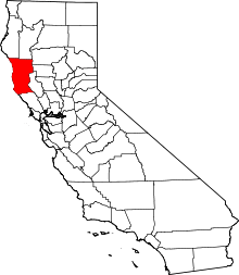
 Yorkville Location in California | |
| Coordinates: 38°53′53″N 123°12′52″W / 38.89806°N 123.21444°WCoordinates: 38°53′53″N 123°12′52″W / 38.89806°N 123.21444°W | |
| Country | United States |
| State | California |
| County | Mendocino County |
| Elevation[1] | 922 ft (281 m) |
Yorkville is an unincorporated community in Mendocino County, California.[1] It is located 7.5 miles (12 km) southwest of Hopland,[2] at an elevation of 922 feet (281 m).[1]
The original townsite was about 3 miles (5 km) northwest of the present site at 38°54′50″N 123°15′40″W / 38.91389°N 123.26111°W.[2] The Yorkville post office opened in 1868 and moved to the new site with the town in 1937.[2] "The Late Pomo or Ma-cu-maks of the present day Yorkville area spoke the central Pomo language."[3]
The name honors R.H. York, the town's founder.[2]
The Yorkville Highlands AVA was established in 1998. The Galbreath Wildlands Preserve, which is owned and managed by Sonoma State University as an educational site, is located nearby.
See also
References
- 1 2 3 U.S. Geological Survey Geographic Names Information System: Yorkville, California
- 1 2 3 4 Durham, David L. (1998). California's Geographic Names: A Gazetteer of Historic and Modern Names of the State. Clovis, Calif.: Word Dancer Press. p. 171. ISBN 1-884995-14-4.
- ↑ "Anderson Valley Historical Museum, Boonville CA". Archived from the original on October 14, 2011. Retrieved 2013-01-14.