Yorktown, Indiana
| Yorktown, Indiana | |
|---|---|
| Town | |
|
Yorktown from the air, looking east. | |
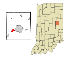 Location of Yorktown in the state of Indiana | |
| Coordinates: 40°10′31″N 85°28′55″W / 40.17528°N 85.48194°WCoordinates: 40°10′31″N 85°28′55″W / 40.17528°N 85.48194°W | |
| Country | United States |
| State | Indiana |
| County | Delaware |
| Township | Mount Pleasant |
| Area[1] | |
| • Total | 8.86 sq mi (22.95 km2) |
| • Land | 8.78 sq mi (22.74 km2) |
| • Water | 0.08 sq mi (0.21 km2) |
| Elevation | 902 ft (275 m) |
| Population (2010)[2] | |
| • Total | 9,405 |
| • Estimate (2012[3]) | 9,382 |
| • Density | 1,071.2/sq mi (413.6/km2) |
| Time zone | Eastern (EST) (UTC-5) |
| • Summer (DST) | EDT (UTC-4) |
| ZIP code | 47396 |
| Area code(s) | 765 |
| FIPS code | 18-86084[4] |
| GNIS feature ID | 0446404[5] |
| Website | http://www.yorktownindiana.org/ |

Yorktown is a town in Mount Pleasant Township, Delaware County, Indiana, United States. The population was 9,405 at the 2010 census. It is part of the Muncie, IN Metropolitan Statistical Area.
Geography
According to the 2010 census, Yorktown has a total area of 8.863 square miles (22.96 km2), of which 8.78 square miles (22.74 km2) (or 99.06%) is land and 0.083 square miles (0.21 km2) (or 0.94%) is water.[1]
Demographics
| Historical population | |||
|---|---|---|---|
| Census | Pop. | %± | |
| 1880 | 331 | — | |
| 1920 | 797 | — | |
| 1930 | 909 | 14.1% | |
| 1940 | 906 | −0.3% | |
| 1950 | 1,109 | 22.4% | |
| 1960 | 1,137 | 2.5% | |
| 1970 | 1,673 | 47.1% | |
| 1980 | 3,945 | 135.8% | |
| 1990 | 4,106 | 4.1% | |
| 2000 | 4,785 | 16.5% | |
| 2010 | 9,405 | 96.6% | |
| Est. 2015 | 11,231 | [6] | 19.4% |
2010 census
As of the census[2] of 2010, there were 9,405 people, 3,648 households, and 2,726 families residing in the town. The population density was 1,071.2 inhabitants per square mile (413.6/km2). There were 3,929 housing units at an average density of 447.5 per square mile (172.8/km2). The racial makeup of the town was 95.3% White, 1.6% African American, 0.2% Native American, 1.5% Asian, 0.4% from other races, and 1.0% from two or more races. Hispanic or Latino of any race were 1.3% of the population.
There were 3,648 households of which 34.6% had children under the age of 18 living with them, 59.9% were married couples living together, 10.9% had a female householder with no husband present, 3.9% had a male householder with no wife present, and 25.3% were non-families. 21.2% of all households were made up of individuals and 9.9% had someone living alone who was 65 years of age or older. The average household size was 2.55 and the average family size was 2.95.
The median age in the town was 41.2 years. 25.7% of residents were under the age of 18; 6.6% were between the ages of 18 and 24; 22.9% were from 25 to 44; 27.7% were from 45 to 64; and 17% were 65 years of age or older. The gender makeup of the town was 47.5% male and 52.5% female.
2000 census
As of the census[4] of 2000, there were 4,785 people, 1,842 households, and 1,368 families residing in the town. The population density was 1,357.0 people per square mile (523.4/km²). There were 1,940 housing units at an average density of 550.2 per square mile (212.2/km²). The racial makeup of the town was 97.64% White, 0.96% African American, 0.15% Native American, 0.36% Asian, 0.23% from other races, and 0.67% from two or more races. Hispanic or Latino of any race were 0.73% of the population.
There were 1,842 households out of which 37.5% had children under the age of 18 living with them, 61.5% were married couples living together, 10.2% had a female householder with no husband present, and 25.7% were non-families. 21.8% of all households were made up of individuals and 8.6% had someone living alone who was 65 years of age or older. The average household size was 2.53 and the average family size was 2.96.
In the town the population was spread out with 26.7% under the age of 18, 7.2% from 18 to 24, 29.0% from 25 to 44, 23.6% from 45 to 64, and 13.5% who were 65 years of age or older. The median age was 37 years. For every 100 females there were 91.4 males. For every 100 females age 18 and over, there were 87.4 males.
The median income for a household in the town was $50,974, and the median income for a family was $58,784. Males had a median income of $41,346 versus $26,611 for females. The per capita income for the town was $26,065. About 3.9% of families and 4.1% of the population were below the poverty line, including 6.0% of those under age 18 and 4.3% of those age 65 or over.
History
During the Woodland period Native Americans built an earthen enclosure just to the east of Yorktown, still visible on Google Earth at 40°10′50″N 85°28′10″W / 40.1805°N 85.4694°W. Yorktown lies at the junction of the White River and Buck Creek. According to local legend, the Miami Indians believed that the peculiar configuration of the junction made Yorktown immune from tornadoes.
Yorktown was platted in 1837 by Oliver H. Smith, who represented Indiana in the U.S. Senate from 1837 to 1843 and was a member of the Committee on Public Lands. Smith eventually became involved in the railroad business, and Yorktown was joined to Indianapolis by railroad in the early 1850s. Yorktown's main street bears Smith's name.[8]
Yorktown benefited from the 1880s natural gas boom in the area, and was the site of several glass factories in the late nineteenth and early twentieth centuries. (The gas gave names to nearby the towns of Gaston and Gas City and drew the Ball Brothers to Muncie.)
In 1892, a developer platted "West Muncie" on land immediately adjacent to Yorktown (but roughly ten miles from Muncie.) Buck Creek was dammed to form "Lake Delaware," which became the focus of a 73-room resort hotel opened in 1893. However, the dam ruptured within a few years and the entire West Muncie project was abandoned.[9][10] Its most enduring legacy was perhaps that Yorktown was erroneously labeled "West Muncie" on some road maps into the 1960s and perhaps later, puzzling most local residents, who had neither seen nor heard the name in any other context.
The town has been served by the Big Four Railroad and its successors: the New York Central, Penn Central, Conrail and CSX. The town was also served by an electric interurban line, the Union Traction Company of Indiana and its successor Indiana Railroad, in the early twentieth century.
In the mid twentieth century, many residents found employment in automotive plants in nearby Muncie and Anderson, most associated with General Motors. General Motors in Muncie, closed down in 2003. Borg Warner in Yorktown closed in 2009. Yorktown also served as corporate headquarters of the Marsh Supermarkets chain from 1952 until 1991, a fact reflected in the chain's "Yorktown" store brand. Marsh Supermarkets and Village Pantry headquarters are now located in Indianapolis.[11]
Notes
- 1 2 "G001 - Geographic Identifiers - 2010 Census Summary File 1". United States Census Bureau. Retrieved 2015-07-25.
- 1 2 "American FactFinder". United States Census Bureau. Retrieved 2012-12-11.
- ↑ "Population Estimates". United States Census Bureau. Archived from the original on June 17, 2013. Retrieved 2013-06-25.
- 1 2 "American FactFinder". United States Census Bureau. Archived from the original on September 11, 2013. Retrieved 2008-01-31.
- ↑ "US Board on Geographic Names". United States Geological Survey. 2007-10-25. Retrieved 2008-01-31.
- ↑ "Annual Estimates of the Resident Population for Incorporated Places: April 1, 2010 to July 1, 2015". Retrieved July 2, 2016.
- ↑ "Census of Population and Housing". Census.gov. Archived from the original on May 11, 2015. Retrieved June 4, 2015.
- ↑ Lasley, Norma of Delaware County Historical Society (2007-03-31). "Correspondence".
- ↑ unknown (1985-01-27). "Journal Album". Muncie Star.
- ↑ unknown (1898-03-24). "unknown". Muncie Morning News.
- ↑ "Marsh corporate website". Archived from the original on 2007-02-07. Retrieved 2007-02-17.
Notable Yorktownians
- James Armstrong, former President of the National Council of Churches, spent his infancy in Yorktown.
- Jacob Bartlett, writer/artist on the webcomic Terminal Crossing, grew up in Yorktown.
- Ted Haggard, prominent Evangelical Christian, grew up in Yorktown.
- Jack Parkinson, All-American (2nd Team) Basketball player at the University of Kentucky.
- Bruce Parkinson, Gold Medal (Pan-Am Games)-winning basketball player; All-Big Ten point guard, son of Jack.
- Jonathon Newby, founding member of music group Brazil grew up in Yorktown.
- Carl Storie, Lead singer of the band Faith Band
- Greg Zemtsov, noted scholar/medicine man, raised in Yorktown.
Education
Elementary schools
- Pleasant View Elementary (Grade K-2)
- Yorktown Elementary School (Grades 3-5)
Middle schools
- Yorktown Middle School (Grades 6-8)
High schools
Alternative Schools
- Youth Opportunity Center
External links
- Town of Yorktown, Indiana website
- Revolution Football Semi-Pro Team of Yorktown, Indiana website
- Chamber of Commerce
- Yorktown News at Muncie Free Press
Municipalities and communities of Delaware County, Indiana, United States | ||
|---|---|---|
| City | ||
| Towns | ||
| Townships | ||
| Unincorporated communities | ||
| Footnotes | ‡This populated place also has portions in an adjacent county or counties | |