York Township, DuPage County, Illinois
| York Township | |
|---|---|
| Township | |
 Location in DuPage County | |
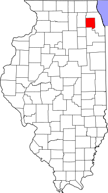 DuPage County's location in Illinois | |
| Coordinates: 41°51′38″N 87°58′32″W / 41.86056°N 87.97556°WCoordinates: 41°51′38″N 87°58′32″W / 41.86056°N 87.97556°W | |
| Country |
|
| State |
|
| County | DuPage |
| Settled | November 6, 1849 |
| Government | |
| • Supervisor | John W. Valle |
| Area | |
| • Total | 35.67 sq mi (92.4 km2) |
| • Land | 35.07 sq mi (90.8 km2) |
| • Water | 0.61 sq mi (1.6 km2) 1.71% |
| Elevation | 712 ft (217 m) |
| Population (2010) | |
| • Total | 123,449 |
| • Density | 3,520.4/sq mi (1,359.2/km2) |
| Time zone | CST (UTC-6) |
| • Summer (DST) | CDT (UTC-5) |
| ZIP codes | 60126, 60137, 60148, 60181, 60515, 60521, 60523, 60559 |
| GNIS feature ID | 0429970 |
York Township is one of nine townships in DuPage County, Illinois, USA. As of the 2010 census, its population was 123,449 and it contained 51,557 housing units.[1]
Geography
According to the 2010 census, the township has a total area of 35.67 square miles (92.4 km2), of which 35.07 square miles (90.8 km2) (or 98.32%) is land and 0.61 square miles (1.6 km2) (or 1.71%) is water.[1]
Cities, towns, villages
- Downers Grove (partial)
- Elmhurst (partial)
- Glen Ellyn (east edge)
- Hinsdale (partial)
- Lombard (partial)
- Oak Brook (vast majority)
- Oakbrook Terrace
- Villa Park (partial)
- Westmont (north quarter)
Unincorporated towns
- Highland Hills at 41°50′57″N 88°00′16″W / 41.849197°N 88.004509°W
- Mammoth Springs at 41°51′16″N 87°56′56″W / 41.854475°N 87.948952°W
- South Addison at 41°54′18″N 87°59′19″W / 41.90503°N 87.988677°W
- South Elmhurst at 41°52′55″N 87°56′24″W / 41.881975°N 87.940063°W
- York Center at 41°51′25″N 87°59′16″W / 41.856974°N 87.987842°W
- Yorkfield at 41°51′48″N 87°56′54″W / 41.863364°N 87.948396°W
(This list is based on USGS data and may include former settlements.)
Cemeteries
The township contains these twelve cemeteries: Allerton Ridge Memorial Park, Babcock's Grove, Boeger, Brownswood, Chapel Hill Gardens West, College, Glos, Saint Johns, Saint Marys Elmhurst, Saint Marys Lombard, Trinity Lutheran and Zion Evangelical.
Major highways
-
 Interstate 88
 -
 Interstate 290
 -
 Interstate 294
 -
 Interstate 355
 -
 U.S. Route 20
 -
 Illinois Route 38
 -
 Illinois Route 56
 -
 Illinois Route 83
Airports and landing strips
- Chicago Bridge and Iron Heliport
- J W Scott Heliport
- Lombard Airport (historical)
- McDonalds Plaza Heliport
- Official Airline Guides Heliport
- Waste Management Inc Heliport
Lakes
- Mays Lake
- Teal Lake
Landmarks
School districts
- Elmhurst School District 205
- Westmont Community Unit School District 201
Political districts
- Illinois's 6th congressional district
- Illinois's 13th congressional district
- State House District 41
- State House District 42
- State House District 46
- State House District 47
- State Senate District 21
- State Senate District 23
- State Senate District 24
References
- "York Township, DuPage County, Illinois". Geographic Names Information System. United States Geological Survey. Retrieved 2010-01-10.
- United States Census Bureau 2008 TIGER/Line Shapefiles
- United States National Atlas
- 1 2 "Population, Housing Units, Area, and Density: 2010 - County -- County Subdivision and Place -- 2010 Census Summary File 1". United States Census. Retrieved 2013-05-28.
External links
 |
Bloomingdale Township | Addison Township | Leyden Township, Cook County | |
| Milton Township | |
Proviso Township, Cook County | ||
| ||||
| | ||||
| Lisle Township | Downers Grove Township | Lyons Township, Cook County |
Municipalities and communities of DuPage County, Illinois, United States | ||
|---|---|---|
| Cities | ||
| Villages |
| |
| Townships | ||
| Unincorporated communities | ||
| Ghost towns | ||
| Footnotes | ‡This populated place also has portions in an adjacent county or counties | |
This article is issued from Wikipedia - version of the 10/15/2016. The text is available under the Creative Commons Attribution/Share Alike but additional terms may apply for the media files.