Yongxiu County
| Yongxiu County 永修县 | |
|---|---|
| County | |
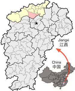 Location of Yongxiu County in Jiujiang City (yellow) and Jiangxi | |
| Coordinates: 29°01′N 115°49′E / 29.017°N 115.817°ECoordinates: 29°01′N 115°49′E / 29.017°N 115.817°E | |
| Country | People's Republic of China |
| Province | Jiangxi |
| Prefecture-level city | Jiujiang |
| County seat | Tubu (涂埠镇) |
| Area | |
| • Total | 2,035 km2 (786 sq mi) |
| Elevation | 31 m (101 ft) |
| Population (2005) | |
| • Total | 361,000 |
| • Density | 180/km2 (460/sq mi) |
| Time zone | China Standard (UTC+8) |
| Area code(s) | 0792 |
| Website |
yongxiu |
Yongxiu (Chinese: 永修; pinyin: Yǒngxiū) is a county under the administration of Jiujiang City in northern Jiangxi province, People's Republic of China, on the western shores of Poyang Lake. As of 2005, the county has a total population of 361,000 residing in an area of 2,035 square kilometres (786 sq mi). Bordering counties are Duchang, Xingzi, De'an, Wuning, Jing'an, Xinjian, and Anyi, while the county seat is 40 kilometres (25 mi) north of Nanchang, the provincial capital, and 80 km (50 mi) south-southwest of downtown Jiujiang.
Administrative divisions
Towns (镇)
The county oversees 12 towns:[1]
|
|
Townships (乡)
There are four:[1]
- Sanjiao Township (三角乡)
- Jiuhe Township (九合乡)
- Lixin Township (立新乡)
- Jiangshang Township (江上乡)
Transport
The Yongxiu County seat is 18 km (11 mi) north-northeast of Nanchang Changbei International Airport, and 50 km (31 mi) south of Jiujiang Lushan Airport.
The Beijing–Kowloon Railway and Nanchang–Jiujiang Intercity Railway traverse the county, and are served by the Yongxiu Railway Station.
Major highways passing through Yongxiu County are G70 Fuzhou–Yinchuan Expressway, China National Highway 105, and China National Highway 316.
Due to its importance in north-south travel in the province, Yongxiu was known as the "Gate of Hongdu" (洪都門戶) in ancient China.
Tourism
The spectacular Zhelin Reservoir lies in the northwest part of the county. The sacred Buddhist heaven Yunju Mountain stands in the southwest. The famous Poyang Lake Nature Reserve in the eastern part of the county.
References
- 1 2 2011年统计用区划代码和城乡划分代码:永修县 (in Chinese). National Bureau of Statistics of the People's Republic of China. Archived from the original on December 8, 2012. Retrieved 2012-12-30.