Yaté
For other uses, see Yate (disambiguation).
| Yaté | |
|---|---|
|
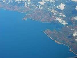
Ouinné, a mining site in the commune of Yaté | |
 Location of the commune (in red) within New Caledonia | |
| Coordinates: 22°10′03″S 166°55′36″E / 22.1676°S 166.9266°ECoordinates: 22°10′03″S 166°55′36″E / 22.1676°S 166.9266°E | |
| Country | France |
| Sui generis collectivity | New Caledonia |
| Province | South Province |
| Government | |
| • Mayor | Adolphe Kamébo Digoué |
| Area1 | 1,338.4 km2 (516.8 sq mi) |
| Population (2014 census)2 | 1,747 |
| • Density | 1.3/km2 (3.4/sq mi) |
| Ethnic distribution | |
| • 1996 census |
Kanaks 95.5% Europeans 3.8% Polynesians 0.1% Other 0.6% |
| INSEE/Postal code | 98832 / 98834 |
| Elevation |
0–1,501 m (0–4,925 ft) (avg. 20 m or 66 ft) |
|
1 New Caledonia Land Register (DITTT) data, which exclude lakes and ponds larger than 1 km² (0.386 sq mi or 247 acres) as well as the estuaries of rivers. 2 Population without double counting: residents of multiple communes (e.g., students and military personnel) only counted once. | |
Yaté is a commune in the South Province of New Caledonia, an overseas territory of France in the Pacific Ocean. The Yaté Dam and Blue River Provincial Park are located within the commune.
| Wikimedia Commons has media related to Yaté. |
| Provinces | |
|---|---|
| Communes | |
This article is issued from Wikipedia - version of the 12/21/2015. The text is available under the Creative Commons Attribution/Share Alike but additional terms may apply for the media files.