Indus-Yarlung suture zone


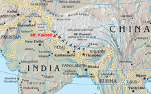
The Indus-Yarlung suture zone or the Indus-Yarlung Tsangpo suture is a tectonic suture in southern Tibet and across the north margin of the Himalayas which resulted from the collision between the Indian plate and the Eurasian plate starting about 52 Ma.[1] The north side of the suture zone is the Ladakh Batholith of the Karakoram-Lhasa Block. The rocks of the suture zone consist of an ophiolite mélanges composed of Neotethys oceanic crustal flyschs and ophiolites; the Dras Volcanics: which are basalts, dacites and minor radiolarian cherts - the remains of a mid to late Mesozoic volcanic island arc; and the Indus Molasse which are an Eocene or later continental clastic sediments.[2]
The Ophiolith which can be found here is not a remnant of a very big ocean, but of a small so called Back-arc basin structure.[3]
See also
References
- ↑ Age of Initiation of the India-Asia Collision http://geosci.uchicago.edu/~rowley/Rowley/Collision_Age.html
- ↑ Dèzes, Pierre, 1999, Major tectonic subdivisions of the Himalaya http://comp1.geol.unibas.ch/~zanskar/CHAPITRE2/page24.html
- ↑ Bédard, É.; Hébert, R.; Guilmette, C.; Lesage, G.; Wang, C.S.; Dostal, J. (2009). "Petrology and geochemistry of the Saga and Sangsang ophiolitic massifs, Yarlung Zangbo Suture Zone, Southern Tibet: Evidence for an arc–back-arc origin". Lithos 113 (1–2): 48–67. doi:10.1016/j.lithos.2009.01.011.