Wysokie Mazowieckie County
| Wysokie Mazowieckie County Powiat wysokomazowiecki | |||
|---|---|---|---|
| County | |||
| |||
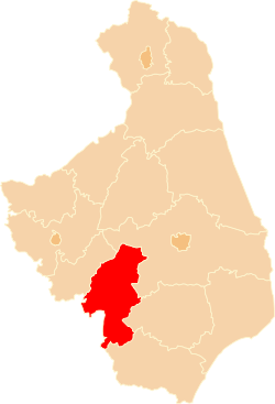 Location within the voivodeship | |||
| Coordinates (Wysokie Mazowieckie): 52°55′9″N 22°30′52″E / 52.91917°N 22.51444°ECoordinates: 52°55′9″N 22°30′52″E / 52.91917°N 22.51444°E | |||
| Country |
| ||
| Voivodeship | Podlaskie | ||
| Seat | Wysokie Mazowieckie | ||
| Gminas | |||
| Area | |||
| • Total | 1,288.49 km2 (497.49 sq mi) | ||
| Population (2006) | |||
| • Total | 59,719 | ||
| • Density | 46/km2 (120/sq mi) | ||
| • Urban | 14,155 | ||
| • Rural | 45,564 | ||
| Car plates | BWM | ||
| Website | http://wysokomazowiecki.pl/ | ||

Wysokie Mazowieckie County (Polish: powiat wysokomazowiecki) is a unit of territorial administration and local government (powiat) in Podlaskie Voivodeship, north-eastern Poland. It came into being on January 1, 1999, as a result of the Polish local government reforms passed in 1998. Its administrative seat and largest town is Wysokie Mazowieckie, which lies 49 kilometres (30 mi) south-west of the regional capital Białystok. The only other towns in the county are Ciechanowiec, lying 27 km (17 mi) south of Wysokie, Szepietowo, 6 km (4 mi) south of Wysokie, and as from 1 January 2011 Czyżew.
The county covers an area of 1,288.49 square kilometres (497.5 sq mi). As of 2006 its total population was 59,719, out of which the population of Wysokie Mazowieckie was 9,257, that of Ciechanowiec 4,898, and the rural population 45,564 (including approximately 2,400 for the population of Szepietowo, which became a town in 2010).
Neighbouring counties
Wysokie Mazowieckie County is bordered by Białystok County and Bielsk County to the east, Siemiatycze County and Sokołów County to the south, and Ostrów Mazowiecka County and Zambrów County to the west.
Administrative division
The county is subdivided into 10 gminas (one urban, three urban-rural and six rural). These are listed in the following table, in descending order of population.
| Gmina | Type | Area (km²) |
Population (2006) |
Seat |
| Gmina Ciechanowiec | urban-rural | 201.5 | 9,454 | Ciechanowiec |
| Wysokie Mazowieckie | urban | 15.2 | 9,257 | |
| Gmina Szepietowo | urban-rural | 151.9 | 7,485 | Szepietowo |
| Gmina Czyżew | urban-rural | 123.4 | 6,653 | Czyżew |
| Gmina Sokoły | rural | 155.6 | 5,952 | Sokoły |
| Gmina Wysokie Mazowieckie | rural | 166.1 | 5,263 | Wysokie Mazowieckie * |
| Gmina Klukowo | rural | 123.8 | 4,681 | Klukowo |
| Gmina Nowe Piekuty | rural | 109.4 | 3,991 | Nowe Piekuty |
| Gmina Kobylin-Borzymy | rural | 119.6 | 3,622 | Kobylin-Borzymy |
| Gmina Kulesze Kościelne | rural | 115.5 | 3,361 | Kulesze Kościelne |
| * seat not part of the gmina | ||||
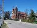
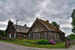
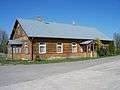
Gallery


References
| Seat |
|  |
|---|---|---|
| Urban-rural gminas | ||
| Rural gminas | ||
| City counties |  | |
|---|---|---|
| Land counties | ||