Wynona, Oklahoma
| Wynona, Oklahoma | |
|---|---|
| Town | |
 Location of Wynona, Oklahoma | |
| Coordinates: 36°32′44″N 96°19′33″W / 36.54556°N 96.32583°WCoordinates: 36°32′44″N 96°19′33″W / 36.54556°N 96.32583°W | |
| Country | United States |
| State | Oklahoma |
| County | Osage |
| Area | |
| • Total | 0.5 sq mi (1.4 km2) |
| • Land | 0.5 sq mi (1.4 km2) |
| • Water | 0.0 sq mi (0.0 km2) |
| Elevation | 906 ft (276 m) |
| Population (2010) | |
| • Total | 437 |
| • Density | 982.5/sq mi (379.4/km2) |
| Time zone | Central (CST) (UTC-6) |
| • Summer (DST) | CDT (UTC-5) |
| ZIP code | 74084 |
| Area code(s) | 539/918 |
| FIPS code | 40-82450[1] |
| GNIS feature ID | 1100029[2] |
Wynona is an incorporated town in central Osage County, Oklahoma, United States. It was founded by a local Osage-Cherokee rancher, Antoine Rogers, in 1903.[3] The population was 437 at the 2010 census, a 17.7 percent decline from 531 at the 2000 census.[4]
History
An Osage-Cherokee rancher, Antoine Rogers, settled in the area that would become the town of Wynona in 1871, after the Osage tribe had been removed from Kansas to Indian Territory by the U. S. Government. In 1903, the Missouri, Kansas and Texas Railway (also known as the MK&T or Katy railroad) built a line across Rogers's land. A store was built adjacent to the track, and that event is considered the establishment of Wynona, which soon became a cattle shipping point.[3]
The Osage Townsite Company began development of the town in 1909. By the end of the year, the population had grown from 20 to over 150 residents. The first local newspaper, a weekly named the Wynona Enterprise, appeared in August 1909.[lower-alpha 1][3]
Oil was discovered near Wynona in 1914, and led to the creation of Wynona Oil and Gas Company. This caused an influx of new residents to support the local oil industry. Wynona's 1920 census reported 2,749 inhabitants. Wynona remained important for its agriculture and ranching business. Ranchers diversified into producing hogs, poultry and dairy products. However, the town failed to put in electric service and paved streets, causing some businessmen to move elsewhere. The end of the boom in Osage County oil production and the onset of the Great Depression caused the population to drop sharply to 1,171 in 1930 and to 652 in 1960. The MK&T abandoned its rail line in 1977.[3]
Geography
Wynona is located at 36°32′44″N 96°19′33″W / 36.54556°N 96.32583°W (36.545583, -96.325962).[5] According to the United States Census Bureau, the town has a total area of 0.5 square miles (1.3 km2), all of it land.
Demographics
| Historical population | |||
|---|---|---|---|
| Census | Pop. | %± | |
| 1920 | 2,749 | — | |
| 1930 | 1,171 | −57.4% | |
| 1940 | 810 | −30.8% | |
| 1950 | 678 | −16.3% | |
| 1960 | 652 | −3.8% | |
| 1970 | 547 | −16.1% | |
| 1980 | 780 | 42.6% | |
| 1990 | 531 | −31.9% | |
| 2000 | 531 | 0.0% | |
| 2010 | 437 | −17.7% | |
| Est. 2015 | 432 | [6] | −1.1% |
As of the census[1] of 2000, there were 531 people, 221 households, and 150 families residing in the town. The population density was 982.5 people per square mile (379.7/km²). There were 246 housing units at an average density of 455.2 per square mile (175.9/km²). The racial makeup of the town was 76.65% White, 14.69% Native American, 0.56% from other races, and 8.10% from two or more races. Hispanic or Latino of any race were 2.82% of the population.
There were 221 households out of which 29.4% had children under the age of 18 living with them, 52.9% were married couples living together, 10.4% had a female householder with no husband present, and 32.1% were non-families. 28.5% of all households were made up of individuals and 12.7% had someone living alone who was 65 years of age or older. The average household size was 2.40 and the average family size was 2.96.
In the town the population was spread out with 25.0% under the age of 18, 8.9% from 18 to 24, 26.2% from 25 to 44, 25.6% from 45 to 64, and 14.3% who were 65 years of age or older. The median age was 36 years. For every 100 females there were 105.8 males. For every 100 females age 18 and over, there were 98.0 males.
The median income for a household in the town was $24,917, and the median income for a family was $32,500. Males had a median income of $23,750 versus $16,932 for females. The per capita income for the town was $14,201. About 9.6% of families and 14.4% of the population were below the poverty line, including 25.7% of those under age 18 and 6.5% of those age 65 or over.
Government
Wynona is governed by a town board.[3]
Notes
References
- 1 2 "American FactFinder". United States Census Bureau. Archived from the original on September 11, 2013. Retrieved 2008-01-31.
- ↑ "US Board on Geographic Names". United States Geological Survey. 2007-10-25. Retrieved 2008-01-31.
- 1 2 3 4 5 6 Jon D. May, "Wynona," Encyclopedia of Oklahoma History and Culture. Accessed May 10, 2015.
- ↑ MuniNet Guide: Wynona, Oklahoma
- ↑ "US Gazetteer files: 2010, 2000, and 1990". United States Census Bureau. 2011-02-12. Retrieved 2011-04-23.
- ↑ "Annual Estimates of the Resident Population for Incorporated Places: April 1, 2010 to July 1, 2015". Retrieved July 2, 2016.
- ↑ "Census of Population and Housing". Census.gov. Archived from the original on May 11, 2015. Retrieved June 4, 2015.
External links
Municipalities and communities of Osage County, Oklahoma, United States | ||
|---|---|---|
| Cities | 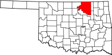 | |
| Towns | ||
| CDP | ||
| Unincorporated communities |
| |
| Footnotes | ‡This populated place also has portions in an adjacent county or counties | |