Woustviller
| Woustviller | |
|---|---|
 | |
 Woustviller | |
|
Location within Grand Est region  Woustviller | |
| Coordinates: 49°04′36″N 7°00′37″E / 49.0767°N 7.0103°ECoordinates: 49°04′36″N 7°00′37″E / 49.0767°N 7.0103°E | |
| Country | France |
| Region | Grand Est |
| Department | Moselle |
| Arrondissement | Sarreguemines |
| Canton | Sarreguemines-Campagne |
| Intercommunality | Communauté d'agglomération Sarreguemines Confluences |
| Government | |
| • Mayor (2008–2014) | Sonya Cristinelli-Fraiboeuf |
| Area1 | 10.97 km2 (4.24 sq mi) |
| Population (2005)2 | 3,146 |
| • Density | 290/km2 (740/sq mi) |
| Time zone | CET (UTC+1) |
| • Summer (DST) | CEST (UTC+2) |
| INSEE/Postal code | 57752 / 57915 |
| Elevation | 209–275 m (686–902 ft) |
|
1 French Land Register data, which excludes lakes, ponds, glaciers > 1 km² (0.386 sq mi or 247 acres) and river estuaries. 2 Population without double counting: residents of multiple communes (e.g., students and military personnel) only counted once. | |
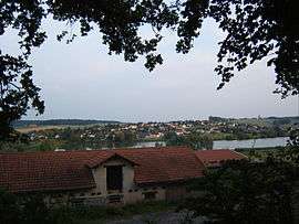
Woustviller is a commune in the Moselle department in Grand Est in north-eastern France.
Twin towns
- Wustweiler (Germany), since 1996.
See also
This article is issued from Wikipedia - version of the 11/6/2016. The text is available under the Creative Commons Attribution/Share Alike but additional terms may apply for the media files.