Woodbury, Tennessee
| Woodbury, Tennessee | |
|---|---|
| Town | |
|
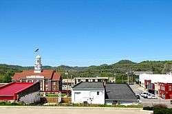
Downtown Woodbury | |
 Location of Woodbury, Tennessee | |
| Coordinates: 35°49′25″N 86°4′13″W / 35.82361°N 86.07028°WCoordinates: 35°49′25″N 86°4′13″W / 35.82361°N 86.07028°W | |
| Country | United States |
| State | Tennessee |
| County | Cannon |
| Established | 1819[1] |
| Incorporated | 1838[2] |
| Named for | Levi Woodbury[3] |
| Government | |
| • Mayor | Harold Patrick |
| Area | |
| • Total | 2.0 sq mi (5.2 km2) |
| • Land | 2.0 sq mi (5.2 km2) |
| • Water | 0.0 sq mi (0.0 km2) |
| Elevation | 722 ft (220 m) |
| Population (2010) | |
| • Total | 2,680 |
| • Density | 1,331/sq mi (513.9/km2) |
| Time zone | Central (CST) (UTC-6) |
| • Summer (DST) | CDT (UTC-5) |
| ZIP code | 37190 |
| Area code(s) | 615 |
| FIPS code | 47-81560[4] |
| GNIS feature ID | 1304664[5] |
Woodbury is a town in Cannon County, Tennessee, United States. Woodbury is part of the Nashville Metropolitan Statistical Area and is located 55 miles (89 km) southeast of downtown Nashville. The population of Woodbury was 2,680 at the 2010 census.[6] It is the county seat of Cannon County.[7]
Geography
Woodbury is a small town located near the center of Cannon County at 35°49′25″N 86°4′13″W / 35.82361°N 86.07028°W (35.823644, -86.070268).[8] It is in the valley of the East Fork of the Stones River, part of the Cumberland River watershed flowing through Nashville.
U.S. Route 70S passes through the town, leading west 19 miles (31 km) to Murfreesboro and southeast 20 miles (32 km) to McMinnville. Tennessee State Route 53 leads south from Woodbury 24 miles (39 km) to Manchester and north 16 miles (26 km) to Liberty. From the west side of Woodbury, Tennessee State Route 145 leads north 10 miles (16 km) to Auburntown.
According to the United States Census Bureau, the town of Woodbury has a total area of 2.0 square miles (5.2 km2), all of it land.[6]
Demographics
| Historical population | |||
|---|---|---|---|
| Census | Pop. | %± | |
| 1870 | 329 | — | |
| 1880 | 393 | 19.5% | |
| 1890 | 576 | 46.6% | |
| 1900 | 468 | −18.7% | |
| 1910 | 604 | 29.1% | |
| 1920 | 278 | −54.0% | |
| 1930 | 502 | 80.6% | |
| 1940 | 663 | 32.1% | |
| 1950 | 1,000 | 50.8% | |
| 1960 | 1,562 | 56.2% | |
| 1970 | 1,725 | 10.4% | |
| 1980 | 2,160 | 25.2% | |
| 1990 | 2,287 | 5.9% | |
| 2000 | 2,428 | 6.2% | |
| 2010 | 2,680 | 10.4% | |
| Est. 2015 | 2,762 | [9] | 3.1% |
| Sources:[10][11] | |||
As of the census[4] of 2010, there were 2,680 people, 1,052 households, and 608 families residing in the town. The population density was 1,552.0 people per square mile (541.9/km²). There were 1,159 housing units at an average density of 671.1 per square mile (258.7/km²). The racial makeup of the town was 94.36% White, 3.83% African American, 0.54% Native American, 0.04% Asian, 0.04% Pacific Islander, 0.41% from other races, and 0.78% from two or more races. Hispanic or Latino of any race were 2.35% of the population.
There were 1,052 households out of which 27.3% had children under the age of 18 living with them, 37.1% were married couples living together, 16.6% had a female householder with no husband present, and 42.2% were non-families. 39.5% of all households were made up of individuals and 19.7% had someone living alone who was 65 years of age or older. The average household size was 2.16 and the average family size was 2.88.
In the town the population was spread out with 23.1% under the age of 18, 10.2% from 18 to 24, 23.4% from 25 to 44, 21.7% from 45 to 64, and 21.6% who were 65 years of age or older. The median age was 40 years. For every 100 females there were 80.0 males. For every 100 females age 18 and over, there were 71.8 males.
The median income for a household in the town was $23,846, and the median income for a family was $33,889. Males had a median income of $28,636 versus $19,231 for females. The per capita income for the town was $17,557. About 17.9% of families and 23.1% of the population were below the poverty line, including 34.2% of those under age 18 and 24.5% of those age 65 or over.
Festivals
There are a few festivals in Woodbury. The most notable taking place each spring, is known as "The Good Ole Days". Other festivals include the Cannon County Christmas Business Open House and a weekly "Cruise-In" on the square. [12]
References
- ↑ Goodspeed's History of Cannon County (1886). Retrieved at USGenNet.org: 2 March 2013.
- ↑ Tennessee Blue Book, 2005-2006, pp. 618-625.
- ↑ Carroll Van West, "Cannon County," Tennessee Encyclopedia of History and Culture. Retrieved: 2 March 2013.
- 1 2 "American FactFinder". United States Census Bureau. Retrieved 2008-01-31.
- ↑ "US Board on Geographic Names". United States Geological Survey. 2007-10-25. Retrieved 2008-01-31.
- 1 2 "Geographic Identifiers: 2010 Census Summary File 1 (G001): Woodbury town, Tennessee". U.S. Census Bureau, American Factfinder. Retrieved July 2, 2015.
- ↑ "Find a County". National Association of Counties. Retrieved 2011-06-07.
- ↑ "US Gazetteer files: 2010, 2000, and 1990". United States Census Bureau. 2011-02-12. Retrieved 2011-04-23.
- ↑ "Annual Estimates of the Resident Population for Incorporated Places: April 1, 2010 to July 1, 2015". Retrieved July 2, 2016.
- ↑ "Census of Population and Housing: Decennial Censuses". United States Census Bureau. Retrieved 2012-03-04.
- ↑ "Incorporated Places and Minor Civil Divisions Datasets: Subcounty Resident Population Estimates: April 1, 2010 to July 1, 2012". Population Estimates. U.S. Census Bureau. Retrieved 11 December 2013.
- ↑ http://cannontn.com/events/2014-12/
External links
- Woodbury offices – Cannon County website
- Town charter
 Media related to Woodbury, Tennessee at Wikimedia Commons
Municipalities and communities of Cannon County, Tennessee, United States | ||
|---|---|---|
| Towns | ||
| Unincorporated communities | ||