Wixom, Michigan
| Wixom | |
|---|---|
| City | |
| City of Wixom | |
|
City Offices | |
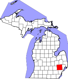
 Location in Oakland County and the state of Michigan | |
| Coordinates: 42°31′29″N 83°32′11″W / 42.52472°N 83.53639°W | |
| Country | United States |
| State | Michigan |
| County | Oakland |
| Government | |
| • Type | Council-Manager |
| • Mayor | Kevin Hinkley |
| • City Manager | Clarence Goodlein |
| • Director of Public Safety | Charlie Yon |
| Area[1] | |
| • Total | 9.36 sq mi (24.24 km2) |
| • Land | 9.15 sq mi (23.70 km2) |
| • Water | 0.21 sq mi (0.54 km2) |
| Elevation | 928 ft (283 m) |
| Population (2010)[2] | |
| • Total | 13,498 |
| • Estimate (2012[3]) | 13,684 |
| • Density | 1,475.2/sq mi (569.6/km2) |
| Time zone | Eastern Standard Time Zone (UTC-5) |
| • Summer (DST) | EDT (UTC-4) |
| ZIP code | 48393 |
| Area code(s) | 248 |
| FIPS code | 26-88140[4] |
| GNIS feature ID | 1616671[5] |
| Website | www.ci.wixom.mi.us |

Wixom is a city that lies in the borders of northwest Novi and southwest Commerce Township in Oakland County in the U.S. state of Michigan. The population was 13,498 at the 2010 census.[6] The city was home to the former Wixom Assembly Plant, which produced the Lincoln LS, the Ford Thunderbird, the Ford GT, and the Lincoln Town Car. The plant closed its doors on May 31, 2007.[7]
Wixom is home to several production and manufacturing businesses, including Trijicon, a leading manufacturer of night gun sights and night telescopic sights; Discraft, a leading manufacturer of flying discs for disc sports games like Ultimate; the U.S. headquarters of spark plug manufacturer NGK; Majic Window, the worlds largest distributor of fiberglass replacement home windows;[8] MAC Valves, Inc.,[9] a manufacturer of pneumatic valves used in the automotive and packaging industries, and Foster Specialty Floors[10] the state's largest and oldest sports flooring contractor.
History
The settlement of Wixom dates back to the 1830s. The establishment of Wixom as a place started in the early 1870s when the Holly, Wayne and Monroe Railroad was constructed through the area. Willard Wixom platted land on either side of the railroad near the Novi and Commerce Township border. The construction of a railroad depot and the naming of the area as Wixom fixed Wixom as a destination.
The village of Wixom was incorporated in the 1950s following the announcement of plans to construct the Wixom Assembly Plant in Novi Township. Prior to that time, Wixom was an unincorporated place. The village borders included portions of both Novi and Commerce Townships. Efforts by the remainder of Novi Township to incorporate as a village prompted the newly established village of Wixom to incorporate as a city. The city largely follows the borders of the village although a small area of parkland on the north side of the city was annexed from Commerce Township in the 1970s.
On November 13, 1996, Gerald Atkins "shot his way" (according to eyewitness reports) into the Ford Wixom Assembly Plant plant with a CAR-15 semi-automatic rifle, eventually killing plant manufacturing manager Darrell Izzard (aged 57) in a hallway; the shooter wounded three others. Fleeing the plant, Atkins hid in storm drain tunnels while law enforcement surrounded the plant and trained their weapons from as far away as the Interstate 96 freeway. Hours later he surrendered.
Downtown development
The downtown area of the city is being developed with a new main street area on Pontiac Trail by the city offices called the Wixom Village Center. This was a $200 million project. The Village Center includes a pedestrian plaza, restaurants, and service shops. The residential development called Tribute of Wixom will contain 600 units that include ranch-style condos, town houses, and single-family homes. The project was postponed in 2008 and construction did not begin again until 2014.
Schools
Most of Wixom is part of Walled Lake Consolidated Schools.[11][12] A small area of commercial property on the city's southern border lies within the Novi Community Schools district, while the extreme southwest portion of the city is within the South Lyon Community School District.[11]
Schools located in the city limits include Loon Lake Elementary School,[13] Wixom Elementary School,[14] and Sarah Banks Middle School.[15] The district's Twin Sun Preschool is also in Wixom.[12]
Walled Lake district elementary schools serving Wixom include Loon Lake,[16] Wixom,[17] Hickory Woods,[18] and Walled Lake.[19] Most of Wixom is zoned to Banks Middle School,[20] with a small part zoned to Geisler Middle School.[21] Most residents are zoned to Walled Lake Western High School.[22] Some parts of the city are zoned to Walled Lake Central High School.[23]
The portion in the South Lyon district is zoned to Dolsen Elementary School, Centennial Middle School, and South Lyon East High School.[24]
St. Catherine of Siena Academy is in Wixom.
Media
The studios of WTVS (Detroit Public Television) are located in the Riley Broadcast Center and HD Studios.[25]
Police and fire
The police station is located in the newly developing downtown area on Pontiac Trail. The Wixom Police Department was formed in 1958. Prior to 1958, Wixom received police services from the Oakland County Sheriff's Department.
Wixom is protected by Fire Station #1 on North Wixom Road and Fire Station #2 located at 50430 Pontiac Trail. The Wixom Fire Department is primarily staffed with paid on-call firefighters in addition to a full-time fire chief and several part-time firefighters.
In 1996, two Wixom police officers, Gary Hamlin and Martin Harp, undertook the dangerous task of apprehending and arresting Gerald Atkins (the above-mentioned Ford plant killer) as he sought refuge in a large storm drain. For their bravery and heroism they received awards and commendations, including official thanks in the form of resolutions passed by the state legislature and the National Association of Police Organizations TOP COPS award, which was given during a ceremony at the White House, conducted by president Bill Clinton.[26]
Geography
According to the United States Census Bureau, the city has a total area of 9.36 square miles (24.24 km2), of which 9.15 square miles (23.70 km2) is land and 0.21 square miles (0.54 km2) is water.[1]
Demographics
| Historical population | |||
|---|---|---|---|
| Census | Pop. | %± | |
| 1960 | 1,531 | — | |
| 1970 | 2,010 | 31.3% | |
| 1980 | 6,705 | 233.6% | |
| 1990 | 8,550 | 27.5% | |
| 2000 | 13,263 | 55.1% | |
| 2010 | 13,498 | 1.8% | |
| Est. 2015 | 13,746 | [27] | 1.8% |
2010 census
As of the census[2] of 2010, there were 13,498 people, 5,725 households, and 3,382 families residing in the city. The population density was 1,475.2 inhabitants per square mile (569.6/km2). There were 6,577 housing units at an average density of 718.8 per square mile (277.5/km2). The racial makeup of the city was 79.8% White, 11.1% African American, 0.2% Native American, 4.9% Asian, 1.9% from other races, and 2.1% from two or more races. Hispanic or Latino of any race were 5.1% of the population.
There were 5,725 households of which 33.6% had children under the age of 18 living with them, 44.0% were married couples living together, 10.9% had a female householder with no husband present, 4.1% had a male householder with no wife present, and 40.9% were non-families. 34.2% of all households were made up of individuals and 5.3% had someone living alone who was 65 years of age or older. The average household size was 2.36 and the average family size was 3.09.
The median age in the city was 34.8 years. 25.4% of residents were under the age of 18; 9.3% were between the ages of 18 and 24; 31.9% were from 25 to 44; 26.4% were from 45 to 64; and 7% were 65 years of age or older. The gender makeup of the city was 49.9% male and 50.1% female.
2000 census
As of the census[4] of 2000, there were 13,263 people, 5,889 households, and 3,150 families residing in the city. The population density was 1,420.0 per square mile (548.3/km²). There were 6,086 housing units at an average density of 651.6 per square mile (251.6/km²). The racial makeup of the city was 90.40% White, 2.50% African American, 0.51% Native American, 2.85% Asian, 0.04% Pacific Islander, 1.55% from other races, and 2.14% from two or more races. Hispanic or Latino of any race were 3.20% of the population.
There were 5,889 households out of which 30.9% had children under the age of 18 living with them, 41.8% were married couples living together, 8.0% had a female householder with no husband present, and 46.5% were non-families. 37.4% of all households were made up of individuals and 4.1% had someone living alone who was 65 years of age or older. The average household size was 2.24 and the average family size was 3.07.
In the city the population was spread out with 24.9% under the age of 18, 14.0% from 18 to 24, 39.1% from 25 to 44, 16.5% from 45 to 64, and 5.4% who were 65 years of age or older. The median age was 30 years. For every 100 females there were 109.5 males. For every 100 females age 18 and over, there were 108.0 males.
The median income for a household in the city was $44,320, and the median income for a family was $64,918. Males had a median income of $45,798 versus $30,942 for females. The per capita income for the city was $27,543. About 4.5% of families and 5.4% of the population were below the poverty line, including 4.0% of those under age 18 and 2.2% of those age 65 or over.
References
- 1 2 "US Gazetteer files 2010". United States Census Bureau. Retrieved 2012-11-25.
- 1 2 "American FactFinder". United States Census Bureau. Retrieved 2012-11-25.
- ↑ "Population Estimates". United States Census Bureau. Retrieved 2013-06-03.
- 1 2 "American FactFinder". United States Census Bureau. Retrieved 2008-01-31.
- ↑ U.S. Geological Survey Geographic Names Information System: Wixom, Michigan
- ↑ "Race, Hispanic or Latino, Age, and Housing Occupancy: 2010 Census Redistricting Data (Public Law 94-171) Summary File (QT-PL), Wixom city, Michigan". U.S. Census Bureau, American FactFinder 2. Retrieved August 19, 2011.
- ↑ Louis Aguilar (May 17, 2007). "Workers at Ford's Wixom plant punching out for the last time". The Detroit News. Retrieved May 3, 2011.
- ↑ http://www.majicwindow.com/about/
- ↑ Welcome to MAC Valves
- ↑ Foster Specialty Floors
- 1 2 "Street Map." (Archive) City of Wixom. Retrieved on November 8, 2012.
- 1 2 "Map of Entire District." (Archive) Walled Lake Consolidated Schools. Retrieved on November 8, 2012.
- ↑ "Loon Lake." Walled Lake Consolidated Schools. Retrieved on November 8, 2012. "2151 Loon Lake Road :: Wixom, Michigan 48393"
- ↑ "Wixom." Walled Lake Consolidated Schools. Retrieved on November 8, 2012. "301 North Wixom Road :: Wixom, Michigan 48393"
- ↑ "Sarah Banks." Walled Lake Consolidated Schools. Retrieved on November 8, 2012. "1760 Charms Road :: Wixom, Michigan 48393"
- ↑ "Loon Lake Elem." (Archive) Walled Lake Consolidated Schools. Retrieved on November 8, 2012.
- ↑ "Wixom Elem." (Archive) Walled Lake Consolidated Schools. Retrieved on November 8, 2012.
- ↑ "Hickory Woods Elem." (Archive) Walled Lake Consolidated Schools. Retrieved on November 8, 2012.
- ↑ "Walled Lake Elem." (Archive) Walled Lake Consolidated Schools. Retrieved on November 8, 2012.
- ↑ "Sarah Banks M.S." (Archive) Walled Lake Consolidated Schools. Retrieved on November 8, 2012.
- ↑ "James R. Geisler M.S." (Archive) Walled Lake Consolidated Schools. Retrieved on November 8, 2012.
- ↑ "Western H.S." (Archive) Walled Lake Consolidated School District. Retrieved on November 8, 2012.
- ↑ "Central H.S." (Archive) Walled Lake Consolidated Schools. Retrieved on November 8, 2012.
- ↑ "Dolsen." (Archive) South Lyon Community School District. Retrieved on November 8, 2012.
- ↑ "Contact Us." WTVS. Retrieved on December 8, 2012.
- ↑ NAPO Washington Report. http://www.napo.org/napo6_nov.htm
- ↑ "Annual Estimates of the Resident Population for Incorporated Places: April 1, 2010 to July 1, 2015". Retrieved July 2, 2016.
- ↑ "Census of Population and Housing". Census.gov. Retrieved June 4, 2015.
External links
- City of Wixom
- Oakland County
- Wixom Public Library
- Wixom Parks & Recreation
- Walled Lake Consolidated School District
- Wixom Association of Professional Firefighters
Coordinates: 42°31′29″N 83°32′11″W / 42.52472°N 83.53639°W
| Topics |  | |
|---|---|---|
| Detroit | ||
| Municipalities over 80,000 | ||
| Municipalities 40,000 to 80,000 | ||
| Cultural enclaves | ||
| Satellite cities | ||
| Counties in MSA | ||
| Counties in CSA | ||