Wittingen
| Wittingen | ||
|---|---|---|
| ||
 Wittingen | ||
Location of Wittingen within Gifhorn district 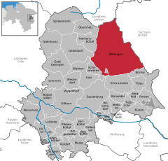
 | ||
| Coordinates: 52°43′N 10°44′E / 52.717°N 10.733°ECoordinates: 52°43′N 10°44′E / 52.717°N 10.733°E | ||
| Country | Germany | |
| State | Lower Saxony | |
| District | Gifhorn | |
| Government | ||
| • Mayor | Karl Ridder (CDU) | |
| Area | ||
| • Total | 225.08 km2 (86.90 sq mi) | |
| Population (2015-12-31)[1] | ||
| • Total | 11,480 | |
| • Density | 51/km2 (130/sq mi) | |
| Time zone | CET/CEST (UTC+1/+2) | |
| Postal codes | 29378, 29379 | |
| Dialling codes | 05831 | |
| Vehicle registration | GF | |
| Website | www.wittingen.de | |

Wittingen (German pronunciation: [ˈvɪ.tɪŋ.ən]) is a town in the district of Gifhorn, Lower Saxony, Germany. It is about 30 kilometres (19 mi) northeast of Gifhorn, and 30 kilometres (19 mi) southeast of Uelzen.
Division of the town
Wittingen consists of 27 districts:
|
|
History
The earliest identified record of Wittingen appears in a document dated 781 which defines the territorial borders of the Bishopric of Hildesheim. Another early mention dates from 803 during the reign of Charlemagne, this time identifying the borders of the newly established Bishopric of Halberstadt. Neither of these sources pins down a date for the foundation of Wittingen, however.
During the Medieval period Wittingen was not merely a frontier point, but also a focus for traffic crossing into and out of the Altmark. The town was a trading point and an overnight stop for east-west commerce. Its significance was signaled in the ninth century when The Bishopric had the Church of St Stephen built. By the beginning of the thirteenth century Wittingen had been granted Town privileges, and was a part owner of the Lüneburg Mint. The fourteenth century was a period of political instability in this part of Europe and in 1340 ownership of Wittingen was transferred to the Welfs of Celle. Later, with the outbreak of the Hildesheim Diocesan Feud, the town was almost completely destroyed in 1519. Consequently, the building of town fortifications began shortly afterwards.


_in_Wittingen_IMG_9229.jpg)
Demographic data
According to the Lower Saxony State Department for Statistics 12,291 people lived in the town of Wittingen in 2005 in 3,745 buildings with a total of 5,399 homes at an average floor space of 49.9 square metres (537 sq ft) per person. Since the formation of the borough, the population grew steadily, both by natural population increase as well as immigration. 21.3% of the population in 2005 were under 18 years old, 7.1% from 18 to 25, 27.0% from 25 to 45, 24.4% from 45 to 64, and 20.3% were 65 years old or older. The unemployment rate stood at an average of 11.3% (men: 9.4%, women: 14.0%). 2,247 people commute regularly out of the town and 1745 into it daily.[2]
Mayors
- 1974-1985: Robert Leipelt
- 1985-1989: Paul Degenhardt
- 1990-1991: Wilfried Wolter
- 1991-1996: Lothar Schoss
- 1996-2001: Günther Schulze
- 2001-2002: Hans-Jürgen Schindler
The mayor of Wittingen is since 2002 Karl Ridder (CDU). He was reelected in 2011 with 65,8 % of the vote.
Infrastructure
Health and medicine
Wittingen has one hospital (Städtisches Krankenhaus), four pharmacies and six dentists.
Sons and daughters of the town


- Friedrich Spitta (1852-1924), theologian
- Bernd Fix (born 1962), computer specialist, member of the Chaos Computer Club
- Lars Nieberg (born 1963), jumping rider
Persons with reference to the town
- Philipp Spitta (1801-1859), Lutheran theologian and poet, Superintendent in Wittingen 1847-1853, father of Friedrich spitta
See also
The Privatbrauerei Wittingen produces with 100 employees 365 000 hectolitres of beer per year.
References
External links
| Wikimedia Commons has media related to Wittingen. |
- www.wittingen.de (German)
- H. BUTTING GmbH & Co. KG
Borough of Wittingen | ||
|---|---|---|