Winter Park, Colorado
| Winter Park, Colorado | |
|---|---|
| Town | |
|
Part of downtown Winter Park with the Continental Divide in the background | |
| Motto: Colorado's Highest | |
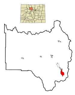 Location in Grand County and the state of Colorado | |
| Coordinates: 39°54′15″N 105°46′45″W / 39.90417°N 105.77917°WCoordinates: 39°54′15″N 105°46′45″W / 39.90417°N 105.77917°W | |
| Country |
|
| State |
|
| County[1] | Grand County |
| Founded | August 1, 1978 |
| Incorporated | September 1, 1979[2] |
| Government | |
| • Type | Home Rule Municipality[1] |
| • Mayor | Jimmy Lahrman |
| Area | |
| • Total | 16.5 sq mi (42.7 km2) |
| • Land | 16.5 sq mi (42.7 km2) |
| • Water | 0.0 sq mi (0.0 km2) |
| Elevation[3] | 9,052 ft (2,780 m) |
| Population (2010) | |
| • Total | 999 |
| • Density | 61/sq mi (23.4/km2) |
| Time zone | MST (UTC-7) |
| • Summer (DST) | MDT (UTC-6) |
| ZIP code[4] | 80482 (PO Box) |
| Area code(s) | 970 |
| FIPS code | 08-85705 |
| GNIS feature ID | 0180960 |
| Website |
www |
|
| |

Winter Park is a home rule municipality in Grand County, Colorado, United States. The permanent population was 999 at the 2010 census,[5] although with 2,572 housing units within the town limits[5] the seasonal population can be much higher.
It is home to the Winter Park Resort, a well-known ski resort owned by the City and County of Denver and managed by Intrawest. The town and resort are served by the Ski Train of the Denver & Rio Grande Western Railroad (D&RGW).
Although the town center is at about 9,000 feet (2,700 m) above sea level,[6] Winter Park, using administrative boundaries as a measure, became the highest incorporated town in the United States after the July 2006 annexation of 5,214 acres (21.10 km2) of Winter Park Resort to allow new on-mountain improvements. This claim is disputed since Winter Park has no residences above 9,550 feet (2,910 m), while contiguous residential neighborhoods in Leadville, Colorado, extend to 10,360 feet (3,160 m) and in Alma, Colorado, to 11,680 feet (3,560 m), and even Alma's town center is at 10,361 feet (3,158 m).
The area also has abundant cross-country skiing opportunities, including Devil's Thumb Ranch. In the spring and summer, Winter Park is known for mountain biking, concerts, hiking, and fishing.
Geography
Winter Park is located in southeastern Grand County at 39°54′15″N 105°46′45″W / 39.904071°N 105.779198°W,[7] at the southern end of the Fraser Valley. It is bordered to the north by the town of Fraser. U.S. Route 40 passes through the town, leading south and east over Berthoud Pass 66 miles (106 km) to Denver and northwest 20 miles (32 km) to Granby.
According to the United States Census Bureau, the town has a total area of 16.5 square miles (42.7 km2), all of it land.[5]
Its elevation ranges from approximately 8,700 to 12,060 feet (2,650 to 3,680 m) above sea level, and is considered sub-alpine country. It is snow-covered for about six months a year.
Demographics
| Historical population | |||
|---|---|---|---|
| Census | Pop. | %± | |
| 1980 | 480 | — | |
| 1990 | 528 | 10.0% | |
| 2000 | 662 | 25.4% | |
| 2010 | 999 | 50.9% | |
| Est. 2015 | 993 | [8] | −0.6% |
As of the census[10] of 2000, there were 662 people, 318 households, and 129 families residing in the town. The population density was 82.1 people per square mile (31.7/km²). There were 1,231 housing units at an average density of 152.7 per square mile (59.0/km²). The racial makeup of the town was 96.53% White, 0.15% African American, 0.60% Native American, 0.91% Asian, 0.45% from other races, and 1.36% from two or more races. Hispanics or Latinos of any race were 1.36% of the population.
There were 318 households out of which 14.8% had children under the age of 18 living with them, 33.3% were married couples living together, 5.0% had a female householder with no husband present, and 59.4% were non-families. 38.4% of all households were made up of individuals and 4.4% had someone living alone who was 65 years of age or older. The average household size was 2.04 and the average family size was 2.67.
The age distribution was 12.5% under the age of 18, 11.5% from 18 to 24, 44.0% from 25 to 44, 27.0% from 45 to 64, and 5.0% who were 65 years of age or older. The median age was 36 years. For every 100 females there were 143.4 males. For every 100 females age 18 and over, there were 143.3 males.
The median income for a household in the town was $44,000, and the median income for a family was $80,660. Males had a median income of $35,221 versus $27,500 for females. The per capita income for the town was $36,699. About 3.3% of families and 9.2% of the population were below the poverty line, including 6.8% of those under age 18 and none of those age 65 or over.
History
Winter Park began as two small settlements, Old Town and Hideaway Park. Old Town came into existence because of the construction taking place on the Moffat Tunnel. Hideaway Park was a village that began in 1932 and quickly developed into the fourth town in the valley. Hideaway Park was developed and built by L.O. "Doc" Graves, a merchant in the valley since 1922. Doc began by building 26 tourist cabins and a cafe and service station called "Doc's Place". He also installed a water wheel on Vasquez Creek to generate all the electricity necessary to operate his business. The village grew rapidly, considering that the entire country was in the depth of a serious depression at that time. The construction of a water tunnel parallel to the existing Moffat railroad tunnel had a positive effect on the local economy. Over a stretch of two years, the village added three more businesses — a saloon, a garage, and a nightclub — and nearly doubled in population.
On August 1, 1978, the town was founded and became Winter Park. In 1980 Winter Park grew again, incorporating the West Portal Village. The West Portal Village became the home of the Mary Jane Base and various other buildings at the resort such as the Iron Horse Resort.
Most recently, the ghost town of Arrow, at the western base of Rollins Pass, was annexed into the town; this marked the beginning of the massive Arrowhead development.
Notable people
- Elizabeth McIntyre (born 1965), freestyle skier, Olympic silver medalist; lives in Winter Park
- Ryan Max Riley (born 1979), freestyle skier, US Champion, and humorist; lived in Winter Park
- Michelle Roark (born 1974), freestyle skier, World Champion silver medalist and two-time Olympian; lived in Winter Park
- Ryan St. Onge (born 1983), freestyle skier, World Champion and two-time Olympian; lived in Winter Park
See also
References
- 1 2 "Active Colorado Municipalities". State of Colorado, Department of Local Affairs. Retrieved 2007-09-01.
- ↑ "Colorado Municipal Incorporations". State of Colorado, Department of Personnel & Administration, Colorado State Archives. 2004-12-01. Retrieved 2007-09-02.
- ↑ "US Board on Geographic Names". United States Geological Survey. 2007-10-25. Retrieved 2008-01-31.
- ↑ "ZIP Code Lookup" (JavaScript/HTML). United States Postal Service. Retrieved 2008-01-09.
- 1 2 3 "Geographic Identifiers: 2010 Demographic Profile Data (G001): Winter Park town, Colorado". American Factfinder. U.S. Census Bureau. Retrieved November 18, 2016.
- ↑ City of Winter Park official web site, . Retrieved February 22, 2007.
- ↑ "US Gazetteer files: 2010, 2000, and 1990". United States Census Bureau. 2011-02-12. Retrieved 2011-04-23.
- ↑ "Annual Estimates of the Resident Population for Incorporated Places: April 1, 2010 to July 1, 2015". Retrieved July 2, 2016.
- ↑ "Census of Population and Housing". Census.gov. Retrieved June 4, 2015.
- ↑ "American FactFinder". United States Census Bureau. Retrieved 2008-01-31.
External links
- Town of Winter Park official website
- CDOT map of the Town of Winter Park
- Winter Park Resort
- Winter Park History
- 3dSkiMap of Winter Park
-
 Winter Park (Colorado) travel guide from Wikivoyage
Municipalities and communities of Grand County, Colorado, United States | ||
|---|---|---|
| Towns | 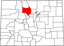 | |
| CDPs | ||
| Unincorporated communities | ||
