Winseler
| Winseler Wanseler | ||
|---|---|---|
| Commune | ||
|
Winseler seen from Schëllerfeld | ||
| ||
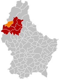 Map of Luxembourg with Winseler highlighted in orange, and the canton in dark red | ||
| Coordinates: 49°58′00″N 5°53′00″E / 49.9667°N 5.8833°ECoordinates: 49°58′00″N 5°53′00″E / 49.9667°N 5.8833°E | ||
| Country |
| |
| Canton | Wiltz | |
| Government | ||
| • Mayor | Romain Schroeder | |
| Area | ||
| • Total | 30.42 km2 (11.75 sq mi) | |
| Area rank | 22nd of 105 | |
| Highest elevation | 520 m (1,710 ft) | |
| • Rank | 13th of 105 | |
| Lowest elevation | 320 m (1,050 ft) | |
| • Rank | 102nd of 105 | |
| Population (2014) | ||
| • Total | 1,107 | |
| • Rank | 95th of 105 | |
| • Density | 36/km2 (94/sq mi) | |
| • Density rank | 101st of 105 | |
| Time zone | CET (UTC+1) | |
| • Summer (DST) | CEST (UTC+2) | |
| LAU 2 | LU00005011 | |
| Website | winseler.lu | |


Winseler (Luxembourgish: Wanseler) is a commune and village in north-western Luxembourg.
Administrative organization and population
It is part of the canton of Wiltz, which is part of the district of Diekirch.
As of 2005, the village of Winseler, which lies in the east of the commune, has a population of 120. The municipality (commune)[1] of Winseler has a population of 1116 and is composed by several villages, namely Doncols, Noertrange, Berlé, Grummelscheid, Pommerlach, Schleif, and Sonlez. The Mayor for his second term is Romain Schroeder and his municipal Council is completed by Charel Pauly, Aly Stelmes, Christophe Hansen (politician), Paul Kayser, Marco Schmitz and Roland Esch.[2]
Other towns within the commune
Other towns within the commune include Berlé, Doncols, Noertrange, Pommerloch, Grummelscheid, Schleif and Sonlez.
Linguistic background
Like Lasauvage in the south of Luxembourg, Doncols and Sonlez, were formerly known as French-speaking (or, strictly, in their cases, Walloon-speaking) villages.
See also
References
External links
-
 Media related to Winseler at Wikimedia Commons
 |
Wincrange | | ||
| Bastogne (BE-WLX) | |
Wiltz | ||
| ||||
| | ||||
| Lac de la Haute-Sûre |
