Winkler County Airport
| Winkler County Airport (former Wink Air Force Aux. Field) | |||||||||||||||
|---|---|---|---|---|---|---|---|---|---|---|---|---|---|---|---|
|
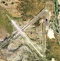
USGS 2006 orthophoto | |||||||||||||||
| IATA: INK – ICAO: KINK – FAA LID: INK | |||||||||||||||
| Summary | |||||||||||||||
| Airport type | Public | ||||||||||||||
| Owner | Winkler County | ||||||||||||||
| Serves | Wink, Texas | ||||||||||||||
| Elevation AMSL | 2,822 ft / 860 m | ||||||||||||||
| Coordinates | 31°46′47″N 103°12′06″W / 31.77972°N 103.20167°WCoordinates: 31°46′47″N 103°12′06″W / 31.77972°N 103.20167°W | ||||||||||||||
| Website | www.co.winkler.tx.us/... | ||||||||||||||
| Map | |||||||||||||||
 INK Location of airport in Texas | |||||||||||||||
| Runways | |||||||||||||||
| |||||||||||||||
| Statistics (2009) | |||||||||||||||
| |||||||||||||||
Winkler County Airport (IATA: INK, ICAO: KINK, FAA LID: INK) is a county owned, public use airport in Winkler County, Texas, United States. It is located three nautical miles (6 km) northwest of the central business district of Wink, Texas.[1] This airport is included in the National Plan of Integrated Airport Systems for 2011–2015, which categorized it as a general aviation facility.[2]
History
The airport was opened in August 1941 as Wink Field and was used by the United States Army Air Forces as a training base. It was an auxiliary airfield to Hobbs Army Airfield, New Mexico as part of the AAF Advanced Flying School (Twin-Engine) at Hobbs. At the end of the war the airfield was determined to be excess by the military and turned over to the local government for civil use. [3] [4]
Facilities and aircraft
Winkler County Airport covers an area of 1,000 acres (405 ha) at an elevation of 2,822 feet (860 m) above mean sea level. It has two asphalt paved runways: 13/31 is 5,003 by 100 feet (1,525 x 30 m) and 4/22 is 3,514 by 100 feet (1,071 x 30 m).[1]
For the 12-month period ending August 13, 2009, the airport had 3,400 aircraft operations, an average of 283 per month: 97% general aviation and 3% military. At that time there were 3 aircraft based at this airport, all ultralight.[1]
See also
- List of airports in Texas
- Texas World War II Army Airfields
-
 United States Air Force portal
 -
 Military of the United States portal
 -
 World War II portal
References
- 1 2 3 4 FAA Airport Master Record for INK (Form 5010 PDF). Federal Aviation Administration. Effective May 31, 2012.
- ↑ "2011–2015 NPIAS Report, Appendix A" (PDF, 2.03 MB). National Plan of Integrated Airport Systems. Federal Aviation Administration. October 4, 2010. External link in
|work=(help) - ↑
 This article incorporates public domain material from the Air Force Historical Research Agency website http://www.afhra.af.mil/.
 - ↑ Thole, Lou (1999), Forgotten Fields of America : World War II Bases and Training, Then and Now - Vol. 2. Publisher: Pictorial Histories Pub, ISBN 1-57510-051-7
External links
- Airport page at Winkler County website
- "Winkler County (INK)" (PDF). at Texas DOT Airport Directory
- Aerial image as of January 1996 from USGS The National Map
- FAA Terminal Procedures for INK, effective December 8, 2016
- Resources for this airport:
- FAA airport information for INK
- AirNav airport information for KINK
- ASN accident history for INK
- FlightAware airport information and live flight tracker
- NOAA/NWS latest weather observations
- SkyVector aeronautical chart, Terminal Procedures