Winifred, Montana
| Winifred, Montana | |
|---|---|
| Town | |
|
Downtown and Northeast Winifred (June 2015) | |
 Location of Winifred, Montana | |
| Coordinates: 47°33′35″N 109°22′38″W / 47.55972°N 109.37722°WCoordinates: 47°33′35″N 109°22′38″W / 47.55972°N 109.37722°W | |
| Country | United States |
| State | Montana |
| County | Fergus |
| Area[1] | |
| • Total | 0.50 sq mi (1.29 km2) |
| • Land | 0.50 sq mi (1.29 km2) |
| • Water | 0 sq mi (0 km2) |
| Elevation | 3,235 ft (986 m) |
| Population (2010)[2] | |
| • Total | 208 |
| • Estimate (2012[3]) | 207 |
| • Density | 416.0/sq mi (160.6/km2) |
| Time zone | Mountain (MST) (UTC-7) |
| • Summer (DST) | MDT (UTC-6) |
| ZIP code | 59489 |
| Area code(s) | 406 |
| FIPS code | 30-81025 |
| GNIS feature ID | 0778598 |
.MP4.00_03_25_20.Still001.jpg)
Winifred is a town in north-central Fergus County, Montana, United States. The population was 208 at the 2010 census. Winifred was founded in 1913 as the terminus of a newly built branch line of the Chicago, Milwaukee, St. Paul and Pacific Railroad ("the Milwaukee Road"). It is popularly believed to have been named after one of the railroad owner's two daughters (the other being Christina, another small town about 15 miles away).
Geography
Winifred is located at 47°33′35″N 109°22′38″W / 47.55972°N 109.37722°W (47.559818, -109.377108).[4]
According to the United States Census Bureau, the town has a total area of 0.50 square miles (1.29 km2), all of it land.[1]
Climate
According to the Köppen Climate Classification system, Winifred has a semi-arid climate, abbreviated "BSk" on climate maps.[5]
Demographics
| Historical population | |||
|---|---|---|---|
| Census | Pop. | %± | |
| 1920 | 262 | — | |
| 1930 | 251 | −4.2% | |
| 1940 | 300 | 19.5% | |
| 1950 | 217 | −27.7% | |
| 1960 | 220 | 1.4% | |
| 1970 | 190 | −13.6% | |
| 1980 | 155 | −18.4% | |
| 1990 | 150 | −3.2% | |
| 2000 | 156 | 4.0% | |
| 2010 | 208 | 33.3% | |
| Est. 2015 | 205 | [6] | −1.4% |
2010 census
As of the census[2] of 2010, there were 208 people, 92 households, and 65 families residing in the town. The population density was 416.0 inhabitants per square mile (160.6/km2). There were 116 housing units at an average density of 232.0 per square mile (89.6/km2). The racial makeup of the town was 94.7% White, 1.0% African American, 3.4% Native American, 0.5% from other races, and 0.5% from two or more races. Hispanic or Latino of any race were 1.0% of the population.
There were 92 households of which 23.9% had children under the age of 18 living with them, 56.5% were married couples living together, 8.7% had a female householder with no husband present, 5.4% had a male householder with no wife present, and 29.3% were non-families. 26.1% of all households were made up of individuals and 14.2% had someone living alone who was 65 years of age or older. The average household size was 2.26 and the average family size was 2.72.
The median age in the town was 46.3 years. 20.2% of residents were under the age of 18; 7.1% were between the ages of 18 and 24; 19.7% were from 25 to 44; 33.2% were from 45 to 64; and 19.7% were 65 years of age or older. The gender makeup of the town was 51.4% male and 48.6% female.
2000 census
As of the census[9] of 2000, there were 156 people, 69 households, and 38 families residing in the town. The population density was 305.0 people per square mile (118.1/km²). There were 85 housing units at an average density of 166.2 per square mile (64.4/km²). The racial makeup of the town was 96.79% White, 1.28% Native American, 0.64% from other races, and 1.28% from two or more races. Hispanic or Latino of any race were 1.92% of the population.
There were 69 households out of which 24.6% had children under the age of 18 living with them, 44.9% were married couples living together, 7.2% had a female householder with no husband present, and 43.5% were non-families. 39.1% of all households were made up of individuals and 13.0% had someone living alone who was 65 years of age or older. The average household size was 2.26 and the average family size was 3.13.
In the town the population was spread out with 23.1% under the age of 18, 5.8% from 18 to 24, 27.6% from 25 to 44, 28.2% from 45 to 64, and 15.4% who were 65 years of age or older. The median age was 41 years. For every 100 females there were 116.7 males. For every 100 females age 18 and over, there were 110.5 males.
The median income for a household in the town was $25,000, and the median income for a family was $33,393. Males had a median income of $17,321 versus $18,750 for females. The per capita income for the town was $12,600. About 17.0% of families and 23.9% of the population were below the poverty line, including 42.9% of those under the age of eighteen and 16.0% of those sixty five or over.
References
- 1 2 "US Gazetteer files 2010". United States Census Bureau. Retrieved 2012-12-18.
- 1 2 "American FactFinder". United States Census Bureau. Retrieved 2012-12-18.
- ↑ "Population Estimates". United States Census Bureau. Retrieved 2013-06-03.
- ↑ "US Gazetteer files: 2010, 2000, and 1990". United States Census Bureau. 2011-02-12. Retrieved 2011-04-23.
- ↑ Climate Summary for Winifred, Montana
- ↑ "Annual Estimates of the Resident Population for Incorporated Places: April 1, 2010 to July 1, 2015". Retrieved July 2, 2016.
- ↑ "Census of Population and Housing". Census.gov. Retrieved June 4, 2015.
- ↑ "Census & Economic Information Center". Retrieved July 3, 2015.
- ↑ "American FactFinder". United States Census Bureau. Retrieved 2008-01-31.
External links
Municipalities and communities of Fergus County, Montana, United States | ||
|---|---|---|
| City | 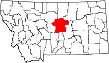 | |
| Towns | ||
| CDP | ||
| Other unincorporated communities | ||
| Ghost town | ||