Winfield, Kansas
| Winfield, Kansas | |
|---|---|
| City | |
|
Cowley County National Bank Building (2013) (National Register of Historic Places) | |
 Location within Cowley County and Kansas | |
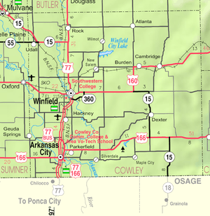 KDOT map of Cowley County (legend) | |
| Coordinates: 37°14′23″N 96°59′44″W / 37.23972°N 96.99556°WCoordinates: 37°14′23″N 96°59′44″W / 37.23972°N 96.99556°W[1] | |
| Country | United States |
| State | Kansas |
| County | Cowley |
| Founded | 1873 |
| Government | |
| • City manager | Warren Porter |
| Area[2] | |
| • Total | 12.93 sq mi (33.49 km2) |
| • Land | 11.56 sq mi (29.94 km2) |
| • Water | 1.37 sq mi (3.55 km2) 10.60% |
| Elevation[1] | 1,129 ft (344 m) |
| Population (2010)[3] | |
| • Total | 12,301 |
| • Estimate (2015)[4] | 12,204 |
| • Density | 950/sq mi (370/km2) |
| Time zone | CST (UTC-6) |
| • Summer (DST) | CDT (UTC-5) |
| ZIP code | 67156 |
| Area code | 620 |
| FIPS code | 20-79950 [1] |
| GNIS feature ID | 0469556 [1] |
| Website | winfieldks.org |

Winfield is a city and county seat of Cowley County, Kansas, United States.[5] It is situated along the Walnut River in South Central Kansas. As of the 2010 census, the city population was 12,301 and second most populous city of Cowley County.[6]
History
19th century
Winfield was founded in 1870.[7] It was named for Rev. Winfield Scott, who promised to build the town a church in exchange for the naming rights.[8][9]
The first post office at Winfield was established in May, 1870.[10]
In 1877, the Florence, El Dorado, and Walnut Valley Railroad Company built a branch line from Florence to El Dorado, in 1881 it was extended to Douglass, and later to Arkansas City.[11] The line was leased and operated by the Atchison, Topeka and Santa Fe Railway. The line from Florence to El Dorado was abandoned in 1942.[12] The original branch line connected Florence, Burns, De Graff, El Dorado, Augusta, Douglass, Rock, Akron, Winfield, Arkansas City.
20th century
Winfield is home to Southwestern College, a four-year private Methodist college and once also held St. John's College before it closed in 1986.[13]
On August 13, 1903, 30-year-old Gilbert Twigg, armed with a 12-gauge double-barrelled shotgun, opened fire at a concert, killing six people and wounding at least 25, before killing himself.[14][15] Three others died in hospitals afterward. The incident, while largely forgotten today, has been called "America's first modern mass shooting" as many aspects were similar to more widely publicized and deadlier events in the late 20th and early 21st centuries.[16]
The city is well known for hosting the Walnut Valley Festival, a large bluegrass and acoustic music festival, on the third weekend of every September.[17]
A Crayola manufacturing plant was located in Winfield from 1952 to 1997.[18]
21st century
In 2010, the Keystone-Cushing Pipeline (Phase II) was constructed west of Winfield, north to south through Cowley County, with much controversy over tax exemption and environmental concerns (if a leak ever occurs).[19][20]
In 2011, Newell Rubbermaid announced it would expand its presence in Winfield by relocating 200 jobs from a facility in Texas to Winfield. Rubbermaid would invest $26.6 million to expand its operations, including a new 500,000 sq. ft. distribution center.[21]

Geography
Winfield is situated along the Walnut River at its confluence with Timber Creek. It is located 17 miles (27 km) north of the Kansas-Oklahoma state border at the junction of U.S. Routes 77 and 160. State highway route K-15 follows U.S. Route 77 to the north of the city and U.S. Route 160 to the east. K-360 is a bypass around the southeastern part of the city between U.S. Route 77 and U.S. Route 160. Arkansas City is 13 miles (21 km) south of Winfield along U.S. Route 77, and Strother Field, a general aviation airport, is about five miles (8 km) south.
According to the United States Census Bureau, the city has a total area of 12.93 square miles (33.49 km2), of which, 11.56 square miles (29.94 km2) is land and 1.37 square miles (3.55 km2) is water.[2]
Climate
Over the course of a year, temperatures range from an average low below 20 °F (−7 °C) in January to an average high of nearly 93 °F (34 °C) in July. The maximum temperature reaches 90 °F (32 °C) an average of 69 days per year and reaches 100 °F (38 °C) an average of 12 days per year. The minimum temperature falls below the freezing point (32 °F) an average of 102 days per year. Typically the first fall freeze occurs between early October and the first week of November, and the last spring freeze occurs during the month of April.
The area receives nearly 38 inches (970 mm) of precipitation during an average year with the largest share being received in May and June—with a combined 20 days of measurable precipitation. During a typical year the total amount of precipitation may be anywhere from 26 to 50 inches (1,300 mm). There are on average 90 days of measurable precipitation per year. Winter snowfall averages almost 12 inches, but the median is less than 3 inches (76 mm). Measurable snowfall occurs an average of 7 days per year with at least an inch of snow being received on four of those days. Snow depth of at least an inch occurs an average of 11 days per year.
| Month | Jan | Feb | Mar | Apr | May | Jun | Jul | Aug | Sep | Oct | Nov | Dec | Year |
|---|---|---|---|---|---|---|---|---|---|---|---|---|---|
| Temperatures (°F) | |||||||||||||
| Mean high | 41.9 | 49.1 | 58.7 | 68.3 | 77.3 | 86.6 | 92.8 | 91.8 | 83.2 | 71.9 | 56.5 | 45.2 | 68.6 |
| Mean low | 19.2 | 24.1 | 33.0 | 42.5 | 53.4 | 62.9 | 68.2 | 66.3 | 57.9 | 45.8 | 33.1 | 23.4 | 44.2 |
| Highest recorded | 75 (1981) |
88 (1996) |
94 (1940) |
98 (1972) |
102 (1934) |
110 (1933) |
115 (1954) |
118 (1936) |
110 (2000) |
98 (1947) |
87 (1950) |
81 (1955) |
118 (1936) |
| Lowest recorded | −20 (1947) |
−27 (1905) |
−3 (1960) |
15 (1936) |
26 (1907) |
40 (1983) |
48 (1924) |
45 (1988) |
31 (1995) |
12 (1993) |
2 (1975) |
−15 (1989) |
−27 (1905) |
| Precipitation (inches) | |||||||||||||
| Median | 1.05 | 1.37 | 2.94 | 2.93 | 4.05 | 4.83 | 3.07 | 3.08 | 2.16 | 2.71 | 2.77 | 1.55 | 37.95 |
| Mean number of days | 5.8 | 5.8 | 8.1 | 8.3 | 10.4 | 9.1 | 7.2 | 7.6 | 7.8 | 6.7 | 6.8 | 5.9 | 89.5 |
| Highest monthly | 3.00 (1973) |
5.23 (1997) |
7.94 (1973) |
12.58 (1994) |
16.57 (1993) |
9.79 (1999) |
9.81 (1995) |
9.34 (1974) |
9.43 (1986) |
14.78 (1998) |
6.68 (1992) |
4.64 (1999) |
|
| Snowfall (inches) | |||||||||||||
| Median | 0.5 | 1.1 | 0.0 | 0.0 | 0.0 | 0.0 | 0.0 | 0.0 | 0.0 | 0.0 | 0.0 | 1.0 | 2.6 |
| Mean number of days | 2.3 | 1.5 | 0.8 | 0.1 | 0.0 | 0.0 | 0.0 | 0.0 | 0.0 | 0.0 | 0.3 | 1.3 | 6.3 |
| Highest monthly | 17.0 (1979) |
17.1 (1980) |
5.0 (1995) |
0.8 (1979) |
0.0 | 0.0 | 0.0 | 0.0 | 0.0 | trace (1981) |
8.0 (1972) |
9.3 (1973) |
|
| Notes: Temperatures are in degrees Fahrenheit. Precipitation includes rain and melted snow or sleet in inches; median values are provided for precipitation and snowfall because mean averages may be misleading. Mean and median values are for the 30-year period 1971–2000; temperature extremes are for the station's period of record (1900–2001). The station is located in Winfield at 37°14′N 96°58′W, elevation 1,160 feet (350 m). | |||||||||||||
Demographics
| Historical population | |||
|---|---|---|---|
| Census | Pop. | %± | |
| 1870 | 472 | — | |
| 1880 | 2,844 | 502.5% | |
| 1890 | 5,184 | 82.3% | |
| 1900 | 5,554 | 7.1% | |
| 1910 | 6,700 | 20.6% | |
| 1920 | 7,933 | 18.4% | |
| 1930 | 9,398 | 18.5% | |
| 1940 | 9,506 | 1.1% | |
| 1950 | 10,264 | 8.0% | |
| 1960 | 11,117 | 8.3% | |
| 1970 | 11,405 | 2.6% | |
| 1980 | 10,736 | −5.9% | |
| 1990 | 11,931 | 11.1% | |
| 2000 | 12,206 | 2.3% | |
| 2010 | 12,301 | 0.8% | |
| Est. 2015 | 12,204 | [4] | −0.8% |
| U.S. Decennial Census | |||
2010 census
As of the census[3] of 2010, there were 12,301 people, 4,600 households, and 2,848 families residing in the city. The population density was 1,064.1 inhabitants per square mile (410.9/km2). There were 5,217 housing units at an average density of 451.3 per square mile (174.2/km2). The racial makeup of the city was 85.7% White, 3.9% African American, 1.3% Native American, 3.9% Asian, 1.8% from other races, and 3.4% from two or more races. Hispanic or Latino of any race were 6.1% of the population.
There were 4,600 households of which 32.0% had children under the age of 18 living with them, 44.7% were married couples living together, 12.2% had a female householder with no husband present, 5.1% had a male householder with no wife present, and 38.1% were non-families. 32.5% of all households were made up of individuals and 13.8% had someone living alone who was 65 years of age or older. The average household size was 2.37 and the average family size was 2.98.
The median age in the city was 36.7 years. 23% of residents were under the age of 18; 12% were between the ages of 18 and 24; 25% were from 25 to 44; 24.4% were from 45 to 64; and 15.7% were 65 years of age or older. The gender makeup of the city was 50.7% male and 49.3% female.
2000 census
As of the census of 2000,[22] there were 12,206 people, 4,627 households, and 2,952 families residing in the city. The population density was 1,104.0 people per square mile (426.1/km²). There were 5,049 housing units at an average density of 456.7 per square mile (176.3/km²). The racial makeup of the city was 88.06% White, 3.26% Black or African American, 1.08% Native American, 3.74% Asian, 0.02% Pacific Islander, 1.73% from other races, and 2.12% from two or more races. Hispanic or Latino of any race were 4.66% of the population.
There were 4,627 households out of which 31.9% had children under the age of 18 living with them, 49.6% were married couples living together, 10.7% had a female householder with no husband present, and 36.2% were non-families. 32.4% of all households were made up of individuals and 16.9% had someone living alone who was 65 years of age or older. The average household size was 2.36 and the average family size was 3.00.
In the city the population was spread out with 24.9% under the age of 18, 11.8% from 18 to 24, 27.4% from 25 to 44, 19.4% from 45 to 64, and 16.6% who were 65 years of age or older. The median age was 36 years. For every 100 females there were 98.5 males. For every 100 females age 18 and over, there were 97.0 males.
The median income for a household in the city was $34,443, and the median income for a family was $44,539. Males had a median income of $31,768 versus $21,605 for females. The per capita income for the city was $19,162. About 9.9% of families and 13.8% of the population were below the poverty line, including 18.6% of those under age 18 and 11.4% of those age 65 or over.
In popular media
- Fictional character Mary Ann Summers (played by Dawn Wells) in the television series Gilligan's Island is from Winfield.
Notable people

- Bob Brannum, basketball player.
- Darren Burrows, actor and director.
- Josh Clarke, baseball player.
- Harold Corbin, Olympian.
- Ira Davenport, Olympic bronze medal winner.
- Bethany Gerber, Miss USA 2010 competitor.
- Greta Goodwin, member Kansas Senate and Kansas House of Representatives.
- John Harts, football coach.
- Bob Kenney, University of Kansas NCAA National Men’s Basketball Championship team in 1952, 1952 Olympic Gold Medal.
- Richard Mawdsley, artist known for his work in metalsmithing.
- Guy McAfee (1888-1960), law enforcement officer, owner of brothels and gambling saloons in Los Angeles, California and co-founder of casinos in Las Vegas, Nevada.[23]
- George McDermott, U.S. federal judge.
- Eugene Pallette, actor; appeared in over 240 silent era and sound era motion pictures.
- Steve Sidwell, football coach.
- Dean Strother, U.S. Air Force four-star general; Commander in Chief of North American Air Defense Command and Continental Air Defense Command.
- Karen Wheeler, artist.
See also
References
- 1 2 3 4 Geographic Names Information System (GNIS) details for Winfield, Kansas; United States Geological Survey (USGS); October 13, 1978.
- 1 2 "US Gazetteer files 2010". United States Census Bureau. Retrieved 2012-07-06.
- 1 2 "American FactFinder". United States Census Bureau. Retrieved 2012-07-06.
- 1 2 "Annual Estimates of the Resident Population for Incorporated Places: April 1, 2010 to July 1, 2015". Retrieved July 2, 2016.
- ↑ "Find a County". National Association of Counties. Retrieved 2011-06-07.
- ↑ "2010 City Population and Housing Occupancy Status". U.S. Census Bureau. Retrieved March 6, 2011.
- ↑ "Cowley County". Blue Skyways. Kansas State Library. Retrieved 7 June 2014.
- ↑ Kansas State Historical Society (1916). Biennial Report of the Board of Directors of the Kansas State Historical Society. Kansas State Printing Plant. p. 167.
- ↑ Blackmar, Frank Wilson (1912). Kansas: A Cyclopedia of State History, Volume 2. Standard Publishing Company. p. 926.
- ↑ "Kansas Post Offices, 1828-1961, page 2". Kansas Historical Society. Retrieved 6 June 2014.
- ↑ Marion County Kansas : Past and Present; Sondra Van Meter; MB Publishing House; LCCN 72-92041; 344 pages; 1972.
- ↑ Railway Abandonment 1942
- ↑ St. John's College Alumni Assn.
- ↑ "TWIGG KILLED SIX MEN.". The New York Times. 16 August 1903. Retrieved 20 November 2015.
- ↑ "The Camen Band Massacre". ausbcomp.com. Winfield Courier. August 14, 1903. Retrieved March 29, 2016.
- ↑ Weinman, Sarah (March 24, 2016). "Massacre on Ninth and Main". BuzzFeed. Retrieved March 26, 2016.
- ↑ Walnut Valley Festival
- ↑ "Crayola.com Can We Help". Retrieved December 11, 2011.
- ↑ Keystone Pipeline - Marion County Commission calls out Legislative Leadership on Pipeline Deal; April 18, 2010.
- ↑ Keystone Pipeline - Trans-Canada inspecting pipeline; December 10, 2010.
- ↑ Kansas Dept of Commerce. "Rubbermaid set to expand facility with major investment in Winfield". State of Kansas. Retrieved 7 March 2012.
- ↑ "American FactFinder". United States Census Bureau. Retrieved 2008-01-31.
- ↑ Lillisview, Maggie (June 7, 2011). "Guy McAfee credited with branding the Strip". Las Vegas Review-Journal. Retrieved March 3, 2016.
Further reading
- County
- History of Cowley County Kansas; D.A. Millington / E.P. Greer; Winfield Courier; 162 pages; 1901. (Download 16MB PDF eBook)
- Kansas
- History of the State of Kansas; William G. Cutler; A.T. Andreas Publisher; 1883. (Online HTML eBook)
- Kansas : A Cyclopedia of State History, Embracing Events, Institutions, Industries, Counties, Cities, Towns, Prominent Persons, Etc; 3 Volumes; Frank W. Blackmar; Standard Publishing Co; 944 / 955 / 824 pages; 1912. (Volume1 - Download 54MB PDF eBook), (Volume2 - Download 53MB PDF eBook), (Volume3 - Download 33MB PDF eBook)
External links
| Wikimedia Commons has media related to Winfield, Kansas. |
| Wikivoyage has a travel guide for Winfield (Kansas). |
- City
- Schools
- USD 465, local school district
- Southwestern College
- Events
- Historical
- Cowley County Historical Museum on YouTube, from Hatteberg's People on KAKE TV news
- Mosaic - The Power of Coffee To Change A Life on YouTube, from Hatteberg's People on KAKE TV news
- Michelle Pentz - Welding An Artistic Life on YouTube, from Hatteberg's People on KAKE TV news
- Maps
- Winfield City Map, KDOT
Municipalities and communities of Cowley County, Kansas, United States | ||
|---|---|---|
| Cities | 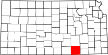 | |
| Unincorporated communities | ||
| Townships | ||
| Footnotes | ‡This populated place also has portions in an adjacent county or counties | |