Wilsonville, Alabama
| Wilsonville, Alabama | |
|---|---|
| Town | |
 Location in Shelby County and the state of Alabama | |
| Coordinates: 33°14′6″N 86°29′11″W / 33.23500°N 86.48639°W | |
| Country | United States |
| State | Alabama |
| County | Shelby |
| Area | |
| • Total | 10.9 sq mi (28.4 km2) |
| • Land | 9.8 sq mi (25.5 km2) |
| • Water | 1.1 sq mi (2.9 km2) |
| Elevation | 423 ft (129 m) |
| Population (2000) | |
| • Total | 1,867 |
| • Density | 142.3/sq mi (54.6/km2) |
| Time zone | Central (CST) (UTC-6) |
| • Summer (DST) | CDT (UTC-5) |
| ZIP code | 35186 |
| Area code(s) | 205 |
| FIPS code | 01-82848 |
| GNIS feature ID | 0129101 |
Wilsonville is a town in southeastern Shelby County, Alabama, United States, located northeast of Columbiana. At the 2010 census the population was 1,867. Wilsonville is named after the earliest settler in the area, Elisha Wilson.[1]
The town was incorporated in 1897.[2] 3 years later in 1900, it had the distinction of being the largest community in Shelby County with 1,095, edging out the county seat of Columbiana by 20 people. It lost the distinction to Columbiana in 1910 and would not exceed its 1900 population again until 1990.[3]
Geography
Wilsonville is located at 33°14′6″N 86°29′11″W / 33.23500°N 86.48639°W (33.234924, -86.486283).[4]
According to the U.S. Census Bureau, the town has a total area of 11.0 square miles (28 km2), of which 9.9 square miles (26 km2) is land and 1.1 square miles (2.8 km2) (10.21%) is water.
Demographics
| Historical population | |||
|---|---|---|---|
| Census | Pop. | %± | |
| 1880 | 93 | — | |
| 1900 | 1,095 | — | |
| 1910 | 933 | −14.8% | |
| 1920 | 815 | −12.6% | |
| 1930 | 770 | −5.5% | |
| 1940 | 749 | −2.7% | |
| 1950 | 692 | −7.6% | |
| 1960 | 683 | −1.3% | |
| 1970 | 659 | −3.5% | |
| 1980 | 914 | 38.7% | |
| 1990 | 1,185 | 29.6% | |
| 2000 | 1,551 | 30.9% | |
| 2010 | 1,827 | 17.8% | |
| Est. 2015 | 1,980 | [5] | 8.4% |
| U.S. Decennial Census[6] 2013 Estimate[7] | |||
At the time of the census[8] of 2010, there were 1,867 people, 610 households, and 486 families residing in the town. The population density was 157.5 people per square mile (60.8/km²). There were 699 housing units at an average density of 71.0 per square mile (27.4/km²). The racial makeup of the town was 92.52% White, 5.22% Black or African American, 0.90% Native American, 0.77% Asian, 0.26% from other races, and 0.32% from two or more races. 0.58% of the population were Hispanic or Latino of any race.
There were 610 households out of which 31.3% had children under the age of 18 living with them, 66.9% were married couples living together, 8.5% had a female householder with no husband present, and 20.3% were non-families. 18.2% of all households were made up of individuals and 8.7% had someone living alone who was 65 years of age or older. The average household size was 2.54 and the average family size was 2.84.
In the town the population was spread out with 23.5% under the age of 18, 6.0% from 18 to 24, 27.9% from 25 to 44, 26.6% from 45 to 64, and 16.0% who were 65 years of age or older. The median age was 41 years. For every 100 females there were 97.1 males. For every 100 females age 18 and over, there were 94.7 males.
The median income for a household in the town was $42,105, and the median income for a family was $48,409. Males had a median income of $40,263 versus $25,598 for females. The per capita income for the town was $21,112. About 4.5% of families and 7.4% of the population were below the poverty line, including 7.8% of those under age 18 and 5.8% of those age 65 or over.
Notable people
- Laurie C. Battle, U.S. Representative from Alabama
- Howard Hill. world-famous archer and stunt archer for Errol Flynn in The Adventures of Robin Hood.
- E. B. Teague, prominent Alabama Baptist minister of the 19th century; helped organize Wilsonville Baptist Church in 1879.
References
- ↑ Foscue, Virginia (1989). Place Names in Alabama. Tuscaloosa: The University of Alabama Press. p. 149. ISBN 0-8173-0410-X.
- ↑ http://www.encyclopediaofalabama.org/article/h-3483
- ↑ 1820-2010 U.S. Censuses research on Shelby County, Alabama communities
- ↑ "US Gazetteer files: 2010, 2000, and 1990". United States Census Bureau. 2011-02-12. Retrieved 2011-04-23.
- ↑ "Annual Estimates of the Resident Population for Incorporated Places: April 1, 2010 to July 1, 2015". Retrieved July 2, 2016.
- ↑ "U.S. Decennial Census". Census.gov. Retrieved June 6, 2013.
- ↑ "Annual Estimates of the Resident Population: April 1, 2010 to July 1, 2013". Retrieved June 3, 2014.
- ↑ "American FactFinder". United States Census Bureau. Retrieved 2008-01-31.
Coordinates: 33°14′06″N 86°29′11″W / 33.234924°N 86.486283°W
Municipalities and communities of Shelby County, Alabama, United States | ||
|---|---|---|
| Cities | 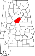 | |
| Towns | ||
| CDPs | ||
| Unincorporated communities | ||
| Footnotes | ‡This populated place also has portions in an adjacent county or counties | |