Wilson Lake (Wisconsin)
| Wilson Lake | |
|---|---|
 | |
| Location | Iron County, Wisconsin |
| Coordinates | 46°07′04″N 090°06′57″W / 46.11778°N 90.11583°WCoordinates: 46°07′04″N 090°06′57″W / 46.11778°N 90.11583°W |
| Basin countries | United States |
| Surface area | 162 acres (0.66 km2) |
| Max. depth | 21 ft (6.4 m) |
| Surface elevation | 479 ft (146 m) |
| Islands | 2 |
Wilson Lake is the name of seven lakes in Wisconsin, United States, as well as four flowages and a pond. Below are listed the county, acres, and maximum depth of the lakes.
| Lake | County | Surface area | Max. Depth |
|---|---|---|---|
| Wilson | Burnett | 10 acres (0.040 km2) | 13 ft (4.0 m) |
| Wilson | Douglas | 27 acres (0.11 km2) | 9 ft (2.7 m) |
| Wilson | Iron | 162 acres (0.66 km2) | 21 ft (6.4 m) |
| Wilson | Sawyer | 103 acres (0.42 km2) | 14 ft (4.3 m) |
| Wilson | Shawano | 20 acres (0.081 km2) | 8 ft (2.4 m) |
| Wilson (Deer) | Vilas | 17 acres (0.069 km2) | 18 ft (5.5 m) |
| Wilson | Waushara | 81 acres (0.33 km2) | 12 ft (3.7 m) |
| Wilson Creek Flowage | Price | 351 acres (1.42 km2) | 11 ft (3.4 m) |
| Wilson Flowage | Price | 269 acres (1.09 km2) | 6 ft (1.8 m) |
| Wilson Marsh Flowage | Jackson | 24 acres (0.097 km2) | 9 ft (2.7 m) |
| Wilson Marsh Flowage, lower | Jackson | 4 acres (0.016 km2) | 7 ft (2.1 m) |
| Wilson Park Pond | Milwaukee | 9 acres (0.036 km2) | 5 ft (1.5 m) |
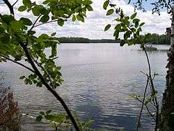
Outside of Wilson Creek Flowage, the largest lake is located in Iron County. This particular lake is a popular fishing lake 5 miles (8.0 km) from the town of Mercer. With three bays, it has two islands and water feed and drain in the South Bay of the lake. The public boat landing is in the Main Bay on the west side of the lake. The North Bay has the most marsh vegetation. There are many cabins located on the lake for residents and vacationers to the North Woods.
External links
- Wisconsin Dept of Natural Resources
- Wilson Lake, Iron County map
- Link to Wilson Lake maps for Sawyer Cty, Waushara Cty, Wilson Creek Flowage, and Wilson Park Pond (pg 2)
This article is issued from Wikipedia - version of the 9/4/2015. The text is available under the Creative Commons Attribution/Share Alike but additional terms may apply for the media files.