Willoughby, Ohio
| Willoughby, Ohio | |
|---|---|
| City | |
|
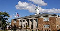
View of Willoughby City Hall | |
| Motto: "The Courtesy City" | |
 Location of Willoughby, Ohio | |
 Location of Willoughby in Lake County | |
| Coordinates: 41°38′45″N 81°24′35″W / 41.64583°N 81.40972°WCoordinates: 41°38′45″N 81°24′35″W / 41.64583°N 81.40972°W[1] | |
| Country | United States |
| State | Ohio |
| County | Lake |
| Government | |
| • Mayor | David E. Anderson |
| Area[2] | |
| • Total | 10.34 sq mi (26.78 km2) |
| • Land | 10.25 sq mi (26.55 km2) |
| • Water | 0.09 sq mi (0.23 km2) |
| Elevation[3] | 659 ft (201 m) |
| Population (2010)[4] | |
| • Total | 22,268 |
| • Estimate (2013[5]) | 22,458 |
| • Density | 2,172.5/sq mi (838.8/km2) |
| Time zone | Eastern (EST) (UTC-5) |
| • Summer (DST) | EDT (UTC-4) |
| ZIP codes | 44094-44097 |
| Area code(s) | 440 |
| FIPS code | 39-85484[6] |
| GNIS feature ID | 1061788[3] |
| Website |
www |

Willoughby is a city in Lake County, Ohio, United States and is a suburb of Cleveland. The population was 22,268 at the 2010 census.[1]
History
Willoughby's first permanent settler was David Abbott in 1798, who operated a gristmill.[7] Abbott and his family had close relations to the local tribe of Erie Indians along the banks of the river the Indians called the "Sha-ga-rin" or Clear Water. This river was later called the Chagrin River, though the derivation of the name remains in dispute.
In 1835, the village was permanently named "Willoughby" in honor of Dr. Westel Willoughby, Jr., a public health official that the founders of a short-lived Medical College, which was based in the city, hoped to attract to the area. Many historical buildings from this period survive to this date, affording the downtown Willoughby area some outstanding specimens of 19th century architecture.
In World War I, the U.S. Army chose Willoughby as the site for a chemical weapons plant producing lewisite.[8]
Over time, Willoughby sent citizens into every major U.S. military conflict. Several memorials and historical relics are displayed in Wes Point Park, the center of downtown Willoughby, to honor those that have served.
Willoughby is the only town in America that has belonged, at one time or other, to six counties (Washington, Jefferson, Trumbull, Geauga, Cuyahoga, and Lake).
Education
Two public high schools are located in Willoughby: Willoughby South High School and Willoughby-Eastlake Technical Center, both of which are a part of the Willoughby-Eastlake School District. Students in the ninth through twelfth grades are enrolled at Willoughby South High School, which opened its doors at its present location in 1959. Previously, Willoughby South High School and current rival Eastlake North High were housed in the same building called Union High, but following the division, the then-abandoned Union High became the location of Willoughby Junior High School until 1972. It then housed the Willoughby-Eastlake Technical Center, located in downtown Willoughby.
The Andrews Osborne Academy is also located in Willoughby.
Willoughby is served by a branch of the Willoughby-Eastlake Public Library.
Geography
Willoughby is located at 41°38′45″N 81°24′35″W / 41.645915°N 81.409681°W (41.645915, -81.408515).[1][9]
According to the United States Census Bureau, the city has a total area of 10.34 square miles (26.78 km2), of which 10.25 square miles (26.55 km2) is land and 0.09 square miles (0.23 km2) is water.[2]
Demographics
| Historical population | |||
|---|---|---|---|
| Census | Pop. | %± | |
| 1840 | 390 | — | |
| 1860 | 589 | — | |
| 1870 | 867 | 47.2% | |
| 1880 | 1,001 | 15.5% | |
| 1890 | 1,219 | 21.8% | |
| 1900 | 1,753 | 43.8% | |
| 1910 | 2,072 | 18.2% | |
| 1920 | 2,656 | 28.2% | |
| 1930 | 4,252 | 60.1% | |
| 1940 | 4,364 | 2.6% | |
| 1950 | 5,602 | 28.4% | |
| 1960 | 15,058 | 168.8% | |
| 1970 | 18,634 | 23.7% | |
| 1980 | 19,290 | 3.5% | |
| 1990 | 20,510 | 6.3% | |
| 2000 | 22,621 | 10.3% | |
| 2010 | 22,268 | −1.6% | |
| Est. 2015 | 22,631 | [10] | 1.6% |
| Sources:[11][12][6][13][5] | |||
2010 census
As of the census[4] of 2010, there were 22,268 people, 10,413 households, and 5,716 families residing in the city. The population density was 2,172.5 inhabitants per square mile (838.8/km2). There were 11,387 housing units at an average density of 1,110.9 per square mile (428.9/km2). The racial makeup of the city was 93.6% White, 3.1% African American, 0.1% Native American, 1.5% Asian, 0.2% from other races, and 1.5% from two or more races. Hispanic or Latino of any race were 1.3% of the population.
There were 10,413 households of which 23.7% had children under the age of 18 living with them, 39.1% were married couples living together, 11.7% had a female householder with no husband present, 4.1% had a male householder with no wife present, and 45.1% were non-families. 38.4% of all households were made up of individuals and 16.2% had someone living alone who was 65 years of age or older. The average household size was 2.12 and the average family size was 2.83.
The median age in the city was 43.6 years. 19.1% of residents were under the age of 18; 7.5% were between the ages of 18 and 24; 25.2% were from 25 to 44; 29.1% were from 45 to 64; and 19.1% were 65 years of age or older. The gender makeup of the city was 46.8% male and 53.2% female.
2000 census
As of the census[6] of 2000, there were 22,621 people, 10,265 households, and 5,892 families residing in the city. The population density was 2,225.3 people per square mile (858.8/km²). There were 10,700 housing units at an average density of 1,052.6 per square mile (406.2/km²). The racial makeup of the city was 96.47% White, 1.14% African American, 0.17% Native American, 1.15% Asian, 0.06% Pacific Islander, 0.11% from other races, and 0.90% from two or more races. Hispanic or Latino of any race were 0.71% of the population. 19.0% were of German, 15.8% Italian, 13.3% Irish, 8.2% English, 5.6% Polish, 5.6% American and 5.4% Slovene ancestry according to Census 2000.
There were 10,265 households out of which 25.2% had children under the age of 18 living with them, 42.8% were married couples living together, 11.1% had a female householder with no husband present, and 42.6% were non-families. 36.6% of all households were made up of individuals and 13.9% had someone living alone who was 65 years of age or older. The average household size was 2.17 and the average family size was 2.87.
In the city the population was spread out with 21.1% under the age of 18, 7.3% from 18 to 24, 31.5% from 25 to 44, 22.5% from 45 to 64, and 17.5% who were 65 years of age or older. The median age was 39 years. For every 100 females there were 85.4 males. For every 100 females age 18 and over, there were 81.9 males.[14]
The median income for a household in the city was $43,387, and the median income for a family was $53,677. Males had a median income of $38,711 versus $30,553 for females. The per capita income for the city was $23,653. About 4.3% of families and 5.8% of the population were below the poverty line, including 8.4% of those under age 18 and 7.6% of those age 65 or over.
Economy
Top employers
According to the City's 2009 Comprehensive Annual Financial Report,[15] the top employers in the city are:
| # | Employer | # of employees |
|---|---|---|
| 1 | Lake Health | 669 |
| 2 | Willoughby-Eastlake City School District | 458 |
| 3 | Ohio Presbyterian Retirement Services | 450 |
| 4 | Momentive Performance Materials | 377 |
| 5 | Marous Brothers Construction | 263 |
| 6 | City of Willoughby | 237 |
| 7 | Windsor-Laurelwood | 225 |
| 8 | Deepwood Industries | 205 |
| 9 | Giant Eagle | 180 |
| 10 | Bescast | 141 |
Notable people
- Grace Bailey, Disney Animation Legend
- Tim Conway, actor
- Greg Harbaugh, NASA astronaut
- Michael Hutter, professional wrestler
- Katie McGregor, athlete
- Lyn St. James, auto racer
- Dan Whalen, professional football player
- Ricky Stanzi, professional football player
- Betty Thomas, actress, director, writer
News and media
The News-Herald, a Lake County newspaper, has been headquartered in Willoughby since its inception.
Willoughby Today is an online news website founded in August 2010 for Willoughby.
Lake County Gazette (Gazette Newspapers Inc.) also features Willoughby news in print and online.
WINT 1330AM is licensed to Willoughby and serves the surrounding area.
References
- Taddeo, Ronald J. "How Willoughby REALLY Got Its Name". City of Willoughby website.
- 1 2 3 "2010 Census Gazetteer Files: Places: Ohio". United States Census Bureau. August 22, 2012. Retrieved December 19, 2012.
- 1 2 "US Gazetteer files 2010". United States Census Bureau. Retrieved 2013-01-06.
- 1 2 "US Board on Geographic Names". United States Geological Survey. 2007-10-25. Retrieved 2008-01-31.
- 1 2 "American FactFinder". United States Census Bureau. Retrieved 2013-01-06.
- 1 2 http://quickfacts.census.gov/qfd/states/39/3985484.html. Retrieved 29 October 2014. Missing or empty
|title=(help) - 1 2 3 "American FactFinder". United States Census Bureau. Retrieved 2008-01-31.
- ↑ Hellmann, Paul T. (May 13, 2013). Historical Gazetteer of the United States. Routledge. p. 876. Retrieved 30 November 2013.
- ↑ Hershberg, James G. (1993). James B. Conant : Harvard to Hiroshima and the making of the nuclear age. Stanford, Cal.: Stanford University Press. p. 47. ISBN 0-8047-2619-1.
- ↑ "US Gazetteer files: 2010, 2000, and 1990". United States Census Bureau. 2011-02-12. Retrieved 2011-04-23.
- ↑ "Annual Estimates of the Resident Population for Incorporated Places: April 1, 2010 to July 1, 2015". Retrieved July 2, 2016.
- ↑ "Number of Inhabitants: Ohio" (PDF). 18th Census of the United States. U.S. Census Bureau. Retrieved 22 November 2013.
- ↑ "Ohio: Population and Housing Unit Counts" (PDF). U.S. Census Bureau. Retrieved 22 November 2013.
- ↑ "Incorporated Places and Minor Civil Divisions Datasets: Subcounty Population Estimates: April 1, 2010 to July 1, 2012". U.S. Census Bureau. Retrieved 25 November 2013.
- ↑ "The City of Willoughby - 1 Public Square • Willoughby, OH 44094 • 440.951.2800". The City of Willoughby. Retrieved 2016-01-25.
- ↑ City of Willoughby CAFR
Further reading
- Sindy, Clarence F. (2002). Willoughby, the First 150 Years (2nd ed.). Eastlake, Ohio: Duke Printing & Mailing Services.
External links
- Willoughby, Ohio
- Willoughby Area Welcome Center
- Willoughby branch of the Willoughby-Eastlake Public Library
Municipalities and communities of Lake County, Ohio, United States | ||
|---|---|---|
| Cities |  | |
| Villages | ||
| Townships | ||
| CDP | ||
| Unincorporated communities | ||