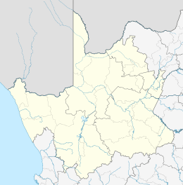
Williston, Northern Cape
| Williston | |
|---|---|
|
Williston | |
 Williston  Williston  Williston
| |
| Coordinates: 31°21′S 20°55′E / 31.350°S 20.917°ECoordinates: 31°21′S 20°55′E / 31.350°S 20.917°E | |
| Country | South Africa |
| Province | Northern Cape |
| District | Namakwa |
| Municipality | Karoo Hoogland |
| • Councillor | (ANC) |
| Area[1] | |
| • Total | 77.95 km2 (30.10 sq mi) |
| Elevation | 1,070 m (3,510 ft) |
| Population (2011)[1] | |
| • Total | 3,368 |
| • Density | 43/km2 (110/sq mi) |
| Racial makeup (2011)[1] | |
| • Black African | 5.6% |
| • Coloured | 83.6% |
| • Indian/Asian | 0.8% |
| • White | 9.4% |
| • Other | 0.7% |
| First languages (2011)[1] | |
| • Afrikaans | 96.2% |
| • Xhosa | 1.3% |
| • English | 1.2% |
| • Other | 1.3% |
| Postal code (street) | 8920 |
| PO box | 8920 |
| Area code | 053 |
Williston is a town in Northern Cape, South Africa. Town 103 km north-east of Calvinia and 140 km south-west of Carnarvon.
History
Williston was originally known as Amandelboom (literally "almond tree") due to the presence of a large almond tree planted in 1768 by Johan Abraham Nel to honour his son's birth. By the time a station was founded at the site by Rhenish mission under Johann Heinrich Lutz in[2] 1845 the tree had grown into a significant landmark in the dry and largely treeless area. A town grew around the station and it was declared a municipality in 1881. It was renamed in 1919 after Colonel Hampden Willis, Colonial Secretary in 1883.[3][4]
Businesses
GerritVanWyk
References
- 1 2 3 4 "Main Place Williston". Census 2011.
- ↑ "Williston". Northern Cape Tourism Authority. Retrieved 12 October 2015.
- ↑ "Dictionary of Southern African Place Names (Public Domain)". Human Science Research Council. p. 475.
- ↑ "Sutherland Karoo South Africa". Sutherland Information. Retrieved 2007-03-12.
| Wikimedia Commons has media related to Williston, Northern Cape. |
This article is issued from Wikipedia - version of the 12/2/2016. The text is available under the Creative Commons Attribution/Share Alike but additional terms may apply for the media files.

.svg.png)